Elevation: 7,541 ft
Prominence: 321
This peak is not in the book. Published November 2021
Peak 7541 is a minor scrub hump that is located along Doublespring Pass Road. It sits above the Earthquake Information Site and is on a separate ridge just west of the south ridge of Dickey Peak (11,141 feet), the high point of the Pahsimeroi Mountains. USGS Dickey Peak
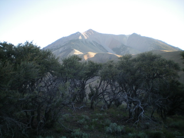
The mountain mahogany-clad summit crest of Peak 7541 as viewed from high on the south ridge. Livingston Douglas Photo
Access
From US-93, turn northeast onto Doublespring Pass Road (signed for May and Patterson). This junction is located 21.5 miles north of Main Street in Mackay and 7.3 miles south of Willow Creek Summit. Drive 2.4 miles up Doublespring Pass Road to the Earthquake Information historical site and its large parking area and turnaround loop. Find a 2-track road on the back side of this loop that heads northwest along the base of the mountains. Drive 0.3 miles northwest on this unsigned 2-track desert road to reach an unsigned junction. Turn right/north and drive 0.1 miles to the base of a steep ATV trail (not shown on maps). Park here (6,835 feet).
South Ridge, Class 2
The Climb
From the unsigned junction, hike north up a dry gully on a VERY STEEP ATV trail to a narrow saddle and a fence row. Continue hiking north-northwest along the ATV trail as it drops into a meadow then bends left-ish/northwest to intercept the south ridge of Peak 7541. Alternatively, leave the road at the saddle and climb directly up onto the south ridge and follow it to intercept the ATV trail higher up the ridge.
If you choose the latter route, follow a dilapidated fence row left/west from the saddle up to the crest of the south ridge. Scramble northwest up the rocky ridge and navigate through the accompanying brush and mountain mahogany to reach a ridge point. From there, drop 75 vertical feet along the ridge in boulders/talus and brush to reach a small saddle. The aforementioned ATV trail crosses this saddle. From the saddle, continue north up the somewhat ill-defined ridge crest in modest-to-easy scrub and scattered mountain mahogany.
After crossing two false summit humps, reach the mountain mahogany-clad true summit of Peak 7541 at the north end of the tilted summit plateau. There is no summit cairn. The high point seems to be a few large ground boulders amongst the mountain mahogany.
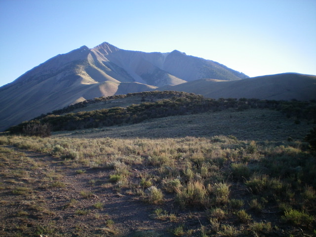
View of Dickey Peak (11,141 feet) from the summit of Peak 7541. Livingston Douglas Photo
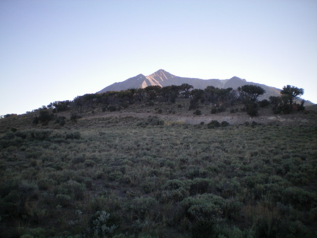
Peak 7541 (forested in mid-ground) with dominating Dickey Peak (11,141 feet) in the distance. Livingston Douglas Photo
Additional Resources
Regions: EASTERN IDAHO->Lost River Range->Pahsimeroi Range
Mountain Range: Lost River Range
Longitude: -113.87809 Latitude: 44.17949