Elevation: 7,549 ft
Prominence: 689
This peak is not in the book. Published November 2022
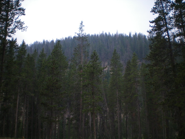
Peak 7549 is the high point on a forested ridge on the west side of Valley Creek in the Sawtooth Range. It sits above the headwaters of Dry Creek. Peak 7549 is most easily climbed from the Valley Creek trailhead via its east side. USGS Elk Meadow
Forested Peak 7549 as viewed from the east. Livingston Douglas Photo
Access
From ID-21 west of Stanley, turn right/north onto [signed] Valley Creek Road/FSR-304. At 0.5 miles, reach a signed road junction. Go right/east onto FSR-304A (this is the continuation of Valley Creek Road) and cross Valley Creek on a good bridge. At 2.3 miles, reach the end of the road at a large trailhead parking area (6,770 feet). GPS coordinates: 44⁰20’27”N, 115⁰03’24”W.
Map Errors
The USGS topo map shows a road heading up the west side of Valley Creek from a junction at 6,640 feet. The main road goes hard right/east here and crosses Valley Creek on a good bridge. The northbound road goes a short distance and ends. The USGS topo map fails to show the two ATV trails that emanate from the end of Valley Creek Road/FSR-304: FST-306/Valley Creek Trail and FST-4037/East Fork Valley Trail.
West Shoulder, Class 2
The Climb
From the large trailhead parking area, follow FST-306 west down to a sturdy footbridge crossing of Valley Creek. Hike about 75-100 yards upstream on FST-306. Leave the trail here and scramble west directly up a steep slope of loose gravel and scrub with scattered pines to reach the southeast shoulder. The southeast shoulder is more of a face initially. Scramble west then right-ish/northwest up through a steep, but reasonable, pine forest to directly reach the semi-open summit. A fallen, uprooted tree is the high point. There were no signs of previous ascent. I built a summit cairn atop the tree trunk/roots, the highest point. This climb is mostly in live forest but there are scattered snags and charred timber to navigate.
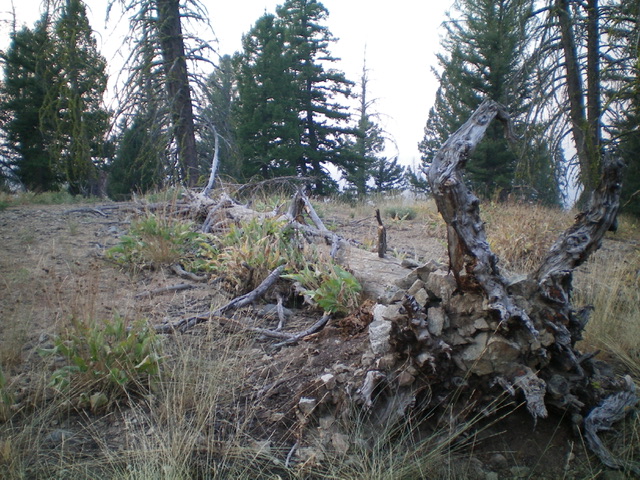
The newly-built summit cairn atop Peak 7549. Livingston Douglas Photo
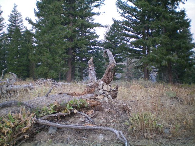
Yes, the fallen tree trunk/roots are the high point. Livingston Douglas Photo
Additional Resources
Regions: Eastern Salmon River Mountains->Salmon River Mountains->Southeast Corner Peaks->WESTERN IDAHO
Mountain Range: Eastern Salmon River Mountains
Longitude: -115.06501 Latitude: 44.34169