Elevation: 7,572 ft
Prominence: 352
This peak is not in the book. Published November 2023
Peak 7572 sits above the confluence of Brush Creek and South Fork Tincup Creek in the Webster Range in eastern Idaho. It is most easily climbed via its west side from FST-048/Crooked Creek Trail. The pine forest in this area is very thick with copious amounts of deadfall and brush. Not a pleasant place to be bushwhacking. USGS Stump Peak
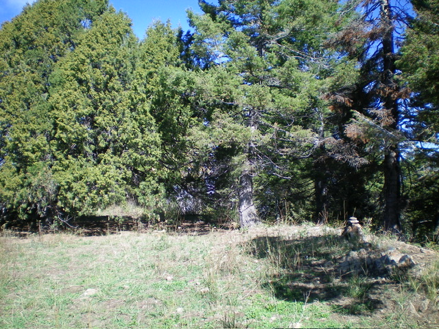
The semi-open summit of Peak 7572. Livingston Douglas Photo
Access
The unsigned trailhead and parking area for FST-008/South Fork Trail is located along ID-34 exactly 7.2 miles west of its genesis just west of Etna, WY. The beautiful, large footbridge at the trailhead is readily visible from ID-34. The trailhead parking area is at 6,120 feet and 42⁰58’41”N, 111⁰10’07”W.
To reach ID-34 from US-89 in Alpine Junction (WY), begin at the signed junction of US-89 and US-26. A stoplight is here. Drive south on US-89 for 9.4 miles to a signed junction with Creamery Road. Turn right/west onto Creamery Road and drive 1.5 miles to a signed 4-way junction. Turn left/south and drive 3.2 miles to a signed junction with ID-34. This is the eastern terminus of ID-34, just west of Etna, WY.
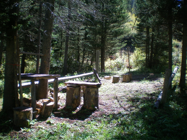
The elaborate hunter’s camp along Brush Creek at the creek crossing point. Livingston Douglas Photo
Map Errors
FST-018/Brush Creek Trail is not shown on the USGS topo map. Contrary to the Caribou-Targhee National Forest map, the trail does not cross the South Fork Tincup Creek to intercept FST-008/South Fork Trail. It ends before even reaching South Fork Tincup Creek. The National Forest map shows FST-008 as staying on the west side of South Fork Tincup Creek all the way to Brush Creek. However, in actuality, the trail crosses to the east side of the creek on a sturdy footbridge about 0.4 miles north of Brush Creek (as the USGS topo map shows).
Northeast Ridge, Class 2
The Climb
From the trailhead parking area, head south on FST-008 by first crossing a sturdy footbridge over marshy Tincup Creek. This trail is heavily used by horse packers. It is quite narrow, muddy (either wet or dried mud), and has horse tracks embedded in it. FST-008 is not a pleasant hiking experience. But it sure beats bushwhacking in this area. Follow the trail for about two miles to a nice footbridge crossing of South Fork Tincup Creek.
Leave the trail here and follow a weak game trail on the right/west side of South Fork Tincup Creek for about 0.4 miles to the mouth of Brush Creek. The game trail merges into [much better] FST-018/Brush Creek Trail here. Follow FST-018 briefly as it begins its trek up the north side of Brush Creek and stays well above the creek. Leave the trail and follow a use trail that heads diagonally left and down to near the creek. Find a hunter’s camp here (see photo).
Cross to the south side of Brush Creek just upstream from the hunter’s camp in a spot with minimal willows and a creek boulder to assist in jumping across the creek. Once across the creek, bushwhack east up through steep, thick veg in a pine forest to quickly reach the crest of the northeast ridge. Follow the rounded ridge south then southwest up through the dense pine forest with a mostly thick understory. This is not pleasant.
Thankfully, there isn’t much deadfall on this ridge. Higher up, the ridge morphs into more of a face but it still has some definition. Reach the summit ridge just right/northwest of the semi-open high point. Stroll about 100 yards southeast to the top. There was no cairn on the high point so I built one. The summit offers nice views of the surrounding area.
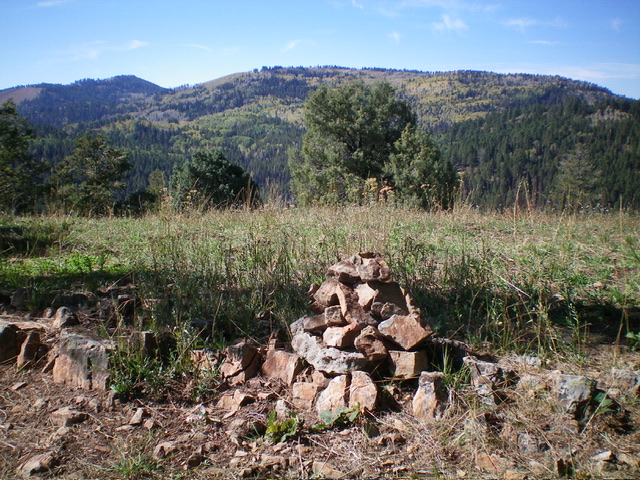
Summit view and the newly-built summit cairn atop Peak 7572. Livingston Douglas Photo
Northwest Ridge, Class 3
The Descent
From the summit, descend the well-defined northwest ridge in a mix of ridge rock and pines. The ridge morphs into a steep face as you approach Brush Creek. Bash down through this mess of thick brush, pines, and copious deadfall (Class 3) to reach Brush Creek. This face section is very steep and requires constant use of your hands to keep you from sliding down the mountain. Upon reaching the creek drainage, bushwhack a short distance in easy grass/brush then jump the small stream (Brush Creek is much smaller here than it is downstream at the hunter’s camp) to reach its north side.
Scramble east along the steeply-angled scrub on the north side of the brush/willow-clogged Brush Creek drainage. Use game trails as available to expedite the descent through the scrub and mix of side gullies and side shoulders. Lower down, find a use trail that leads down to the hunter’s camp. Follow a use trail diagonally up and left/north from the hunter’s camp to return to the mouth of Brush Creek. From there, follow the weak game trail down the west side of the creek to the footbridge crossing and FST-008. Hike north down FST-008 for about two miles to the trailhead parking area.
Additional Resources
Regions: Peale Mountains->SOUTHERN IDAHO->Webster Range
Mountain Range: Peale Mountains
First Ascent Information:
- Other First Ascent: Northwest Ridge (Descent)
- Year: 2023
- Season: Summer
- Party: Livingston Douglas
Longitude: -111.1582 Latitude: 42.9400