Elevation: 7,580 ft
Prominence: 560
This peak is not in the book. Livingston Douglas added two additional routes approaching the peak from a northern access point as well as a few new photos. Updated November 2023
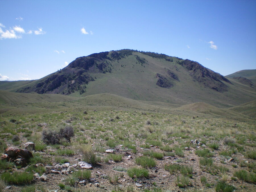
This pup tent-shaped peak is located on the west side of Bradshaw Basin, southwest of Lone Pine Peak. USGS Lone Pine Peak
Peak 7580 as viewed from the west, with the Pahsimeroi Range and the Lost River Range in the background
Access
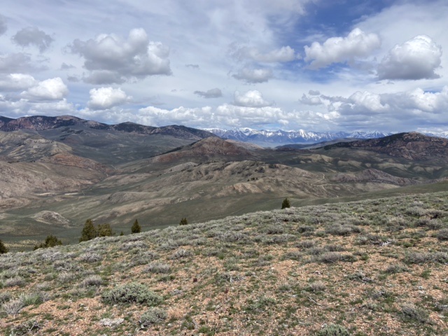
Spar Canyon Road is the primary access for the Northern Boulder Mountain peaks [(D)(1) on Page 243]. Spar Canyon Road can be accessed from US-93 in the east or from East Fork Salmon River Road in the west. The road is maintained except during the Winter. It is subject to occasional flash floods and can be difficult to drive when wet. All of the side roads departing from the Spar Canyon Road require high-clearance vehicles and 4WDs are recommended.
To reach the 4WD road that leads to Peak 7794 from US-93, follow Spar Canyon Road west for 7.0 miles to the junction for Bradshaw Basin Road. To reach this junction from the west, follow East Fork Salmon River Road south from ID-75 for 4.1 miles, turn left/east, and follow Spar Canyon Road east for 7.7 miles. Follow Bradshaw Basin Road north for 3.1 miles. Turn left/west and follow the 4WD road to the saddle on the south side of the peak. Park here.
South Ridge, Class 2
The south side of Peak 7580 is a quick ascent from the parking spot without any obstacles. The route covers 0.4 miles with 280 feet of elevation gain round trip.
Access for Malm Peak and Peak 7580
Northwest Face and North Ridge/Northeast Shoulder Routes by Livingston Douglas

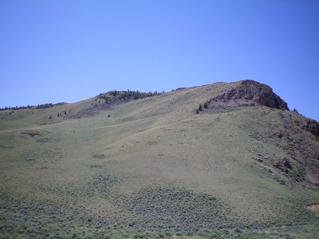
Peak 7580 as viewed from the northwest. My ascent route climbs the open terrain diagonally from lower left to dead center. Livingston Douglas Photo
Access
Same as for Peak 7307 (Malm Gulch Road). This is the second leg of a 2-peak adventure that includes Peak 7307 and Peak 7580. It covers 9.0 miles with 3,300 feet of elevation gain round trip.
Map Errors
The USGS topo map shows a jeep trail heading left/northeast from Malm Gulch Road that no longer exists. The USGS topo map fails to show the critical road junction (and side road) near the base of the north spur of Peak 7307. The Malm Gulch Road (shown on the USGS topo map) does not even exist for a chunk of it and is either an unmaintained foot trail or no trail at all. The USGS topo map shows two jeep trails heading east from Malm Gulch Road near the base of the northeast shoulder of Peak 7580. Neither of those roads exist anymore.
Northwest Face, Class 2
The Climb
From the gulch crossing between Peak 7307 and Peak 7580 (at about 6,450 feet), scramble south up reasonable sagebrush, staying right/west of ugly rockbands/outcrops and a pine forest near the ridge crest. Either continue climbing in open scrub all the way to, and past, Point 7565 (the smartest route) or go up onto the ridge in a gap just past the rocky outcrops where there are no pines or only scattered pines.
Once on the ridge crest, follow it south in semi-open pine forest (easy) to reach rocky Point 7565. Scramble just past the point on its right/west side then climb up to its top from the south. This is the [lower] northwest summit of Peak 7580. Continue southeast and drop 60 vertical feet to a minor saddle. Scramble southeast up a rocky ridge section to reach the large cairn atop the true/southeast summit of Peak 7580. It measures 30 feet higher than Point 7565 according to my altimeter.
Peak 7580 as viewed from Malm Gulch Road to its northeast. The summit is well left of center. My descent route follows the north ridge (skyline in center) and descends a shoulder (right of center) where the ridge falls off sharply (well right of center). Livingston Douglas Photo
North Ridge/Northeast Shoulder, Class 2
The Descent
From the summit, return northwest to Point 7565 then descend the north ridge in easy pine forest (initially). Continue down the ridge crest across the tops of a few rocky buttresses (not difficult) to soon reach an impasse: a massive buttress (as shown on the USGS topo map). Head right/east here and descend a shoulder (of sorts) of loose scree and scrub down to Malm Gulch Road which, in this area, is a visible 2-track road.
Once on the road, follow it north as it weaves to cross a ridge then two dry gullies. The road now becomes a footpath and then it just ends in a streambed/gulch. Follow the wide streambed northwest then north then northwest to find the road again at a sign for “Malm Gulch.” Follow the washed-out road northwest back to the road junction just below Peak 7307. Continue northwest down the road for another mile to reach the parking area and your awaiting vehicle.
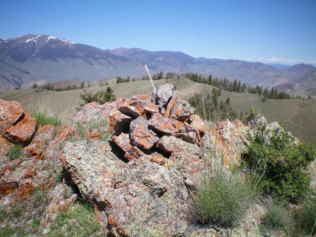
The summit cairn atop Peak 7580 with Point 7565 directly behind the cairn. Livingston Douglas Photo
Additional Resources
Regions: Boulder Mountains->EASTERN IDAHO
Mountain Range: Boulder Mountains
Year Climbed: 2022
Longitude: -114.21869 Latitude: 44.30901