Elevation: 7,603 ft
Prominence: 383
This peak is not in the book. Published November 2020
Peak 7603 is a gentle hump that has Tincup Creek on its south, west, and north sides. It is most easily climbed from a corral along Tincup Road/FSR-117 at the base of the southwest side of the mountain. Peak 7603 is an easy, open scramble up scrub and short patches of aspens from the road. USGS Wayan East
Access
From the east end of ID-34 (at a county road about a mile north of Freedom, WY), drive west on ID-34 for 12.2 miles to a [signed] junction with Tincup Road/FSR-117. Turn right/north onto Tincup Road and drive 1.7 miles to a large corral (and parking area) on the left side of the road. Park here (6,535 feet).
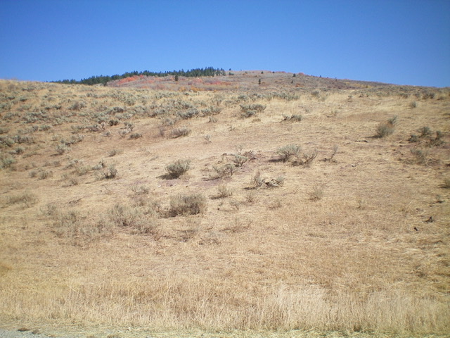
Peak 7603 and its southwest face as viewed from the corral along Tincup Road. The summit is just right of the pine trees at the top of the photo. Livingston Douglas Photo
Southwest Face/South Ridge, Class 2
The Climb
From the parking area at the corral, cross to the east side of Tincup Road and bushwhack east through thick, tall sagebrush and other tall brush up a face to reach a shoulder. Follow the easy, short scrub northeast up the shoulder. Stay to the right/east of the scattered pines on the ridge crest for the easiest going. Avoid the patches of aspens whenever possible. Higher up, there is a prominent gully on the right/east side of the shoulder to guide you. The shoulder brings you up to a final ridge section that heads north to the elongated, gravel summit area of Peak 7603.
The summit had no cairn so I built one. The summit high point is on a narrow ridge line with trees and ridge rock on it. It sits just above, and north of, the open area of gravel. When you descend this route, aim for the [visible] corral along Tincup Road. Lower down, there is a mix of minor gullies and shoulders/faces that you may have to work your way through. There is no clear ridge descent to the road lower down. Avoid the aspen patches and brush-filled gullies whenever possible. This is a short route so any brush- or aspen-busting that you must endure will be short-lived.
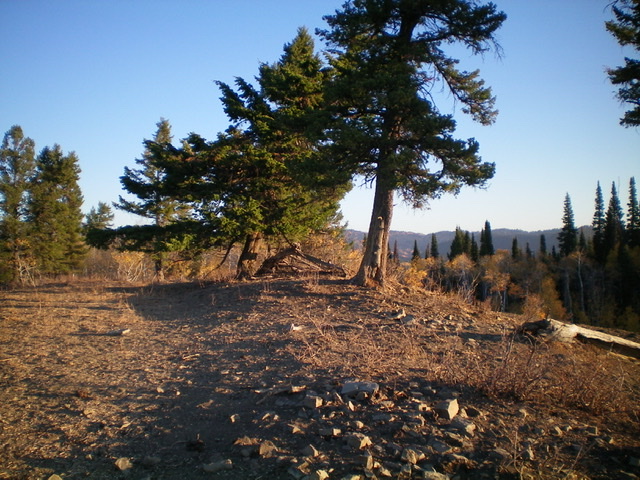
The summit high point of Peak 7603 is between the first 2 trees in the center of the photo. Livingston Douglas Photo
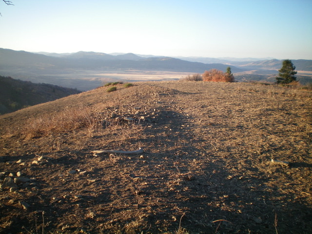
The flat, elongated summit area atop Peak 7603, looking south. Livingston Douglas Photo
Additional Resources
Regions: Caribou Range->SOUTHERN IDAHO
Mountain Range: Caribou Range
Longitude: -111.26879 Latitude: 42.99339