Elevation: 7,692 ft
Prominence: 312
This peak is not in the book. Published November 2023
Peak 7692 is a thickly-forested summit that sits on a ridgeline above the headwaters of Noon Creek in the Webster Range. It is just southwest of the lengthy Stump Creek drainage. Peak 7692 is most easily climbed from FSR-107 to its west. USGS Stump Peak
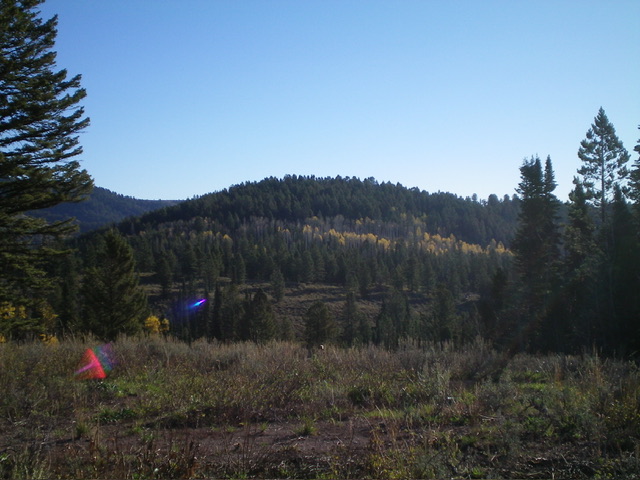
Peak 7692 as viewed from the southwest near the starting point of my ascent. Livingston Douglas Photo
Access
From ID-34, turn south onto [unsigned] Lanes Creek Cutoff Road. This unsigned junction is located 12.7 miles west on ID-34 from its eastern terminus and 5.5 miles west of the South Fork Trailhead parking area. Drive south (then southwest then south) on Lanes Creek Cutoff Road for 3.1 miles to an unsigned junction with FSR-107/Lander Cutoff Road. Turn left/east onto FSR-107 and reset your odometer. At 6.1 miles, cross Flat Creek. At 7.7 miles, reach an unsigned junction with a side road that heads left/east then north. Drive about 100 feet up this badly rutted, mud-holed side road and park (7,515 feet; 42⁰52’22”N, 111⁰13’19”W).
Map Errors
The Oregon Trail/FST-001 (shown on the Caribou-Targhee National Forest map) no longer exists. It is shown on the USGS topo map as the Emigrant Trail, the Lander Cutoff Trail (in its south section), and as a jeep road (in its northernmost section). The USGS topo map labels FSR-107 as Poison Creek Road but it is actually Diamond Flat Road. The USGS topo map shows the main road (FSR-107) heading southeast then south in the area where I parked. However, most of this road no longer exists. Only a short spur road (0.2 miles long) to an old campsite is still there. The actual road (FSR-107) is to the west and IS shown on the USGS topo map but is not labeled. Confusing, eh?
West Face, Class 2
The Climb
From the parking spot, follow the spur road north briefly to reach its end on a bluff at an old campsite. There is an old Forest Service information board laying on the ground here. From the end of the spur road, bushwhack north down easy, open grass/scrub to reach a grassy meadow at a saddle. This saddle is at the head of a dry gully.
There is a “Lander Trail” sign here but no trail at all. From the grassy saddle, head northeast then east up over a brushy, thickly-forested knoll then drop east in thick forest to a nice saddle. From this forested saddle, scramble east up through miserably thick brush and forest to reach the willow-covered high point of Peak 7692. There is a modest cairn on top. Although the USGS topo map shows more of a rounded ridge on the west side of Peak 7692, it’s really more of a face.
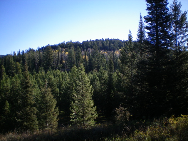
Peak 7692 and its forested west face, my ascent route. Livingston Douglas Photo
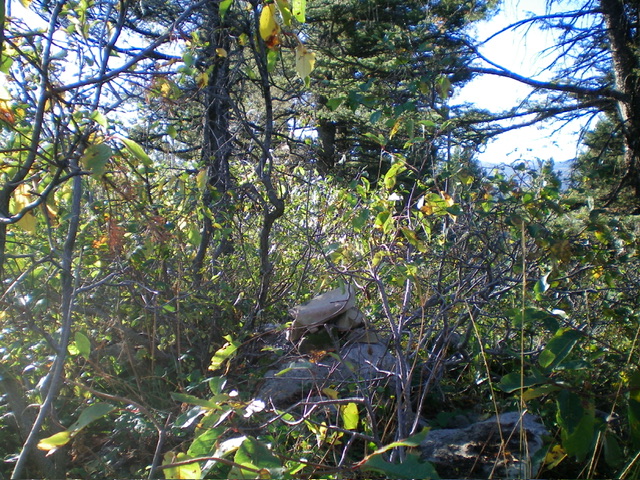
The thick, brushy summit of Peak 7692 and its summit cairn. Livingston Douglas Photo
Additional Resources
Regions: Peale Mountains->SOUTHERN IDAHO->Webster Range
Mountain Range: Peale Mountains
Longitude: -111.2087 Latitude: 42.8770