Elevation: 7,642 ft
Prominence: 302
This peak is not in the book. Published November 2023
Peak 7642 is a pyramidal hump that is located at the head of Bady Canyon in the White Knob Mountains. ATV Trail #4303 leads from Alder Creek Road to the base of its north ridge. Peak 7642 can also be reached from an ATV trail in Big Blind Canyon. USGS Big Blind Canyon
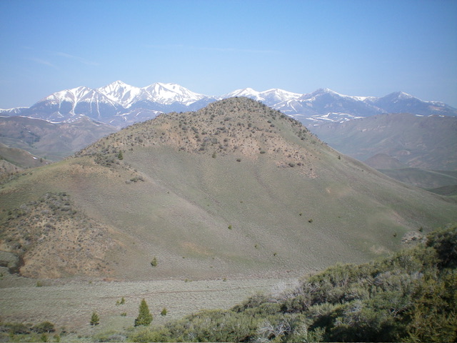
Peak 7642 (dead center) as viewed from the northwest. Livingston Douglas Photo
Access
From the road junction at the mouth of Alder Creek Canyon, reset your odometer and drive southwest up Alder Creek Road. At 2.4 miles, reach a signed junction with BLM-4303 (an ATV trail/road). Park here (6,370 feet; 43⁰49’37”N, 113⁰35’14”W).
Map Errors
Most of the ATV trails in this area are not shown on the USGS topo map.
Northwest Shoulder/North Ridge, Class 2
The Climb
From the signed ATV trail junction, hike about 1-3/4 miles up BLM-4303 (a decent ATV trail/road) as it undulates a bit and climbs a ridge on the right/west side of Bady Canyon. Peak 7642 is visible early on (to the left/east) and is an impressive hump. BLM-4303 finally descends diagonally left down into Bady Canyon and crosses Bady Creek. The ATV trail follows the east side of Bady Creek for a bit until it leaves the drainage to climb left/east up onto the northwest then north aspects of Peak 7642. Leave the ATV trail as it crests to cross the northwest shoulder.
You can either leave the ATV trail here and climb directly southeast up the northwest shoulder OR continue about 0.3 miles on the ATV trail to the north ridge and climb to the summit from there. I chose the former, shorter route to the summit. Leave the ATV trail and scramble southeast up open terrain of easy scrub with a steep-ish scree/gravel base. Reach the crest of the north ridge about 250-300 feet below the summit. The top of the north ridge is full-on Class 2 with some ridge rock and mountain mahogany mixed in to make the finish a bit tedious. The summit has a decent cairn with a tree branch stuck in it.
Southeast Ridge, Class 3
The Descent
To continue on to Peak 8712, descend the narrow, rocky outcrops on the southeast ridge in steep terrain (Class 3 downclimbing) then exit the ridge mess and descend its left/east side on gentler scrub with no outcrops to reach a minor saddle. The USGS topo map makes this ridge look much easier than it actually is. This 7,340-foot connecting saddle is the low point between Peak 7642 and Peak 8712 and concludes the first leg of today’s 2-peak journey. Peak 8712 is up next.
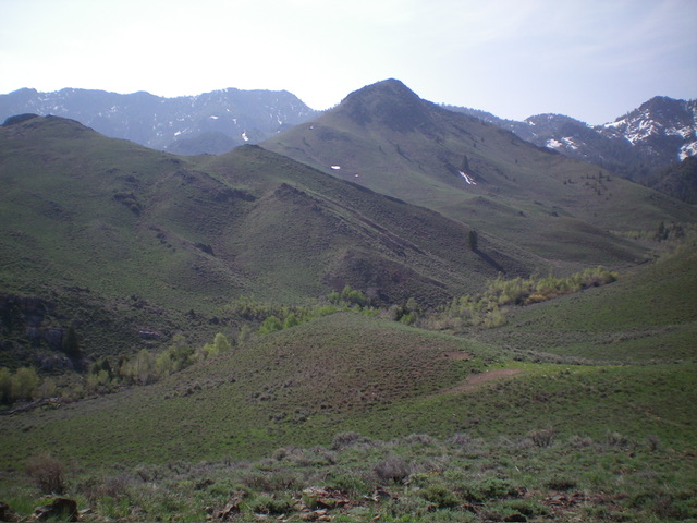
Looking back up the southeast ridge of Peak 7642. This was my descent route. Livingston Douglas Photo
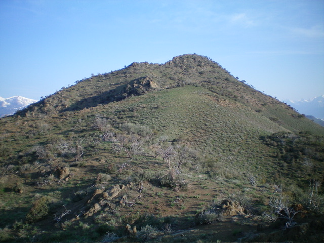
Peak 7642 (in mid-ground) as viewed from the southeast. Livingston Douglas Photo
Additional Resources
Regions: EASTERN IDAHO->White Knob Mountains
Mountain Range: White Knob Mountains
Longitude: -113.5761 Latitude: 43.8080