Elevation: 7,650 ft
Prominence: 500
This peak is not in the book. Published November 2023
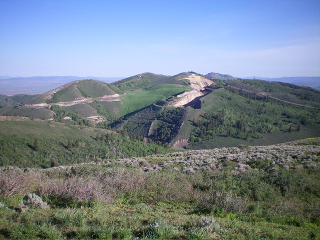
Peak 7650 is a double-humped summit that separates Trail Canyon from Shield Canyon in the Aspen Range northeast of Soda Springs. The east summit is the actual high point (marked with a rebar post) not the official LOJ/west summit. USGS Johnson Creek
Peak 7650 as viewed from the southeast. The true/east summit hump is in dead center. Livingston Douglas Photo
Map Errors
There are a number of old mining roads in this area that are not shown on any maps but are very useful to hikers.
Access
From the junction of US-30 and ID-34 in Soda Springs, drive north on ID-34 for 3.0 miles to the signed junction with [paved] Trail Canyon Road/FSR-124. Go right/east onto Trail Canyon Road and drive 4.4 miles to a large pullout on the right/southside of the road and an unsigned junction. The roadside pullout is at 6,665 feet and 42⁰41’59”N, 111⁰29’46”W. It sits at the base of the southwest shoulder. This area is a mix of private and public land, so be careful. The route to the west summit is entirely on BLM land. However, the east summit is on private land. There is no fencing or signage to prohibit entry onto the east summit.
Southwest Shoulder/South Ridge, Class 2
The Climb
From the roadside pullout, cross to the north side of Trail Canyon Road and hike northwest up an unmapped mining road to quickly reach an open gate. Leave the road here (or continue hiking up the mining road which adds more mileage but cuts down on the bushwhacking required) and scramble up a steep shoulder of thick-ish sagebrush to cross an old 2-track road (also unmapped) and, soon after, the mining road. The mining road now shows up on the USGS topo map and completely encircles the mountain. Continue up the steep ridge to a juncture with the south ridge at about 7,300 feet. Head left-ish/north up the south ridge to reach gentle Point 7520+.
Descend north for 135 vertical feet to a minor saddle, staying left/west in open sagebrush to avoid aspens and thicker brush. Grind northward up the final ridge section in sagebrush to reach the bare west summit of Peak 7650. This is the official LOJ summit but there is no cairn here. Descend east for 75 vertical feet to a minor saddle then scramble east in easy sagebrush to reach the east summit. This summit (which measures 5-10 feet higher than the west summit) has a tall rebar post and is the actual high point of Peak 7650. Both the east and west summits share the same higher contour line.
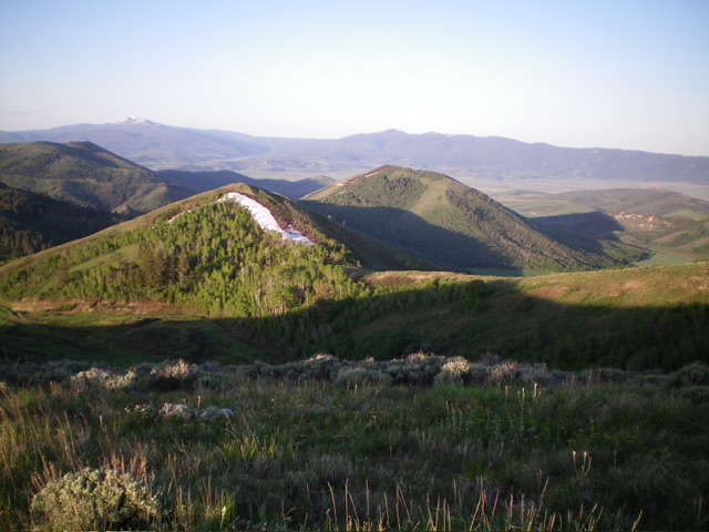
Looking at Point 7520+ (left of center) and the upper south ridge (right of center) from the east summit. The south ridge was my ascent route. Livingston Douglas Photo
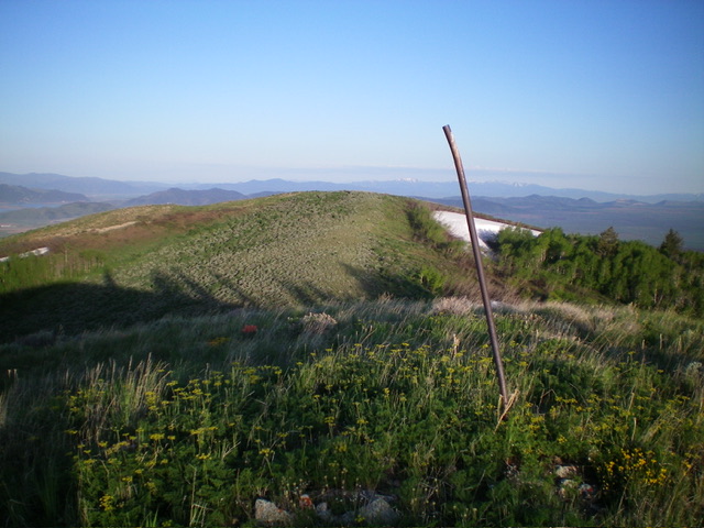
Looking at the [lower] official/west summit hump from the [slightly-higher] east summit. Livingston Douglas Photo
South Ridge Variation, Class 2
The Descent
From the east summit, descend briefly south on the ridge then angle right/southwest and descend steep scrub/scree/gravel to intercept the old mining road in the gully that separates the west summit from the east summit. Follow the mining road south then west to its crossing of the southwest shoulder. Bushwhack southwest down to the road gate on the mining road then follow the road briefly down to Trail Canyon Road and the large pullout area.
Additional Resources
Regions: Aspen Range->Peale Mountains->SOUTHERN IDAHO
Mountain Range: Peale Mountains
Longitude: -111.4958 Latitude: 42.7124