Elevation: 7,701 ft
Prominence: 361
This peak is not in the book. Published December 2020
Peak 7701 is a ridgeline summit that is overshadowed by the longer, more dominant Deadhorse Ridge to its southwest. It sits at the head of Dry Hollow and is one of the few ridges in this area of the Caribous that is not named. Peak 7701 is most easily accessed from Fall Creek Road via FST-140 and FST-267. A short scramble up the southwest face puts you on top. Peak 7701 is best climbed in combination with nearby Deadhorse Ridge North. USGS Red Ridge
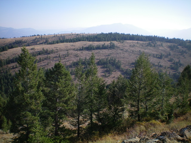
Peak 7701 and its southwest face. The summit is in dead-center behind the pine trees on the far ridge of the two ridges you see. Livingston Douglas Photo
Access
From US-26 north of Swan Valley, ID, turn right/south at a signed junction just before a bridge crossing of the Snake River a few miles west of the junction of US-26 and ID-31 in Swan Valley. This junction is signed for Snake River Road and “Fall Creek Road 1 mile.” Drive 1.2 miles south on Snake River Road as it follows the west side of the Snake River and reaches a [signed] junction with Fall Creek Road/FSR-077. Turn right/west on Fall Creek Road and drive 4.5 miles west to the [signed] trailhead for Horse Creek Trail/FST-140 on the left/southeast side of the road. The trail has an immediate ATV/foot bridge crossing of Fall Creek that is visible from the road. Park in the open grassy area at the trailhead (5,500 feet).
Southwest Face, Class 2
The Climb
From Fall Creek Road, hike southeast up FST-140 (an ATV trail) to a signed “T” junction with FST-267 at 7,005 feet. FST-267 is an ATV trail heading north from here but it is a MC trail heading south from here. Both are good for hiking. Please note that the USGS topo map does not show FST-140 at all, though it does show FST-267. The aforementioned trail junction is at a saddle just south of Peak 7391. From that junction, go right/south on FST-267 and follow it for about a mile to the 7,340-foot connecting saddle between Deadhorse Ridge and Peak 7701.
From the connecting saddle, follow a good cattle trail east (diagonally right) up an open scrub slope. Leave the cattle trail as it tops out because it is now heading too far southeast. Scramble northeast up a steep sagebrush slope to quickly reach a plateau/ridge of sorts. Bushwhack northeast through a blowdown-ridden pine forest to reach a hidden saddle (or cross the head of a minor dry gully on its right/east side). From the forested, hidden saddle, bushwhack northeast up through a final short patch of easy forest to reach the easy open scrub of the summit ridge crest of Peak 7701. Walk right/southeast a short distance to the cairned high point.
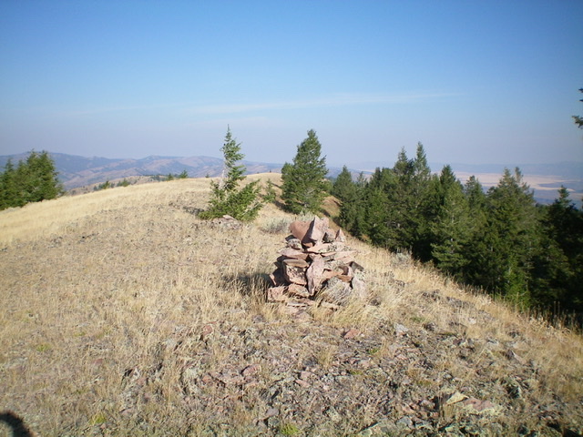
The summit area of Peak 7701, looking northwest. Livingston Douglas Photo
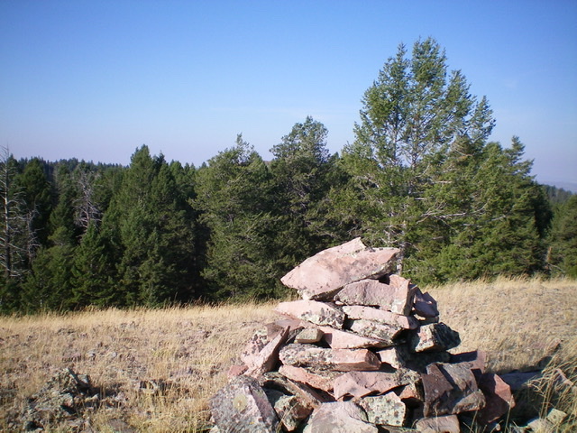
The summit cairn atop Peak 7701 with Deadhorse Ridge North in the distance, behind the pine trees. Livingston Douglas Photo
Additional Resources
Regions: Caribou Range->SOUTHERN IDAHO
Mountain Range: Caribou Range
Longitude: -111.36929 Latitude: 43.37469