Elevation: 7,704 ft
Prominence: 384
This peak is not in the book. Published January 2023
Peak 7704 is located on the west side of Pole Canyon in the Snake River Range. It is a ranked summit on the northeast ridge of Blanchard Ridge. This is the third leg of a 3-peak journey that includes Peak 8308, Blanchard Ridge (7,982 feet), and Peak 7704. This adventure covers 7.5 miles with 2,800 feet of elevation gain round trip. USGS Fourth of July Peak
Access
Same as for Peak 8308. This is the third leg of a 3-peak adventure that begins at the Pole Canyon Trailhead.
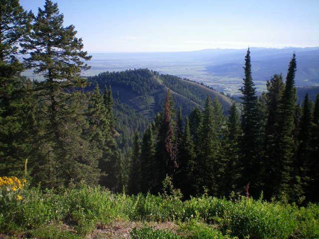
Peak 7704 as viewed from the south on the main ridge crest. Livingston Douglas Photo
Southwest Face, Class 2
The Climb
From the 7,320-foot connecting saddle, scramble northeast up a slope of open scrub and scattered pines to reach the bare summit hump of Peak 7704. I rebuilt the torn-down summit cairn. The summit offers a splendid view of lake-clad Victor, Idaho to the north.
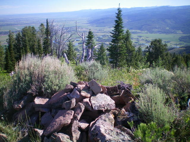
The summit of Peak 7704 with lake-laden Victor, Idaho in the valley below. Livingston Douglas Photo
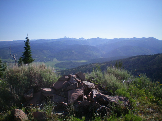
View of the Teton Range from the summit of Peak 7704. The Grand Teton is the pinnacle just left of center in the distance. Livingston Douglas Photo
Northeast Ridge, Class 2
The Descent
From the summit, descend northeast into the thick pine forest. The underbrush isn’t too bad but the ridge is not well defined. Face sections that are semi-open are clogged with aspens/bushes, some blowdown, and thick brush. It is critical to NOT descend east to Pole Canyon as the terrain gets very steep and thick on the drop to Pole Canyon Creek. You can see this when you ascend Pole Canyon Trail. Your objective is to reach an open hump/plateau at 7,080 feet (shown on the USGS topo map) that is at a point where the ridge bends left-ish/north briefly.
From the forested saddle just below it, bash your way north up for 40 vertical feet in thick-ish veg to reach the short scrub atop the 7,080-foot hump. The objective now is to bushwhack north-northeast down the rounded ridge to reach a gully that heads right/east to Pole Canyon just above (and south of) the trailhead. The forest is thick and the blowdown is miserable in this final section of the ridge. You will be happy to emerge onto the Pole Canyon Trail just above the trailhead. There is very little visibility almost the entire length of this miserable, ill-defined ridge. But it is the shortest way from Peak 7704 to the Pole Canyon Trailhead.
Additional Resources
Mountain Range: Big Hole and Snake River Mountains
Longitude: -111.1306 Latitude: 43.5536