Elevation: 7,718 ft
Prominence: 1,320
This peak is not in the book. Published October 2025
Peak 7718 sits above the headwaters of both Nelson Creek and Garden Creek in the foothills of the Caribou Mountains. It is most easily climbed from the Nelson Creek ATV trail and FST-057 higher up. USGS Point Lookout
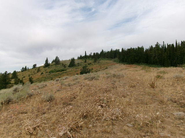
Peak 7718 as viewed from the southeast. Livingston Douglas Photo
Access
From the Caribou-Targhee National Forest Office on US-26 at the north end of Idaho Falls, drive east on US-26 for 23.9 miles to a signed junction with Antelope Road. Go right/south onto Antelope Road/FSR-037. At 3.1 miles, go left at a junction. At 6.1 miles, go straight at a junction. At 6.9 miles, reach the Caribou National Forest Boundary and a cattle gate. There is a shaded campsite to the left here and a large parking area. At 7.6 miles, reach a small trailhead parking area along Antelope Creek. Park here [6,392 feet; 43°27’16.8”N, 111°33’29.2”W].
North Side/Southeast Ridge, Class 2
The Climb
From the trailhead, hike east up FST-167/Nelson Creek Trail. Continue straight on FST-167 at an early junction with Antelope Creek Trail/FST-166 (right). Reach a signed trail junction on an open saddle at 7,230 feet. Go right/southeast onto FST-057 (an ATV trail). Hike up this steep, rocky trail to an open area and a saddle of sorts. Soon after exiting the thick pine forest and reaching the open area, find an old, unmapped 2-track (overgrown and weak) heading right/west-northwest. Contrary to the comments of one Idaho climber, there is no fence row to follow from here to the summit.
Follow this 2-track as it drops 25 feet to cross a dry gully then climbs northwest up onto the crest of the southeast ridge near the edge of the pine forest. It continues west to the fence row summit in open scrub. The old 2-track fades to a foot path at times and even disappeared for a little while. There is a small cairn on the left/south side of the old fence row. This is the high point and is just up from, and west of, two large fence posts. I rebuilt the summit cairn and added a post to it. The summit has decent views but there is a nearby pine forest to the north.
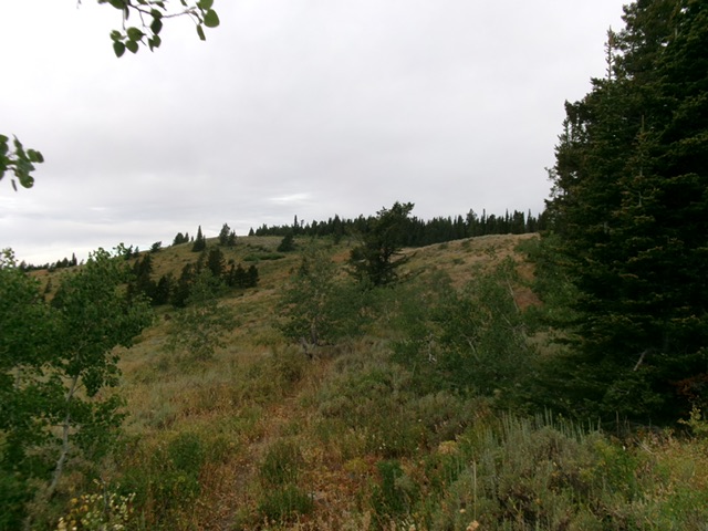
The final push up the southeast ridge (the summit is left of center). This was my ascent route. Livingston Douglas Photo
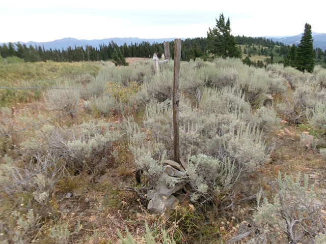
The summit of Peak 7718. Livingston Douglas Photo
Additional Resources
Regions: Caribou Range->SOUTHERN IDAHO
Mountain Range: Caribou Range
Longitude: -111.53933 Latitude: 43.277