Elevation: 7,730 ft
Prominence: 320
This peak is not in the book. Published January 2023
Peak 7730 is located due north of Wooley Range HP. It is the high point on a ridgeline that overlooks the Rasmussen Valley to its northeast. The shortest ascent route is from Rasmussen Valley Road. This is the second leg of a 2-peak adventure that includes Wooley Range HP and Peak 7730. The journey covers 7.5 miles with 1,850 feet of elevation gain round trip. USGS Lower Valley
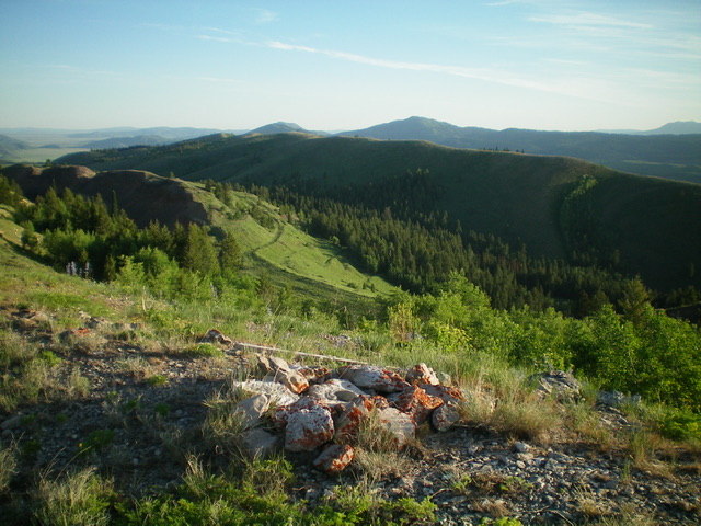
Peak 7730 as viewed from the southeast near Point 7558. Livingston Douglas Photo
Access
Same as for Wooley Range HP. This is the second leg of a 2-peak journey.
Southwest Face/Southeast Ridge, Class 2
The Climb
From the 7,410-foot connecting saddle with Wooley Range HP, follow a fence row northeast up through a somewhat thick pine forest to quickly reach open terrain. Scramble north up through [initially thick] sagebrush and other veg to reach easier, shorter veg higher up to reach the crest of the southeast ridge. Once on the southeast ridge, scramble northwest up the ridge crest on easy scrub and a very weak 2-track on (or just left/west of) the ridge crest.
Cross over a ridge hump and descend 35 vertical feet to a minor saddle. Continue northwest to reach the true summit of Peak 7730. There was a cairn (and summit scrap) on the [lower] southeast summit. The true/northwest summit lacked either, so I built a summit cairn there. The summit offers a magnificent view of the Rasmussen Valley and double-humped Peak 7487 to the northeast. You can readily see the active phosphate mining operations that block access to several possible routes on the mountains surrounding Rasmussen Valley.
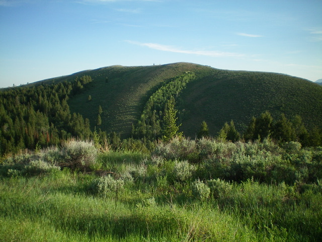
The summit hump of Peak 7730 (dead center) as viewed from the [lower] southeast summit on my ascent route. Livingston Douglas Photo
Southeast Ridge/East Gully, Class 2
The Descent
From the summit, return back to the 7,410 connecting saddle. From the saddle, descend the forested (and somewhat brushy) east gully down to Blackfoot River Road. Follow the remnants of an old trail that is now mostly overgrown and strewn with blowdown. The trail is completely gone in many places so just stay near the center of the dry gully and bushwhack through the brush and blowdown. As you approach the valley floor, find a jeep road (FSR-876) and follow it down to Blackfoot River Road. Hike south along Blackfoot River Road to the Mill Canyon Campground entrance. Hike west up the campground road to the top of the campground loop (Campsite #10) and your parked vehicle.
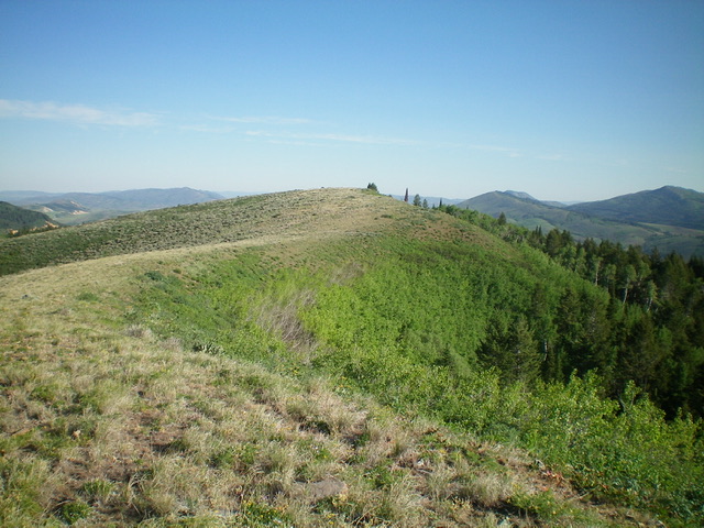
Peak 7730 and its long southeast ridge (mid-ground) as viewed from the summit of Wooley Range HP. Livingston Douglas Photo
Additional Resources
Regions: Peale Mountains->SOUTHERN IDAHO->Wooley Range
Mountain Range: Peale Mountains
Longitude: -111.3883 Latitude: 42.8312