Elevation: 7,794 ft
Prominence: 374
This peak is not in the book. Livingston Douglas added new photos, a new access point, and a new ascent/descent route which, unlike my route, is self propelled. Updated November 2023
Peak 7794 is located on a ridgeline between Bradshaw Basin to the east and the East Fork Salmon River to the west. A 4WD road leads from the Bradshaw Basin Road nearly to its summit. USGS Lone Pine Peak
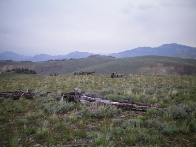
Peak 7794 (right of center in mid-ground) as viewed from Peak 7821. Livingston Douglas Photo
Access and Route, Class 1
Spar Canyon Road is the primary access for the Northern Boulder Mountain peaks [(D)(1) on Page 243]. Spar Canyon Road can be accessed from US-93 in the east or from East Fork Salmon River Road in the west. The road is maintained except during the Winter. It is subject to occasional flash floods and can be difficult to drive when wet. All of the side roads departing from the Spar Canyon Road require high-clearance vehicles and 4WDs are recommended.
To reach the 4WD road that leads to Peak 7794 from US-93, follow Spar Canyon Road west for 7.0 miles to the junction for Bradshaw Basin Road. To reach this junction from the west, follow East Fork Salmon River Road south from ID-75 for 4.1 miles, turn left/east, and follow Spar Canyon Road east for 7.7 miles. Follow Bradshaw Basin Road north for 1.8 miles. Turn left onto the 4WD road that leads past the south side of Peak 7891 and continues onto the summit area of Peak 7794. Sorry, I didn’t record the distance.
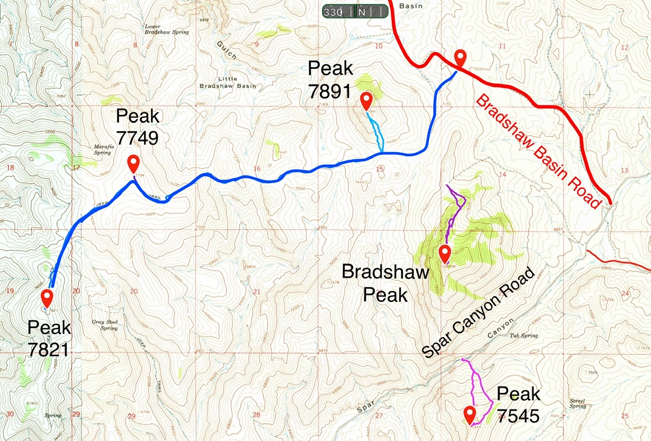
Access roads for Peak 7794 and Peak 7821. 4WD required. (Peak 7794 is mislabeled as Peak 7749. Darn!)
South Ridge by Livingston Douglas
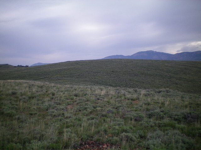
The sagebrush summit hump of Peak 7794 as viewed from high on the south ridge, my descent route. Livingston Douglas Photo
Access
If you are unable to drive up Bradshaw Basin Road (the Lopez Route), this is a good alternative route for hikers. From East Fork Road, drive 2.8 miles northeast up Spar Canyon Road to an unsigned junction with a 2-track road (the second of two unsigned junctions that are only 0.1 miles apart). Park/camp at the base of this 2-track road. Given the nearby cattle cistern, expect a visit from a herd of cows.
This junction is at 6,125 feet and 44⁰14’29”N, 114⁰14’19”W. This is the second leg of a 2-peak adventure that includes Peak 7821 and Peak 7794. It covers 8.0 miles with 2,125 feet of elevation gain. It climbs two magnificent open ridges in the Boulder Mountains on the north side of Spar Canyon Road. I highly recommend it. From Peak 7821, follow the ridge road north to a connecting saddle then continue northeast up the ridge road to the summit of Peak 7794. The Class 1 ridge road is already discussed in this posting.
Map Errors
The USGS topo map fails to show the first road junction (and 2-track road) referenced in the Access Section. The USGS topo map incorrectly positions the 2-track road that heads up to the high ridge. The actual road goes straight/north-northeast at 6,200 feet at a prominent fork in the canyon. It does NOT go left/northwest up the left fork as the USGS topo map shows. There is no road there.
The actual road reaches a ridge saddle east of Peak 7794 at 7,220 feet and a “T” road junction with the ridge road. Surprisingly, a section of the “left fork” road still exists up near the high ridge crest and is visible if you climb the southwest ridge of Peak 7794. Unfortunately, it soon disappears into nothingness. The USGS topo map also fails to show a junction and 2-track road that heads west along a ridge from the summit of Peak 7794.
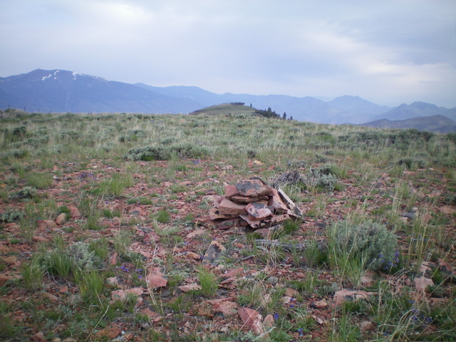
The summit cairn atop Peak 7794, looking north along the ridge crest. Livingston Douglas Photo
South Ridge, Class 2
The Descent
From the summit, return southwest on the 2-track ridge road to a minor saddle. Leave the road here and scramble south up 35 vertical feet to a tall set of powerlines that are on the crest of the south ridge. From the powerlines, descend southeast then south down the magnificent open ridge in short scrub. The upper section of the south ridge has chunky, protruding ground talus which makes the descent somewhat tedious. Lower down, the terrain is less rocky and less tedious.
The ridge wiggles a bit but it leads directly down to the fork in the gulch where you left it earlier in the day to climb the southeast ridge of Peak 7821. There is a game trail (of sorts) on the lower section of the ridge, which has some steep-ish areas. Once back to the fork, follow the overgrown 2-track road southwest for 0.6 miles to the “T” junction then head left/southeast for 0.1 miles back to the road junction and your parked vehicle. If climbing only Peak 7794, the south ridge makes for a good ascent route.
Additional Resources
Regions: Boulder Mountains->EASTERN IDAHO
Mountain Range: Boulder Mountains
Year Climbed: 2022
Longitude: -114.24239 Latitude: 44.28209