Elevation: 7,758 ft
Prominence: 338
This peak is not in the book. Updated November 2023
Peak 7758 is a ranked summit on the lengthy north-south ridge on the west side of Left Fork Knox Canyon in the Deep Creek Mountains. It sits above the headwaters of both Water Canyon and Wheeler Canyon. Peak 7758 is most easily climbed from Left Fork Knox Canyon Road to its east. This area is a mix of private and public land, so be careful. This climb is entirely on BLM land. USGS Bannock Peak
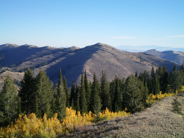
Peak 7758 as viewed from Peak 7700 to its southwest. Livingston Douglas Photo
Access
From Exit 52/Arbon Valley on I-86, drive south on [paved] Arbon Valley Road. At 23.5 miles, reach a signed junction with South Mink Creek Road. At 26.7 miles, reach a signed junction with Knox Canyon Road. Turn right/west onto Knox Canyon Road West. Drive 6.0 miles west then southwest on Knox Canyon Road West to reach an unsigned road junction in a meadow at a major fork in Knox Canyon.
The main road turns left-ish/south here to follow the Left Fork Knox Canyon. Continue south on the main road for another 1.6 miles to reach the mouth of a narrow gully on the right/west side of the road. Park here in a small roadside pullout or continue another 0.1 miles south on the road to a large roadside pullout as I did. My pullout is at 6,295 feet and 42⁰28’59”N, 112⁰40’57”W.
East Spur/South Ridge, Class 2
The Climb
From the roadside pullout, walk 0.1 miles north down Left Fork Knox Canyon Road to the mouth of the aforementioned side gully. This side gully is the demarcation line between BLM land and private land. The gully itself is on BLM land. Contrary to what some have stated, there is no old 2-track (or any remnants of it) or water trough in the side gully. Leave the road and bushwhack briefly up the gully. It quickly becomes thick with deadfall, brush, and aspens/pines.
Follow a decent cattle trail on the right/north side of the gully early on. This trail quickly enters open, thick sagebrush on the south side of the east spur. Leave the cattle trail after about 0.3 miles and bushwhack diagonally right/northwest up through the sagebrush. This section is pretty steep and relatively thick. Reach the crest of the east spur and, soon after, the top of Point 7029. Descend southwest from Point 7029 for 135 vertical feet to a minor saddle. Continue heading west up the open scrub of the east spur to reach the rocky cliff bands of Point 7580.
Climb up over (or skirt) Point 7580 to reach the crest of the south ridge. From Point 7580, descend north for just over 400 vertical feet to a ridge saddle in easy, open scrub. Continue north to a ridge juncture at 7,480 feet where the ridge bends left-ish/northwest. Follow the open ridge crest northwest up to a high ridge juncture at 7,650 feet. From there, head hard left/southwest to reach the summit in open scrub. The summit has a decent cairn and a triangulation post/wiring laying on the ground nearby. Overall, the south ridge is open and relatively easy. It meanders a bit and has some easy cliff bands to navigate.
On the descent, avoid climbing up over Point 7029 on the east spur. From the saddle just to its west, descend diagonally right/southeast to reach the side gully. Follow a cattle trail on the left/north side of the gully for much of this descent. It disappears for a short section where you can follow the gully proper briefly. Return to Left Fork Knox Canyon Road at the base of the gully then head south for 0.1 miles to your parked vehicle.
Peak 7758 can also be climbed on BLM land via the east ridge from the canyon fork at the road junction of the Right Fork Road and the Left Fork Road. The east ridge is long, has several ups and downs, and is much more forested and rockier than the south ridge. It also begins at a much lower point than the aforementioned East Spur/South Ridge Route. But it does avoid the massive 400-foot descent to a ridge saddle (800 feet of extra uphill round trip) on the South Ridge Route.
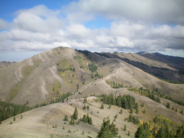
The long, meandering south ridge of Peak 7758 as viewed from Point 7580 to its south. The summit hump is left of center. Livingston Douglas Photo
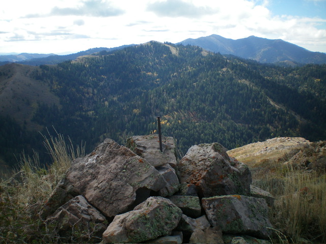
The blocky summit cairn atop Peak 7758 with Peak 7855 in the distance (dead center). Livingston Douglas Photo
Additional Resources
Regions: Deep Creek Mountains->SOUTHERN IDAHO
Mountain Range: Deep Creek Mountains
Longitude: -112.7088 Latitude: 42.5023