Elevation: 7,761 ft
Prominence: 301
This peak is not in the book. Published November 2020
Peak 7761 is surrounded by three canyons: Ras Canyon to the south, Spring Canyon to the north, and Schoolhouse Canyon to the east. The easiest approach is via Ras Canyon, a side canyon that comes up from Antelope Creek Valley. Peak 7761 is a gentle hump that has old 2-track roads and cattle trails on its slopes. The easiest ascent route is via the Waddoups Canyon jeep road which leads up to the saddle at the base of the north ridge. USGS Grouse
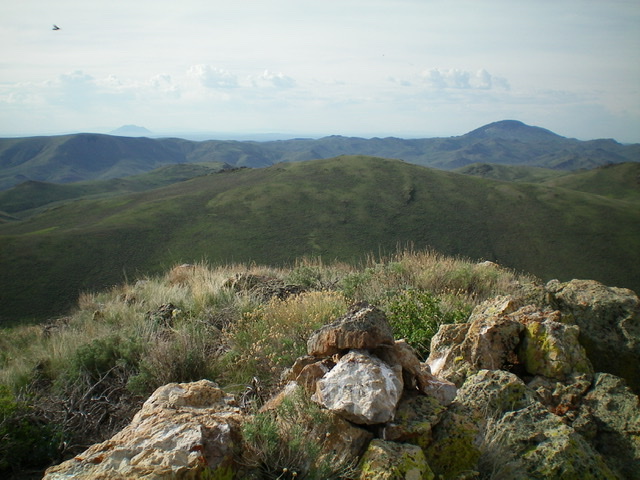
Peak 7761 is the gentle peak in mid-ground. This view is from the summit of Peak 7955 to its northwest. Livingston Douglas Photo
Access
Antelope Creek Road/FSR-137 is located 11.5 miles north of the Conoco gas station at the south end of Arco, ID on US-93. The junction is poorly signed, so look for the road itself. Drive 10.9 miles southwest on FSR-137 to a signed junction at a bridge crossing of Antelope Creek. Do not cross the bridge. Go straight/southwest on well-graded Cherry Creek Road for 0.6 miles to reach the mouth of Ras Canyon. Park here (6,075 feet).
East Face, Class 2
The Climb
Hike about a mile up an old 2-track jeep road from the mouth of Ras Canyon to a headwall where the road ends. Scramble northwest up a steep face of scrub and scattered mountain mahogany to reach a shoulder/ridge heading north. Follow the ridge north then northeast to skirt the top of a gully to the left/west of the ridge. You see two possible peaks to the west, separated by a high saddle. Point 7694 (a rocky affair to the southwest) and Peak 7761 (a gentle scrub hump to the northwest). You want Peak 7761. Scramble west then northwest through open scrub to reach the summit of Peak 7761. The high point is a small, rocky outcrop with a summit cairn.
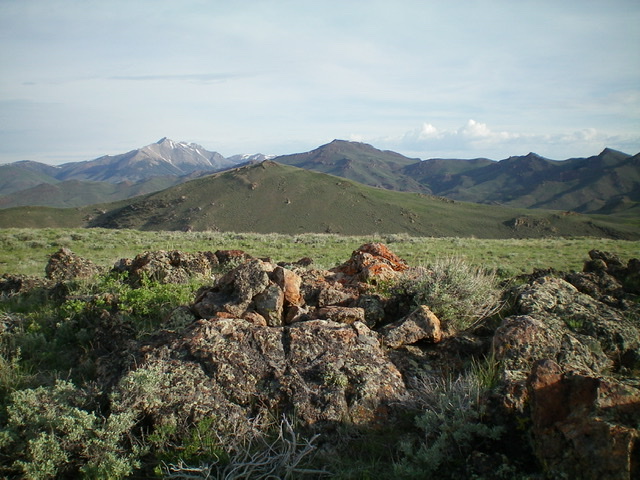
The summit of Peak 7761 with Peak 7955 in mid-ground (left of center). Livingston Douglas Photo
North Ridge, Class 1
The Descent
From the summit, descend north on a faint, old 2-track that leads down to a well-beaten jeep road at a saddle. The 2-track road is mostly grass now, but there is no sagebrush to bash through so it goes quickly. The saddle is at the base of the north ridge. The good jeep road that you have reached is Waddoups Canyon Road which descends in a long circuitous manner to the mouth of Waddoups Canyon at Antelope Creek Road. It also continues southeast to reach Richardson Spring and a saddle north of Point 7309 (part of my descent route to Ras Canyon). Before completing the descent back to the mouth of Ras Canyon, there is another nearby peak to climb (Peak 7955). Please consult the posting for Peak 7955 for details on the descent route to Ras Canyon.
Additional Resources
Regions: EASTERN IDAHO->White Knob Mountains
Mountain Range: White Knob Mountains
Longitude: -113.60121 Latitude: 43.72579