Elevation: 7,771 ft
Prominence: 311
This peak is not in the book. Published November 2023
Peak 7771 is located southeast of Diamond Flat in the Webster Range in eastern Idaho. It sits above Boulder Creek at the south end of a narrow ridgeline. Peak 7771 is most easily climbed from FSR-107 to its west. USGS Diamond Flat
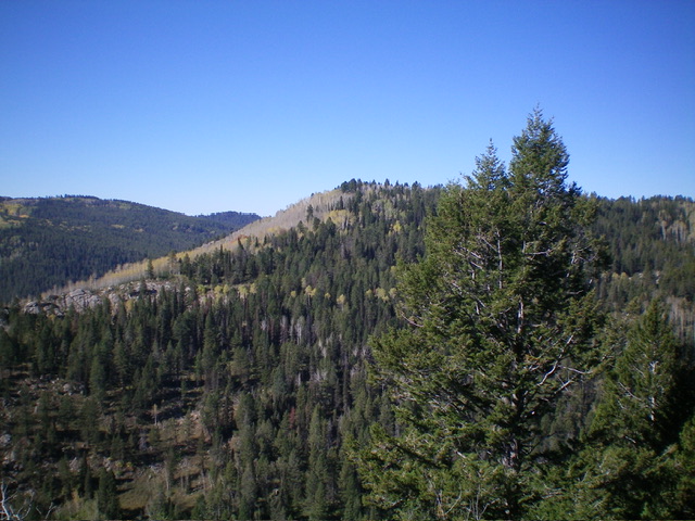
Peak 7771 (in mid-ground) as viewed from Peak 7580 to its northeast.
Livingston Douglas Photo
Access
From ID-34, turn south onto [unsigned] Lanes Creek Cutoff Road. This unsigned junction is located 12.7 miles west on ID-34 from its eastern terminus and 5.5 miles west of the South Fork Trailhead parking area. Drive south (then southwest then south) on Lanes Creek Cutoff Road for 3.1 miles to an unsigned junction with FSR-107/Lander Cutoff Road. Turn left/east onto FSR-107 and reset your odometer. At 6.1 miles, cross Flat Creek.
At 9.9 miles, park in a pullout/campsite on the left/east side of the road before the road encounters mudholes and rougher terrain. This pullout is at 7,350 feet and 42⁰50’47”N, 111⁰12’33”W. The pullout is at the southeast end of Diamond Flat. This is the first leg of a 2-peak adventure that includes Peak 7771 and Peak 7580. It covers 9.0 miles with 1,550 feet of elevation gain round trip.
Map Errors
There is a decent jeep road on the west side of the north ridge of Peak 7771. This road is not shown on maps. There are two southbound jeep roads with unsigned junctions early in the road hike. Both of these side roads are not shown on the Caribou-Targhee National Forest map. These side roads ARE shown on the USGS topo map.
West Face, Class 2
The Climb
From the parking pullout, follow FSR-107 south then east then southeast for 1.2 miles to a junction with a weak 2-track side road on the left/east side of the road. Go left/east at two unsigned road junctions early on. Leave the road here and head briefly east on the side road. Leave the side road and bushwhack east across a broad valley through sagebrush and other brush. Descend about 30-40 feet to cross Boulder Creek. Look for a spot that has the least amount of thick willows to bushwhack through. The stream is small but the creek drainage is somewhat deep.
Once across Boulder Creek, climb east up the forested face to reach a shoulder high up. This face has some brushy areas but, overall, is not too bad. Follow the shoulder northeast up to the crest of the north ridge of Peak 7771. This ridge is a mess of brush and willows. Scramble right/southeast along the minor ups and downs of the ridge crest to reach the end of the ridge and the small summit perch. The summit is a mix of pines, brush, and boulders. There was no summit cairn nor any loose rocks with which to build one. This is clearly the high point.
Contrary to the USGS topo map, the entire north ridge and summit cap of Peak 7771 is forested and visibility is limited. There are some patches of open scrub/brush on the west face but they don’t last for long. The ridge road does not go all the way to the summit and I did not cross it on my ascent route, only on my descent route.
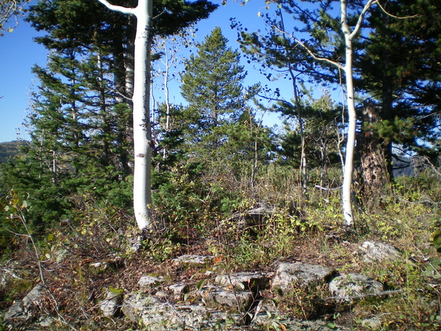
The summit of Peak 7771. Livingston Douglas Photo
East Face, Class 2+
The Climb
From the 7,260-foot connecting saddle with Peak 7771, return northwest then west to a slightly higher saddle at the head of the gully that separates the two peaks. From this saddle (7,340 feet), bushwhack west then southwest to cross the north ridge of Peak 7771 just south of Point 7751. This is a punishing bushwhack in a forest that includes thick brush, willows, and copious deadfall. Once across the north ridge, head southwest then west to return to FSR-107 at the aforementioned side road. Follow FSR-107 northwest then west then briefly north to reach the parking pullout and your awaiting vehicle.
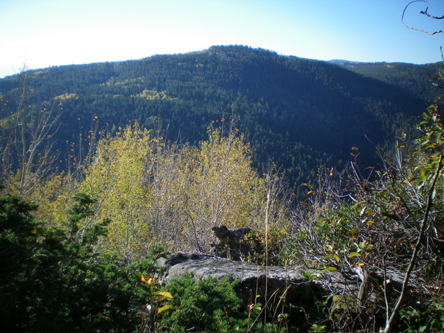
Summit view from atop Peak 7771. Livingston Douglas Photo
North Ridge, Class 2
The Descent
From the summit, scramble northwest then north along the forested ridge crest in reasonable pine forest. There are some areas of deadfall and willows to avoid. Leave the ridge and descend diagonally right/northeast in a dense pine forest that includes thick willows (in spots), brush, and deadfall. Find a hidden saddle at the head of a large gully that separates Peak 7771 from Peak 7580. The saddle area is forested in contrast to the open terrain that the USGS topo map suggests.
From the saddle, head east-southeast to another flat area. From there, bushwhack southeast then south to a splendid, semi-open, forested saddle at the base of the northwest ridge of Peak 7580. This is the 7,260-foot connecting saddle with Peak 7580 and concludes the first leg of today’s 2-peak adventure. Peak 7580 is up next.
Additional Resources
Regions: Peale Mountains->SOUTHERN IDAHO->Webster Range
Mountain Range: Peale Mountains
Longitude: -111.1763 Latitude: 42.8420