Elevation: 7,772 ft
Prominence: 312

This peak is not in the book. Published November 2023
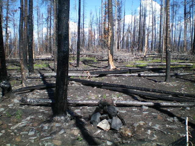
Peak 7772 is a charred ridge hump that is located just over 1-1/2 miles south of Napoleon Hill. It is a short scramble from FSR-020/Ridge Road in an extensive burn area. There is no clear high point, just a summit cap area. USGS Napoleon Hill
Access
From the Sinclair Gas Station at the north end of Salmon on US-93, drive 3.1 miles north on US-93 to a signed junction with Diamond Creek Road at the Lemhi County Fairgrounds. Turn left/west onto Diamond Creek Road and reset your odometer. At 0.5 miles, the road bends hard right/north. At 0.8 miles, reach a “Y” junction. Go left onto [signed] FSR-023. At 11.6 miles, reach a 4-way signed junction on a saddle. Turn right/north here and drive north on FSR-020/Ridge Road for 1.8 miles to a 4-way junction. Park here (7,480 feet; 45⁰19’18”N, 113⁰59’45”W).
East Face/North Ridge, Class 2
The Climb
From the road junction, walk briefly north on FSR-020 to find an old, overgrown 2-track road heading diagonally left/northwest up into the charred pine forest. Follow the 2-track as it switchbacks its way up the east face of Peak 7772 until it ends. Bushwhack west up onto the rounded north ridge in a massive burn area. Head south to reach the charred summit area. I built a nice cairn on what seemed to be the high point.
Southeast Face, Class 2
The Descent
From the summit, descend southeast through the charred forest to intercept FSR-020 just above the road junction. The descent route was thicker but more direct than the ascent route. Choose your poison. Neither of them is fun due to the burn area and the limited visibility with all of the standing, charred snags.
Additional Resources
Mountain Range: Eastern Salmon River Mountains
Longitude: -114.0031 Latitude: 45.3235
