Elevation: 7,780 ft
Prominence: 480
This peak is not in the book. Published January 2023
Peak 7780 is a forested peak in the Snake River Range that sits above the confluence of the South Fork Indian Creek and Indian Creek. In addition, it overlooks Palisades Reservoir from the east. There is no simple route to the top. The issue is not the route but the time of year. Wait until Fall to climb this peak and do it from the South Fork Indian Creek Road when the South Fork is bone dry. Do not attempt to ford either of these creeks in the Spring/Summer runoff, particular Indian Creek (which flows all year). USGS Alpine
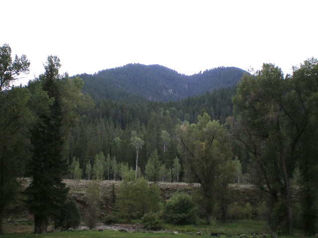
Peak 7780 (summit hump is left of center) as viewed from Indian Creek Road to its north. Livingston Douglas Photo
Access
From US-26 south of Swan Valley, drive east on [unsigned] Indian Creek Road/FSR-281. This road junction is in a massive valley that heads east from US-26. US-26 makes a sharp turn away from the junction in both northbound and southbound directions, particularly the southbound direction. From the junction, reset your odometer and drive east up Indian Creek Road. At 1.8 miles, reach a signed junction with FSR-282. Go straight to stay on FSR-281. At 1.9 miles, cross Indian Creek on a bridge. The road now heads up the South Fork Indian Creek. At 2.0 miles, reach dispersed Campsite #14 on the right side of the road. Park here (5,875 feet). GPS coordinates: 43⁰15’33”N, 111⁰03’45”W.
Northeast Spur/North Ridge, Class 2
The Climb
From the dispersed campsite, cross to the southwest side of [bone dry] South Fork Indian Creek and bushwhack southwest then south up through the pine forest to find the northeast spur. It is located on the right/west side of a prominent gully but is difficult to see due to the thick forest. Once on the ridge crest, climb southwest on the spur ridge up through the forest. The ridge crest is well-defined but is thick with pines, blowdown, and undergrowth. That being said, it goes. There is an on-and-off game trail to help in the ascent.
At about 6,700 feet, the northeast spur merges into the north ridge. It is critical to find this rather hidden junction on the descent. A game trail helps in this regard. In the final push to the summit, move to the right/west of the ridge crest to avoid an area of very thick brush. Reach the west ridge just below the summit and head left/east to the high point. The summit area is a ridge crest with thick brush and pines. The high point seems to be a ground boulder (covered by veg) at the north end of the high point area. There is no summit cairn nor any signs of previous ascent. There are minimal views from the top due to the nearby pine forest.
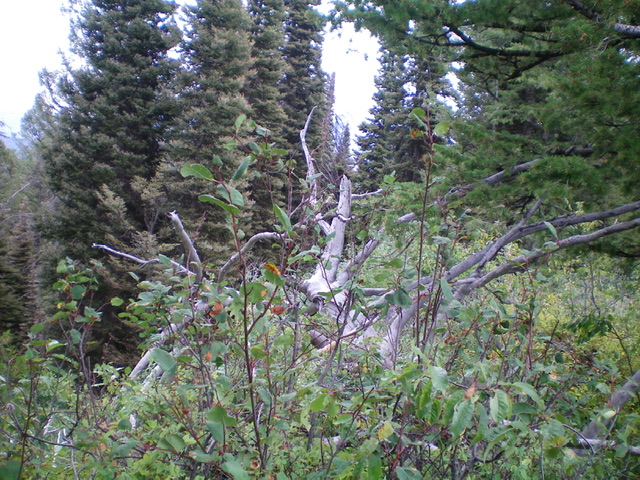
The thick, forest-and-brush summit high point of Peak 7780. No visibility whatsoever. Livingston Douglas Photo
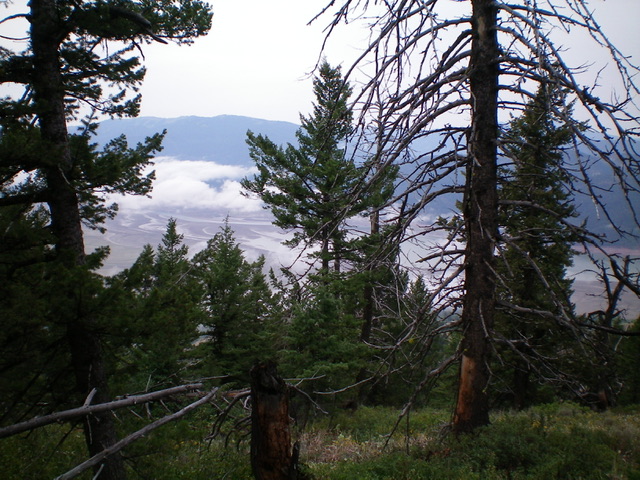
View of Palisades Reservoir (through the trees) from near the summit. Livingston Douglas Photo
Additional Resources
Mountain Range: Big Hole and Snake River Mountains
Longitude: -111.0673 Latitude: 43.2424