Elevation: 7,780 ft
Prominence: 320
This peak is not in the book. Published November 2023
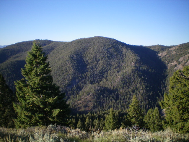
Peak 7780 is a thickly-forested mountain that separates Porphry Creek from Fourth of July Creek in the Yellowjacket Mountains. It is most easily climbed from Porphry Creek Road/FSR-112 via its northeast ridge. But it is a tedious, unpleasant forest bushwhack and I do not recommend it. USGS Blackbird Mountain
Thickly-forested Peak 7780 as viewed from the north. Livingston Douglas Photo
Access
From the signed junction of Panther Creek Road/FSR-055 and Porphry Creek Road/FSR-112, drive 2.3 miles west then northwest up Porphry Creek Road to an unsigned junction with a side road. Park here (6,150 feet; 45⁰01’29”N, 114⁰22’11”W).
Map Errors
The USGS topo map shows the summit cap having a large open area on its east side, but that is not the case. The entire summit cap is thickly forested with copious amounts of deadfall to navigate through. In addition, there is no obvious rise at the southwest end of the summit cap as the USGS topo map shows. Any rise here is pretty minimal.
Northeast Ridge, Class 2
The Climb
From the unsigned road junction, cross to the west side of Porphry Creek Road and bushwhack through a small patch of forest to reach the west side of [small] Porphry Creek. Scramble up a very steep patch of talus and scrub to reach less-steep terrain and a reasonably well-defined ridge crest. The ridge is relatively thick with pine forest, often of young pine trees. The deadfall is tedious in some areas. Follow the ridge crest as it meanders its way southwest to the summit cap.
Once you reach the flattish summit cap, continue southwest until there is no higher point and the terrain begins to descend. There is no obvious high point and, not surprisingly, no summit cairn. The summit cap is a miserable mix of pines and endless deadfall (see photo). Needless to say, there are no views from the summit. I must caution you that it is difficult to find the northeast ridge when descending from the summit cap. Visibility is nil and the ridge is more of a face very high up.
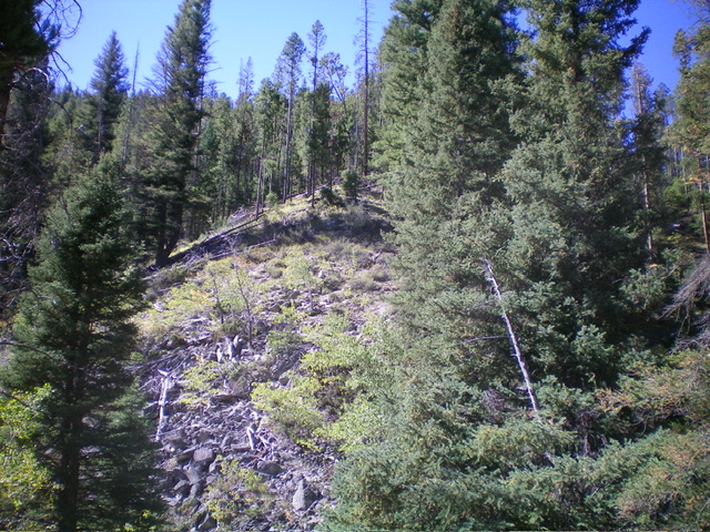
Looking up the steep initial section of the northeast ridge of Peak 7780 from its base on FSR-112. This was my ascent route. Livingston Douglas Photo
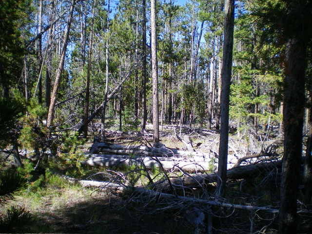
The densely-forested summit of Peak 7780. Lots of deadfall. Livingston Douglas Photo
Additional Resources
Regions: Eastern Salmon River Mountains->Salmon River Mountains->WESTERN IDAHO->Yellowjacket Mountains
Mountain Range: Eastern Salmon River Mountains
Longitude: -114.3810 Latitude: 45.0144