Elevation: 7,793 ft
Prominence: 293
This peak is not in the book. Published November 2020
Peak 7793 is a Henrys Lake Mountain that is located west of Mount Two Top (8,710 feet). It separates Twin Creek from Tygee Creek. Twin Creek is prime grizzly country so be extra careful. Carry bear spray. The terrain on Peak 7793 is mostly forested but there are areas of open meadows. Finding the summit of this one may be a challenge since there are multiple summits and no summit cairns or other markers. USGS Big Springs
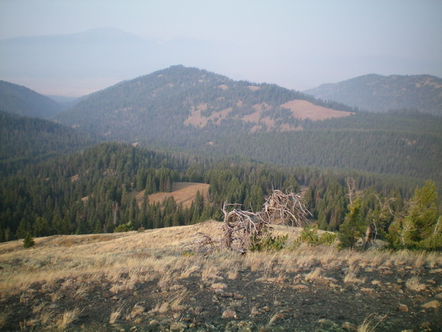
Peak 7793 (mid-ground, left of center) and its upper northeast ridge (a mix of forest and meadows) as viewed from the east. Livingston Douglas Photo
Access
Same as for Mount Two Top. This is the final leg of a two-peak journey that begins on Mount Two Top Road alongside Twin Creek.
Northeast Ridge, Class 2
The Climb
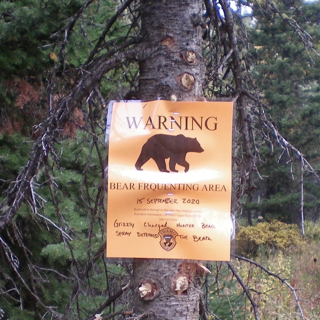
The Twin Creek drainage (on the east side of Peak 7793) is prime grizzly country. Beware. Livingston Douglas Photo
From the point on Mount Two Top Road where it crosses the base of the west ridge of Mount Two Top, hike another 0.7 miles to a forested saddle where the road flattens out. When the road bends right-ish/north, leave it and bushwhack southwest through a flat forested area using game trails and remnants of old roads to expedite the push to reach a large open meadow and saddle south of Point 7692. This bushwhack is not too bad, thanks to light veg and not-so-dense pines. Angle diagonally right/southwest up to near the ridge crest and skirt the left/east side of a minor ridge hump.
Follow the ridge in a mix of meadows and semi-open forest over a hump (Point 7760+) that is the [lower] northeast summit of Peak 7793. Continue southwest down to an open saddle at 7,660 feet. Bushwhack up through reasonable pine forest (somewhat thick but not too bad) to reach the true summit of Peak 7793 in a semi-open, forested ridgeline area. There is no summit cairn on top so I built a small cairn at the base of the highest tree. There isn’t much loose rock near the summit.
Southeast Face, Class 2
The Descent
From the summit, descend east through the thick forest into a prominent dry gully and follow it briefly southeast. Given that the gully is thick with veg and blowdown, leave it and continue east onto a forested face. Bushwhack southeast down the face to Mount Two Top Road. The brush-busting gets easier as you approach the road. Hike a short distance down the road to your parked vehicle.
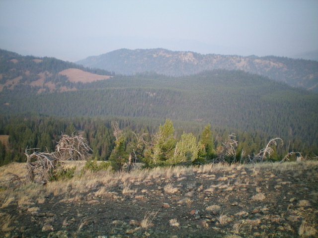
The lower northeast ridge of Peak 7793 is thickly forested (mid-ground, center and right of center). Livingston Douglas Photo
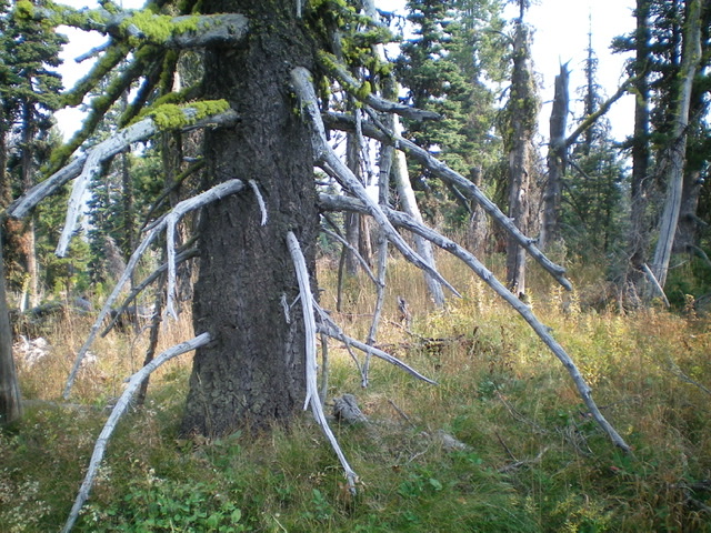
The forested summit of Peak 7793. Livingston Douglas Photo
Additional Resources
Regions: EASTERN IDAHO->Henrys Lake Range
Mountain Range: Henrys Lake Range
Longitude: -111.29859 Latitude: 44.61869