Elevation: 7,820 ft
Prominence: 320
This peak is not in the book. Published December 2020
Peak 7820 is a rather nondescript hump that barely qualifies as a ranked summit. It overlooks the beautiful Angielen Ranch on Irving Creek Road. The south ridge is probably the only publicly-accessible route to the summit, given all of the private ranch land that surrounds it. An old 2-track jeep road leads from Medicine Lodge Road all the way to the top. USGS Edie Creek
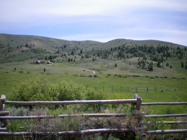
Peak 7820 (summit is right of center) as viewed from Irving Creek Road. The beautiful Angielen Ranch is in the meadow below it. Livingston Douglas Photo
Access
From I-15 at Dubois, ID, drive west on ID-22 for 5.9 miles to [signed] Medicine Lodge Road. Turn right/north onto Medicine Lodge Road and reset your odometer. At 21.0 miles, the pavement ends. At 22.5 miles, reach a [signed] road junction with Webber Creek Road/FSR-196. At 22.7 miles, reach a [signed] road junction with Edie Creek Road. At 24.4 miles, reach an unsigned road junction with a 2-track road heading right/north from Medicine Lodge Road. Park at this junction (6,380 feet). This side road is a rocky, 2-track road that does not appear to have been used in a long time. This old 2-track leads to the summit of Peak 7820 as per the USGS topo map.
South Ridge, Class 1
The Climb
Hike north up a dry gulch on the 2-track road briefly (1/4 mile) to an unsigned road junction that does not show up on maps. Go right here to cross to the right/east side of the dry creek bed. Continue north-northeast up the dry gulch on the 2-track road and reach an unsigned junction in just over a mile. Go right/east here to leave the gulch and follow a steeper 2-track road up onto the south ridge. This road section is steep, loose scree so be careful, especially when you descend it later in the day. When you reach the south ridge, go left/north on a weak 2-track road that follows the ridge crest all the way to the summit.
There are sections of this road that, frankly, are completely gone but the terrain is easy, short scrub and broken scree. You can see where the road used to be in those weak areas. Higher up, the sagebrush re-emerges and so does the old 2-track road. A fence row also joins the ridge on its left/west side. The summit is at a corner in the fence row (northwest/true summit). But since it has the same contour line, I walked southeast to the southeast summit and found it to be 5-10 feet lower than the northwest summit (by altimeter and visual readings). There was no summit cairn as there are no loose rocks with which to build one. The high point is at the fence corner, so there is no need to cross the high, stiff fence to reach a higher point.
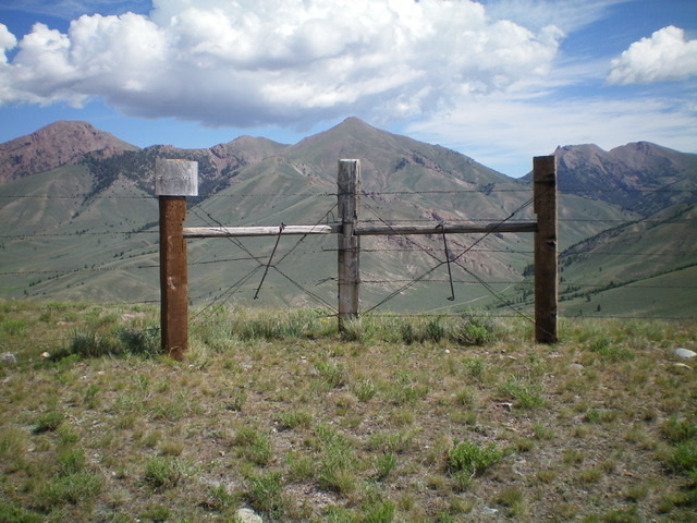
The summit of Peak 7820 is at a fence corner. This view is looking north at the South Beaverhead peaks on the Continental Divide. Livingston Douglas Photo
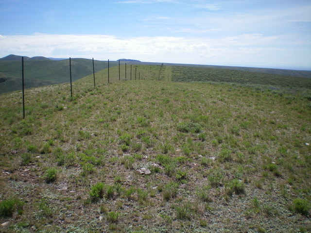
Looking southeast from the true/northwest summit of Peak 7820 at the [lower] southeast summit hump. Livingston Douglas Photo
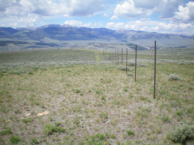
Looking back down the ascent route (south ridge) from the true summit of Peak 7820. Livingston Douglas Photo
Additional Resources
Regions: Beaverhead Range->EASTERN IDAHO
Mountain Range: Beaverhead Range
Longitude: -112.59389 Latitude: 44.43001