Elevation: 7,835 ft
Prominence: 765
This peak is not in the book. Published November 2023
Peak 7835 is located on the south side of Wood Canyon in the Aspen Range northeast of Soda Springs. The summit is most easily reach via its northeast or east sides from FSR-201, but it is a difficult bushwhack in thick terrain. USGS Johnson Creek
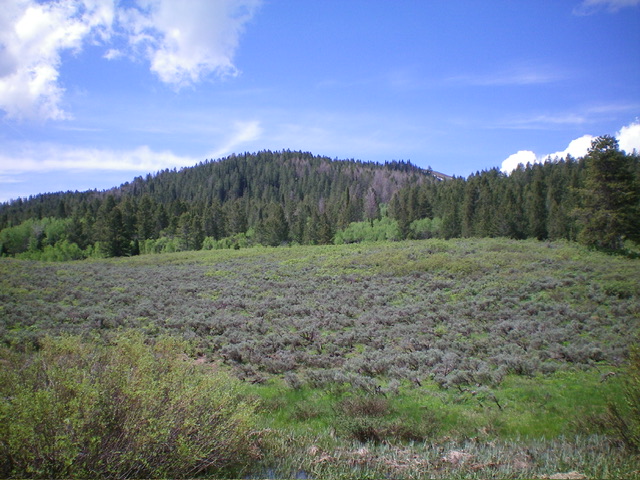
Peak 7835 as viewed from the northeast at the road junction (start of climb). Livingston Douglas Photo
Access
FSR-201 is located along Wood Canyon Road/FSR-125 exactly 2.9 miles west up Wood Canyon Road from its east end (at its signed junction with South Trail [Canyon] Road and 8.1 miles up Wood Canyon Road from its junction with ID-34 in Soda Springs on East Hooper Avenue (which becomes South Hooper Avenue then becomes Wood Canyon Road). The FSR-201/FSR-125 junction is 0.8 miles east of the FSR-175/FSR-125 junction. The junction of FSR-201/FSR-125 is signed (sort of) and is at 7,080 feet and 42⁰41’25”N, 111⁰27’50”W. Park at this junction. FSR-201 is in very bad shape and is impassable after 0.2 miles.
Northeast Face, Class 2
The Climb
From the road junction, hike south up FSR-201 to a blockage from fallen trees. Continue up the road briefly to a signed junction with an ATV trail (not shown on maps) that initially heads right/southwest toward Peak 7835. Unfortunately, this unmapped road/trail turns right/west to cross the north face so you must leave it pretty soon and bushwhack southwest up through a very thick pine forest with short aspens mixed in to tie up your feet and poke at you endlessly.
Follow orange markings on many pine trees (designed to be cut down). This line of marking generally follows a weak ridge (of sorts) but does get you pretty high up. Continue southwest up to an open scrub area and the east summit. Continue west to the true summit, with a 15-foot drop in thick scrub in between. The summit of Peak 7835 is open and bare and has a small piece of rebar protruding from the ground. I rebuilt the summit cairn.
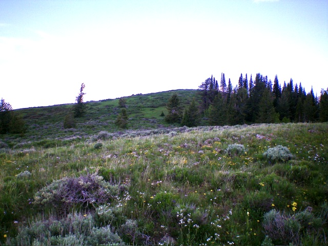
The summit hump of Peak 7835 (dead center) as viewed from the [lower] east summit.
On the descent, I initially descended the north ridge but it was a thick mess so I angled east back onto the northeast face and retraced my ascent route to find the ATV trail and then FSR-201. There simply is no easy way to the top of this peak without encountering some unpleasant bushwhacking. Sorry.
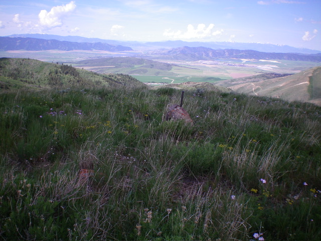
The summit of Peak 7835 with Soda Springs in the distance. Livingston Douglas Photo
Additional Resources
Regions: Aspen Range->Peale Mountains->SOUTHERN IDAHO
Mountain Range: Peale Mountains
Longitude: -111.4718 Latitude: 42.6898