Elevation: 7,900 ft
Prominence: 840

This peak is not in the book. Published December 2019
Peak 7900 is a ranked summit on the LONG south ridge of Blizzard Mountain (9,313 feet). Viewed from US-20, Peak 7900 is a BIG mountain, even though it’s only one of many points on the southern extremity of Blizzard Mountain. The south ridge and southwest ridge are great early-season climbs as Peak 7900 is free of snow well before its neighbors to the north. The terrain is short scrub and gravel and is completely open. This peak is almost entirely on BLM land. USGS Blizzard Mountain South
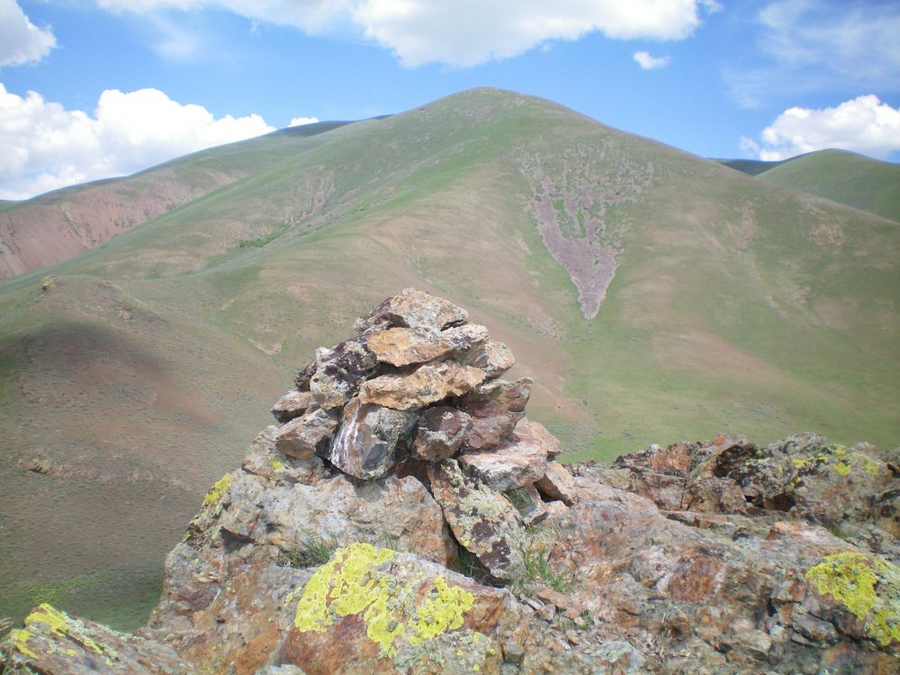
The summit cairn atop Peak 5764 with Peak 7900 in the background. Livingston Douglas Photo
Southwest Ridge, Class 2
Access
Lava Lake Road (unsigned) is located just over 2.5 miles east of Lava Lake on US-20. It is 8.9 miles west of the entrance to Craters of the Moon National Monument on US-20. This gravel road is on the north side of US-20. Drive 1.0 mile northwest on Lava Lake Road to an unsigned jeep track on the right/north side of the road. Drive 0.1 mile up this jeep track to a cattle meadow. Park here (5,250 feet).
The Climb
From the grassy meadow, hike cross-country eastward through easy sagebrush in a wide gully to reach the toe of the southwest ridge. Scramble northeast out of the gully to reach the ridge crest. Once on the ridge, follow it north. The ridge slowly bends right-ish/northeast to reach Point 7392 and, soon after, merges with the south ridge at Point 7600+. From that point, continue north-northeast up the ridge to Point 7859, the south summit. Scramble north for another 0.2 miles to reach the true summit.
The terrain on the southwest ridge is a joy—short tundra/scrub/grass with a broken scree base. The true summit is a gentle hump. The south summit has a cairn and some triangulation posts/wires. I moved two short triangulation posts to the true summit to enhance the cairn on the true summit.
South Ridge, Class 2
Access
Same as for the southwest ridge
The Descent
From the summit, descend the ridge south to Point 7600+. At this critical ridge juncture, head south (not southwest) to continue with the descent of the south ridge. Stay near the ridge crest during this descent. The south ridge is rockier (more talus/scree) and has a bit more scrub than the southwest ridge, especially in its lower reaches. Just prior to reaching US-20, you must cross a cattle fence. The ridge bends left/southeast for its final descent to the highway. Follow US-20 west to return to Lava Lake Road. Hike 1.0 mile northwest on Lava Lake Road then follow the 2-track jeep track for 0.1 mile to reach your parked vehicle in the grassy meadow.
Additional Resources
Regions: EASTERN IDAHO->Pioneer Mountains
Mountain Range: Pioneer Mountains
Longitude: -113.66489 Latitude: 43.42179