Elevation: 7,924 ft
Prominence: 406
This peak is not in the book. Published November 2022
Peak 7924 sits on the south side of Deer Creek. It separates Curran Gulch from Kinsey Creek. Peak 7924 is a ranked hump on the north ridge of Peak 8562. USGS Buttercup Mountain
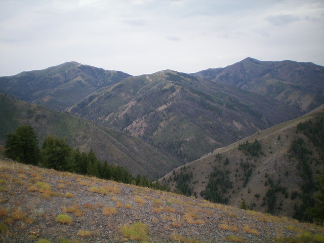
Peak 7924 as viewed from the north. Livingston Douglas Photo
Access
From Albertson’s at the north end of Hailey, drive north on ID-75 for 1.9 miles to a signed junction with Deer Creek Road/FSR-097. Turn left/west onto Deer Creek Road and drive 9.9 miles to the end of the road at the Deer Creek trailhead (6,030 feet). The Deer Creek trailhead has a bathroom and ample parking. GPS coordinates: 43⁰31’44”N, 114⁰30’18”. Please note that the USGS map shows a Deer Creek Picnic Area (which no longer exists), fails to show the trailhead, and shows Deer Creek Road continuing much farther up Deer Creek than it actually does.
Northeast Ridge, Class 2
The Climb
From the Deer Creek trailhead, hike ¼ mile up Deer Creek Trail/FST-158 to a signed junction with Kinsey Creek Trail/FST-319. Go onto FST-319 briefly and cross Deer Creek on a nice footbridge. Leave FST-319 almost immediately after the bridge crossing and climb up a narrow rib/shoulder that heads southwest up to the northeast ridge. This initial bushwhack is a bit tedious since this is a burn area and has a mix of thick veg, snags, and downed timber.
It gets a bit easier as you go higher. Higher up, the ridge is a mix of veg and scattered pines. You can avoid the thickest of the veg and make decent progress. High up, the ridge loses the trees and bends left/south then bends right/southwest to climb up through moderate veg to reach a final ridge hump at 7,740 feet. Skirt the right/west side of this hump. A final push up a hill of easy veg puts you on the summit. The summit of Peak 7924 is a small area and has a decent summit cairn.
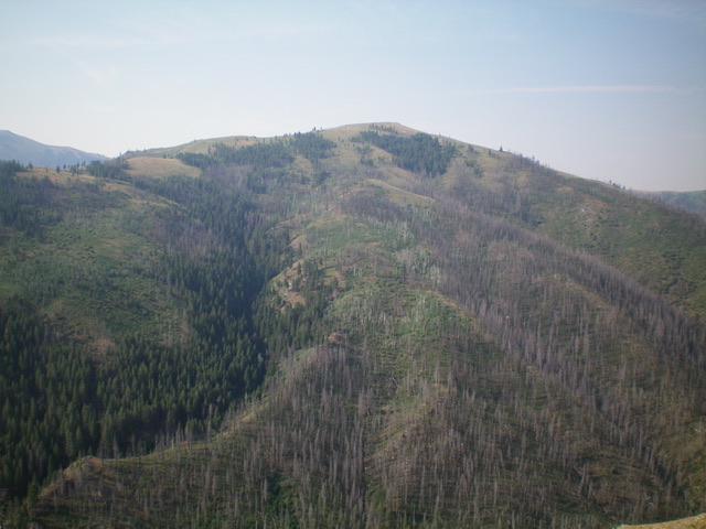
Peak 7924 (mid-ground in dead center) and its magnificent northeast ridge (dead center, coming at the camera). Livingston Douglas Photo
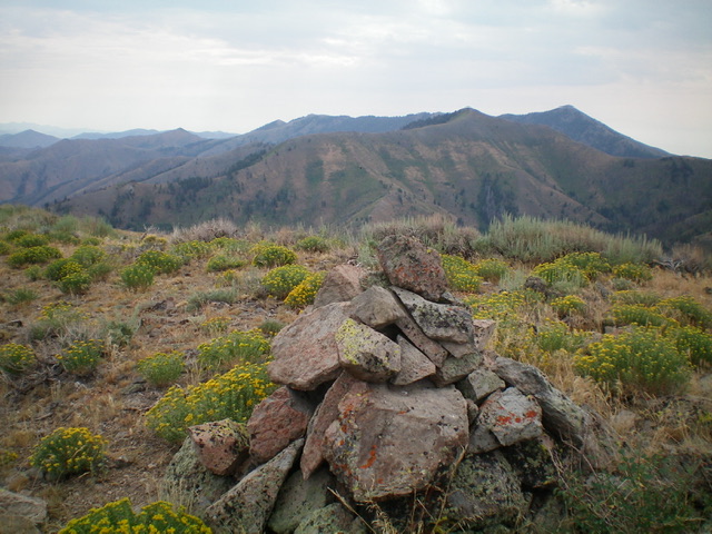
The summit cairn atop Peak 7924 with Peak 8344 in the distance (mid-ground). Livingston Douglas Photo
East Rib, Class 2
The Descent
From the summit, descend northeast down the ridge to the final ridge hump. Leave the northeast ridge here and descend southeast to quickly find the well-defined top of the east rib. Work down through some ridge rock/outcrops to reach less rocky terrain and a left/east bend in the ridge. Descend endless veg eastward then bend left/northeast into a forest of scattered pines. Some of the forest is burned but it’s not too bad and it is semi-open. Continue down through the veg with loose underlying scree/gravel to approach a prominent gully to the left/north. Drop through (or near) the forest steeply to reach the Kinsey Creek Trail then follow it for about 0.8 miles to its junction with the Deer Creek Trail. Follow the Deer Creek Trail east for about ¼ mile back to the trailhead.
Additional Resources
Regions: Smoky Mountains->WESTERN IDAHO
Mountain Range: Smoky Mountains
Longitude: -114.53501 Latitude: 43.51669