Elevation: 7,940 ft
Prominence: 320
This peak is not in the book. Published November 2023
Peak 7940 is located south of Williams Creek Summit. It is below the primary north-south ridge that crosses Williams Creek Summit and extends for many miles both north and south. Peak 7940 can be climbed via its northeast ridge from Williams Creek Road/FSR-021 or via its west ridge from the Ridge Road/FSR-020. Peak 7940 is seldom climbed. USGS Lake Mountain
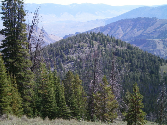
Peak 7940 as viewed from the west. Livingston Douglas Photo
Access
Williams Creek Summit is located 13.3 miles west of US-93 on FSR-021/Williams Creek Road. From Williams Creek Summit, drive south on the Ridge Road/FSR-020 for 1.9 miles and park in a pullout on right/west side of the road (8,305 feet; 45⁰03’56”N, 114⁰05’03”W). You can also drive another 0.2 miles south on FSR-020 to a crest in the road at a sharp right/west bend. This spot offers a more open, forest-free descent to the saddle at the base of the west ridge of Peak 7940. FSR-020 (south of Williams Creek Summit) was recently re-graded and, although rocky in areas, is in good shape.
West Ridge, Class 2
The Climb
From the roadside pullout, bushwhack southeast through dense pine forest to quickly find a shoulder that heads east downward to the 7,620-foot saddle at the base of the west ridge of Peak 7940. This forested shoulder has open sagebrush on its right/south side. Follow the edge of the forest in the somewhat-thick sagebrush to avoid the deadfall in the forest. Lower down, the open terrain ends but the pine forest is tolerable and even has a few game trails (on-and-off) that lead down to the saddle.
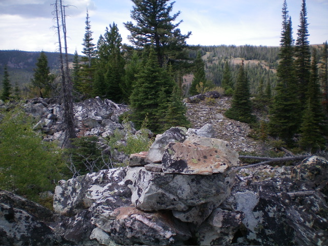
The saddle has areas of heavy deadfall which can be skirted on its right/south side. The understory is short grass. Once across the forested saddle, head northeast up a forested ridge that becomes quite rocky midway up. Stay on the right/south side of the rounded ridge crest for the most open, easiest going. Scramble diagonally left/north up across relatively stable patches of boulders and talus to move closer to the ridge crest. Stay near the ridge crest to avoid side-hilling. An easy scramble up a mix of pines and boulders/talus leads to the semi-open, rocky summit. The summit of Peak 7940 has a nice cairn atop the highest boulder.
When I returned to FSR-020, I followed a game trail up through the forest (near its left/south edge) then scrambled up through open sagebrush to reach the road at a sharp bend that is about 30 feet higher than my parking pullout. I walked north down the road for 0.2 miles to return to my parked vehicle. This route avoids the thick forest bushwhack that I encountered initially on my ascent route and I recommend it.
The rocky summit of Peak 7940. Livingston Douglas Photo
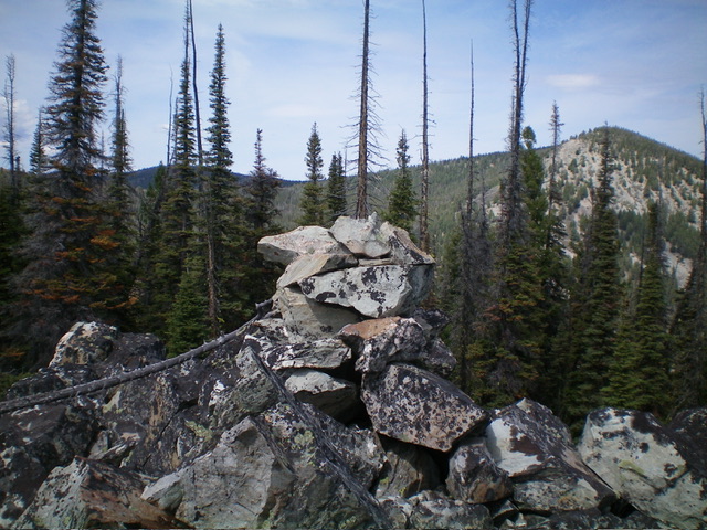
The summit cairn atop Peak 7940. Livingston Douglas Photo
Additional Resources
Mountain Range: Eastern Salmon River Mountains
Longitude: -114.0670 Latitude: 45.0661