Elevation: 7,940 ft
Prominence: 320
This peak is not in the book. It is the 20th-steepest peak in Idaho. See Tim Worth’s Idaho Summit Steepness list. Published December 2019
Peak 7940 is a massive rocky buttress that has probably never been climbed. It is located on the north side of North Creek just above a signed trail junction. The easiest approach is from a saddle on its north side. Peak 7940 is a full-on Class 5 rock climb with rotten rock, vertical and overhanging walls, and cliff faces galore. I got to within 170 vertical feet of the summit and, wishing to “climb another day,” walked away with my body and soul intact. I found no other route to get closer to the top. USGS Howe NE

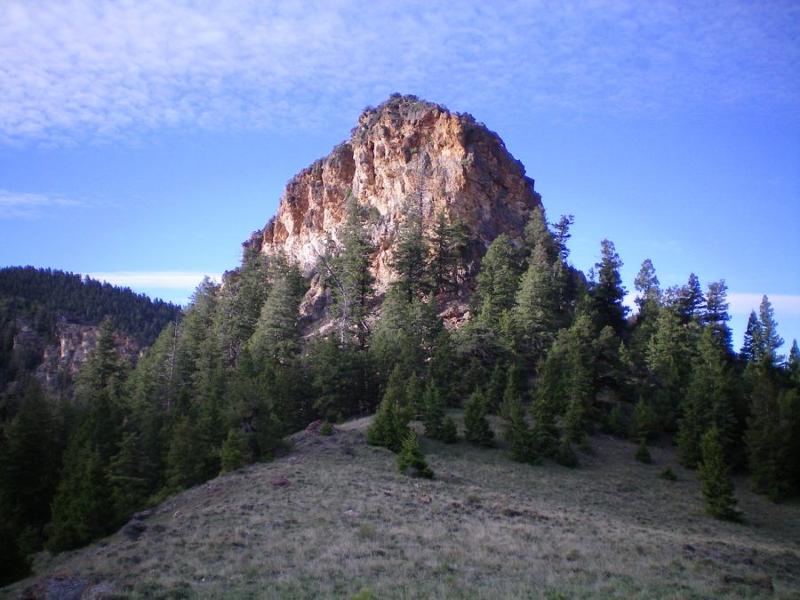
Peak 7940 as viewed from the north. Livingston Douglas Photo
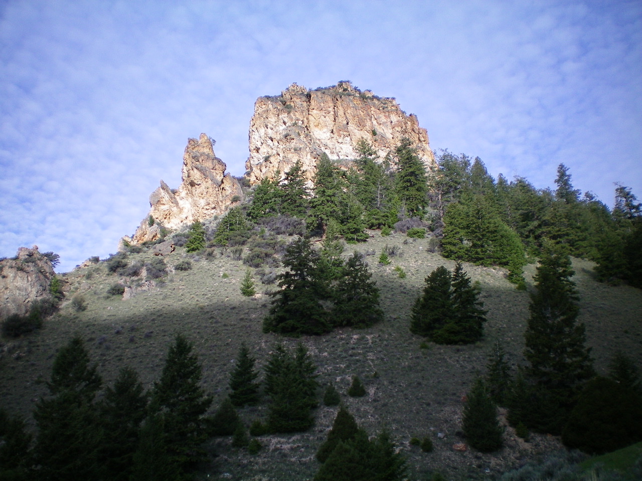
Peak 7940 as viewed from the east. Livingston Douglas Photo
Access
North Creek Road is located 12.6 miles north of Howe on the [paved] Little Lost River Highway. Turn right/east onto [signed] North Creek Road. Drive 5.5 miles on North Creek Road to an unsigned dirt road on the right/south side of the road. Park here (6,495 feet). The road ends at a private ranch 0.1 farther up. The small, unmarked parking area is on BLM land and is at the junction of two ATV trails next to North Creek. You cross into the Challis National Forest soon after heading up North Creek from here. The Challis National Forest map is accurate in its placement of the roads/trails here, but it is a bit difficult to decipher in the small area at the mouth of North Creek Canyon.
Please note that the USGS topo map is incorrect in its placement of the roads at the mouth of North Creek Canyon. The main road ends at a ranch on the north side of North Creek. It does not continue up into the canyon and cross to the south side of the creek. That part of the road is gone. The actual jeep road (now an ATV trail) that goes up into North Creek Canyon is located on the south side of the creek and follows the creek upstream to the “Tailings Ponds” shown on the map. While there aren’t any tailings ponds anymore, there are remnants of old mines in that area. From that point on, the USGS topo map is accurate.
The Attempted Climb
From the parking area, follow an ATV trail (FST-4209) that crosses North Creek and follows the creek upstream. Reach a signed trail junction in a meadow just over 1-1/2 miles from the parking area. Rugged Peak 7940 is directly northwest of here and is quite visible. The sight isn’t a pretty one. But the USGS topo map makes it look potentially do-able from its north side. Go left/north onto FST-4252 and follow the ATV trail up to a saddle on the north side of Peak 7940.
From the saddle, scramble south to the base of the steep cliffs/walls. Work around to the right/west side of this massive buttress. Climb up a chute, fighting with mountain mahogany that is intertwined with the large boulders here. The climb quickly becomes impossible due to overhanging rock walls with dubious rock quality at best. I investigated more potential routes on the west face but found nothing even remotely do-able. I returned to the saddle north of Peak 7940 and hiked down FST-4252 to its junction with the North Creek Trail/FST-4209. Perhaps another climber with a higher skill level can figure this peak out.
Additional Resources
Regions: EASTERN IDAHO->Lemhi Range
Mountain Range: Lemhi Range
Longitude: -113.01609 Latitude: 43.98629