Elevation: 7,962 ft
Prominence: 378
This peak is not in the book. Published January 2023
Peak 7962 is a minor, ranked hump on the long south ridge of Bald Mountain (8,491 feet) in the Caribou Range. It sits on a ridgeline that separates Trail Creek from Squaw Creek. Peak 7962 is most easily reached either from the Jackknife Creek Trail to its south or from Trail Creek Trail to its west. USGS Tincup Mountain
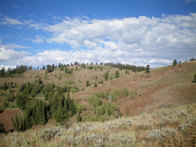
Peak 7962 as viewed from the southwest. The bald summit hump is just left of center.
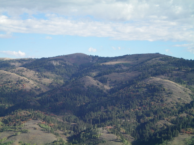
Peak 7962 (dead center, partially forested) as viewed from the upper leg of the southeast ridge. Livingston Douglas Photo
Access
From the junction of US-89 and US-26 at the north end of Alpine, WY, drive 9.4 miles south on US-89 to a signed junction with Creamery Road. Turn right/west onto Creamery Road (which becomes Jackknife Creek Road/FSR-136) and drive 6.2miles to the end of the road at the [signed] trailhead for Jackknife Creek Trail/FST-448 (5,990 feet).
Map Errors
The Caribou National Forest map shows Bald Mountain Trail/FST-453 heading northwest all the way up to just east of Point 7761. In actuality, it heads north (as shown on the USGS map) to a junction with FST-458. The USGS map shows a trail coming up over a minor point east of Point 7761. No such trail exists, not even at the saddle between Point 7761 and that minor hump.
The actual trail re-emerges above the saddle and climbs up over the top of Point 7761, not skirting its north side as the USGS map shows. The trail (now pretty weak) drops to a saddle then climbs with a few switchbacks up over Point 7962. The trail is just horse tracks in loose dirt/mud up over Point 7761 and on to Peak 7962. The USGS map shows a trail junction at 6,520 feet. No such side trail exists.
Southeast Ridge, Class 2
The Climb
From the trailhead, hike up Jackknife Creek Trail/FST-448 (very popular to hunters). Almost immediately, cross Jackknife Creek on a beautiful footbridge. Jackknife Creek is a wide but shallow creek with lots of willows and beaver ponds in this area. After another 0.2 miles, reach a trail junction at another footbridge with a massive trail sign for Bald Mountain Trail/FST-453. This footbridge crosses the miniscule (if not bone dry) Skull Canyon Creek. This side trail is just across the footbridge and heads steeply right/northwest up into the forest. Leave Jackknife Creek Trail and hike up Bald Mountain Trail. This trail is narrow, overgrown, and poorly maintained, quite a contrast to the well-beaten Jackknife Creek Trail.
Follow Bald Mountain Trail northwest up the forested southeast ridge. Much of this ridge is in open or semi-open terrain with areas of scrub and field grass. The trail reaches an unsigned junction with a game/use trail on a flat ridge/shoulder at 6,900 feet. The game/use trail goes straight ahead and almost immediately ends. Go right/north here and follow Bald Mountain Trail to a crest at a large tree that is cut off about 20 feet above the ground. Leave the trail here and bushwhack west up through thick forest to reach a critical north-south section of the ridge just south of Point 7442. Thankfully, there are some nice patches of open scrub mixed in with the forest, unlike what the USGS map shows. Reaching the critical ridge is not too much work.
Once on the ridge crest, follow it north in scrub and scattered pines/blowdown up over Point 7442. From Point 7442, drop 20 feet in easy scrub/grass to a saddle. Continue north in easy, open scrub/grass to approach a minor hump (Point 7680+). Skirt the left/south side of this hump to reach a saddle just east of Point 7761. Quickly find a weak use trail (which is actually the Bald Mountain Trail) and follow it up over Point 7761. Descend west on a weak use trail to a final saddle. From the saddle, hike west up a weak use trail (that is Bald Mountain Trail) as it switchbacks its way to the cairned summit of Peak 7962.
On the descent, it is critical to leave the southeast ridge at the entry point and bushwhack east (staying in open fields of scrub/grass as much as possible) to find the Bald Mountain Trail. There is much more off-trail work on this climb than some would suggest and the “trail” on the upper east-west ridge section is pretty much of a joke and is, in many ways, could be considered off-trail.
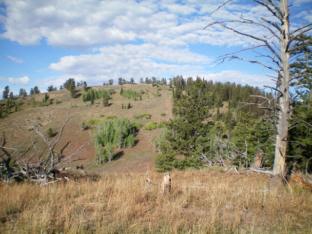
The summit hump of Peak 7962 as viewed from Point 7761 to its east. Livingston Douglas Photo
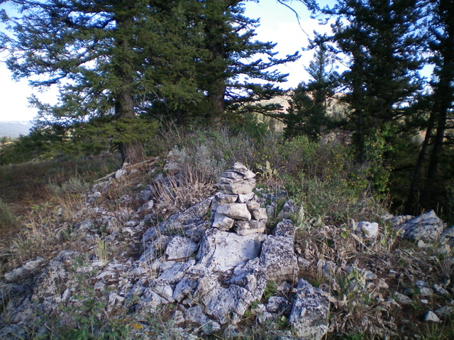
The summit of Peak 7962. The high point is the large pine tree behind the summit cairn. Livingston Douglas Photo
Additional Resources
Regions: Caribou Range->SOUTHERN IDAHO
Mountain Range: Caribou Range
Longitude: -111.18039 Latitude: 43.06579