Elevation: 8,002 ft
Prominence: 372
This peak is not in the book. Published January 2023
Peak 8002 is a forested peak that separates Dry Canyon from Worm Creek in the Bear River Range. It is most easily climbed from Dry Canyon Road/FSR-410 to its south. Climb Peak 8002 along with Peak 7980 to its south to make it a more worthwhile endeavor. With an ATV or MC, you can significantly shorten the hiking mileage required. USGS Paris
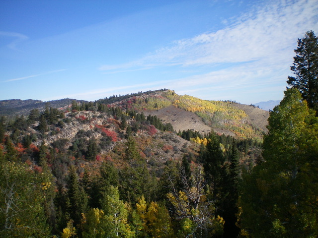
Peak 8002 (dead center) as viewed from the south. Livingston Douglas Photo
Access
From US-89 at the north end of St. Charles (0.2 miles north of the well-signed turnoff for Bear Lake State Park), turn right/west onto a road that is signed for the Minnetonka Cave. Reset your odometer at this junction. At 0.7 miles, turn right onto [unsigned] Dry Canyon Road/FSR-410, a dirt road in contrast to the paved road that continues west to the St. Charles Campground and beyond. At 2.9 miles, reach the Cache National Forest boundary. Park here or at a small pullout on the left side of the road about 100 yards farther up the road (6,430 feet). The road is significantly rutted and has serious mudholes after this point.
Map Errors
The USGS topo map shows Dry Canyon Road/FSR-410 as an improved road all the way up the canyon to a major fork (Stewart Fork and Water Fork) and a junction with FSR-1152 (an ATV trail). It most certainly is NOT. The USGS topo map also shows FSR-1152 as a decent road but it is now an ATV trail. The USGS topo map shows a 4WD road heading up Limekiln Fork but that old road no longer exists. There are not even any remnants of an old road in Limekiln Fork, only a cattle trail in its lower reaches.
South Face/Southwest Ridge, Class 3
The Climb
From the parking pullout, hike west up Dry Canyon on FSR-410. When you reach a meadow at Limekiln Fork (to the left/south) at 6,996 feet, you can leave the road and climb the south face up to the southeast shoulder from here. Or, as I did, continue another ½ mile up FSR-410 to a point that is a more direct line to the summit. Leave FSR-410 at the base of the south face at 7,230 feet. Bushwhack right/north up the steep slope in field grass and scattered junipers/mountain mahogany/pines. Higher up, the grass turns to taller, thicker brush. Worse yet, an aspen forest higher up looms above you. A band of rock/boulders sits above the aspens and just below the summit ridge. Not attractive prospects.
Bushwhack up through the brutal, steep aspens, which also have thick brush, blowdown from scattered pines, and large boulders mixed in. Pull yourself higher by using aspen branches. Yes, that’s how steep this bushwhack is. Climb up through the cliff band of boulders high up to reach the southwest ridge. The cliff band is difficult to surmount (Class 3) because it is very steep and has aspens and brush mixed in. Once atop the crest of the southwest ridge, it is a cruise northeast to the summit. Stay left/north of the mahogany-studded ridge crest in open grass/scrub and scattered mountain mahogany. The summit of Peak 8002 has a tall, blocky cairn and beautiful views to the east and northeast.
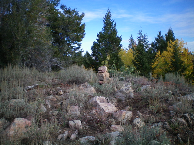
The summit cairn atop Peak 8002. Livingston Douglas Photo
Southwest Ridge/West Face, Class 2
The Descent
From the summit, descend the southwest ridge, staying to the right/north of the mahogany-clogged ridge crest in semi-open grass/scrub. Leave the ridge at 7,600 feet to descend right-ish/west straight down the forested pine face. This face has decent gaps in the pines and areas of grass/scrub. Reach a side gully and a good cattle trail that heads left/south. Follow the trail and quickly reach FSR-410. Walk briefly west on FSR-410 to reach a signed road junction just above a creek crossing in a flat area. This is the junction of FSR-410 and FST-1152 (an ATV trail). This is the low point (7,420 feet) in the traverse from Peak 8002 to Peak 7980 and concludes the first leg of today’s 2-peak adventure. Peak 7980 is up next.
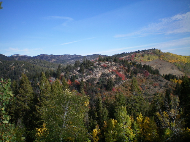
Peak 8002 (summit is at far right) and its southwest ridge (skyline in mid-ground), my descent route. Livingston Douglas Photo
Additional Resources
Regions: Bear River Range->SOUTHERN IDAHO
Mountain Range: Bear River Range
Longitude: -111.4922 Latitude: 42.1362