Elevation: 8,090 ft
Prominence: 350
This peak is not in the book. Published November 2022
Peak 8090 sits on the north side of ID-75. It separates Coal Creek from Upper Harden Creek in the Eastern Salmon River Mountains. Peak 8090 is most easily climbed from Coal Creek Road to its west. USGS East Basin Creek
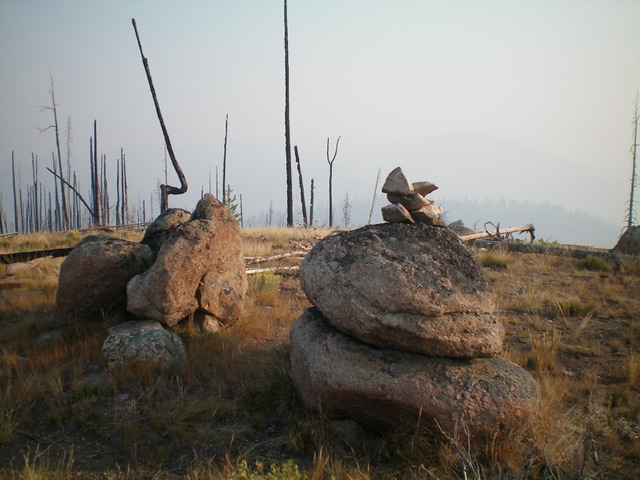
The large summit boulders and newly-built summit cairn atop Peak 8090. Livingston Douglas Photo
Access
From ID-75, drive west up Basin Creek Road/FSR-034 for 0.7 miles to its signed junction with Coal Creek Road/FSR-132. Park at a campsite at this junction (6,130 feet). GPS coordinates: 44⁰16’09”N, 114⁰49’43”W.
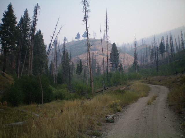
The toe of the west shoulder (dead center) of Peak 8090 as seen when hiking up Coal Creek Road. This was my ascent route. Livingston Douglas Photo
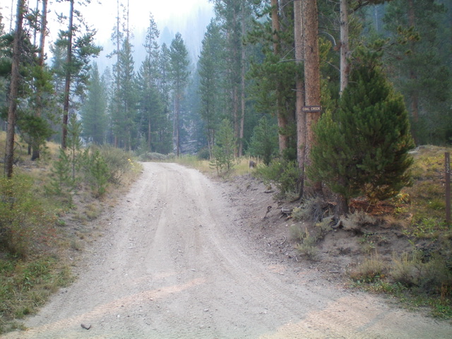
The base of Coal Creek Road, the start of the hike up Peak 8090. Livingston Douglas Photo
Map Errors
Basin Creek Campground is located 1.1 miles up Basin Creek Road, NOT along ID-75 as the USGS topo map indicates. The USGS topo map shows Coal Creek Road crossing to the right/east side of Coal Creek well before a big gully on the right/east side of the road and staying there for a good ½ mile or so. That is not true. The road only briefly crosses to the right/east side of the creek and does NOT traverse the west face of the west shoulder of Peak 8090. It stays in the creek drainage on its left/west side. This is critical in determining where to leave the road to avoid a bushwhack across the thick foliage that surrounds Coal Creek.
West Shoulder, Class 2
The Climb
From the road junction, hike (or drive) 0.6 miles up the somewhat rugged Coal Creek Road to the base of the west shoulder at 6,355 feet. Leave the road here and scramble northeast then north up a narrow ridge of scrub and charred logs. This is a burn area. Follow the shoulder as it bends right (northeast then east) and leads directly to the summit. The shoulder is somewhat ill-defined in its mid-section. The terrain is a mix of brush, grass, charred logs, and snags. The shoulder gains definition higher up.
There are only certain sections that are tedious with downed timber. The bigger challenge is the final push to the summit, which is on steep scrub with scattered blowdown and loose underlying dirt/gravel. This route leads right to the high point of Peak 8090, which is in the middle of a high ridge. The summit is a collection of large boulders on a summit hump. It is clearly the high point and the terrain is open. There were no signs of previous ascent so I built a modest cairn atop one of the summit boulders. This climb is mostly in open (albeit burnt) terrain. There is no forest to speak of.
Additional Resources
Regions: Eastern Salmon River Mountains->Salmon River Mountains->Southeast Corner Peaks->WESTERN IDAHO
Mountain Range: Eastern Salmon River Mountains
Longitude: -114.80839 Latitude: 44.28249