Elevation: 8,105 ft
Prominence: 525
This peak is not in the book. Published November 2022
Peak 8105 is located at the head of Bullion Gulch, Democrat Gulch, and Narrow Gauge Gulch just outside of Hailey. This area is a mish-mash of private and public land, so be careful. Peak 8105 is most easily climbed from Bullion Gulch. USGS Mahoney Butte
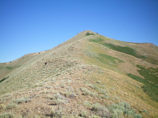
The summit hump of Peak 8105 as viewed from high on the southeast ridge. Livingston Douglas Photo
Access
From ID-75 in Hailey, turn left/southwest onto Bullion Street (which becomes Croy Creek Road) and drive 4.4 miles to a signed junction with Bullion Gulch Road. Turn right/north onto Bullion Gulch Road and drive 3.1 miles to a turnaround at a few old mining buildings. Park here (6,440 feet). GPS coordinates: 43⁰30’13”N, 114⁰24’38”W. The road becomes narrow, rough, and steep at this point and is only suitable for ATVs and [perhaps] jeeps.
Please note that the USGS map fails to show that Bullion Gulch Road goes all the way to a ridge saddle just southwest of Peak 8105 and the road has switchbacks that make it a bit longer than the map shows. There is a small patch of private land that my ascent route crosses high up in Bullion Gulch and at the base of the southwest ridge. However, there is no fencing or signage to prohibit crossing it. ATVs clearly use this rocky, narrow, overgrown road high up.
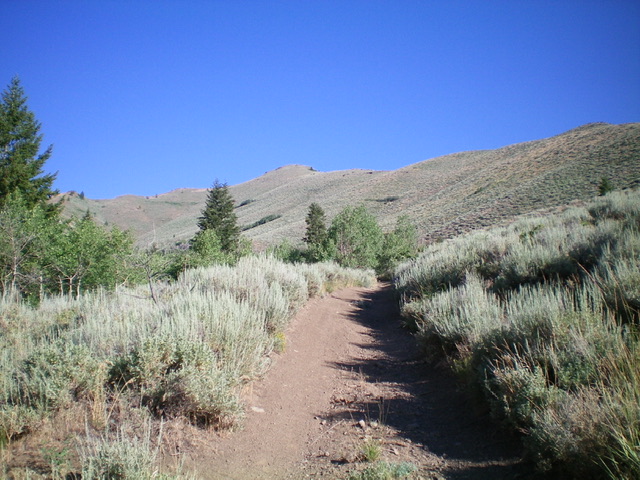
Peak 8105 (the summit is the hump just left of center) as viewed from Bullion Gulch. The southeast ridge (my descent route) is the right skyline. Livingston Douglas Photo
Southwest Ridge, Class 2
The Climb
From the parking/turnaround area at the 3.1-mile point on Bullion Gulch Road, hike up the steep, rocky Bullion Gulch Road on lots of loose rock, overgrowth, and an angled road bed. The old road leaves the center of the gulch to climb up its left/south side through a few switchbacks to reach the small ridge saddle just southwest of the summit. From the saddle, find an old 2-track road on the left/northwest side of the ridge crest. Follow this old 2-track until it soon ends at a rocky ridge hump. From that hump, follow the ridge left/north then right-ish/northeast to reach the small summit of Peak 8105. There was no summit cairn so I built one.
Southeast Ridge/South Face, Class 2
The Descent
From the summit, descend the beautiful southeast ridge on relatively easy scrub with a bit of rock high up. The terrain is mostly nice, gapped sagebrush with underlying loose scree/gravel. Drop right/southwest off the ridge just before reaching the ridge saddle northwest of Point 7113. Bushwhack down through thicker sagebrush (weaving required) on a shoulder of sorts to reach Bullion Gulch Road. This is a steep, fast descent to the road. Once on the road, follow it for about ½ mile to the parking/turnaround area and your awaiting vehicle.
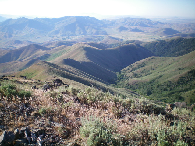
Looking down Bullion Gulch (just right of center) from the summit of Peak 8105. Livingston Douglas Photo
Additional Resources
Regions: Smoky Mountains->WESTERN IDAHO
Mountain Range: Smoky Mountains
Longitude: -114.42264 Latitude: 43.51819