Elevation: 8,108 ft
Prominence: 528
This peak is not in the book. Published January 2023
Peak 8108 is a beautiful ridgeline peak that towers over Big Basin in the Aspen Range. It is most easily climbed from FSR-1251/Big Basin Road to its southwest. USGS Harrington Peak
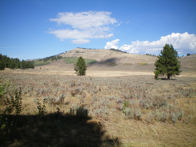
Peak 8108 as viewed from across Big Basin to its south. Livingston Douglas Photo
Access
From US-30 in Georgetown, turn right/east at the Mormon Church and drive up Stringtown Road to reach a signed fork in the road at the east end of town. Go left onto Left Fork Georgetown Canyon Road/FSR-1095. At 7.8 miles up from US-30, reach a signed junction with FSR-1238 near the Summit Campground. Turn left onto FSR-1238 (which is a bit narrow and rocky) and drive northwest then north to reach a signed junction with FSR-1251/Big Basin Road at 4.5 miles.
Reset your odometer here. Turn left onto FSR-1251 and follow it as it drops down into Big Basin. At 4.1 miles, reach a roadside pullout and dispersed campsite on the right/east side of the road. Park here (7,360 feet). GPS coordinates: 42⁰36’53”N, 111⁰21’56”W. This campsite sits at the base of the southwest face of Peak 8108.
Map Errors
The USGS topo map fails to show any of FSR-1238 which comes from the Left Hand Fork Georgetown Canyon Road at the Summit Campground all the way to a signed junction with FSR-1251/Big Basin Road (which IS shown on the map). The USGS topo map also fails to show the ATV trails in Big Basin, one of which heads across the basin and up onto the southeast ridge of Peak 8108.
Southwest Face, Class 2
The Climb
From the dispersed campsite, scramble northeast directly at the obvious summit. Cross scrub and drop 60 feet to cross a dry gulch with a good ATV trail coming up through it. Continue northwest up over a ridge then drop 40 feet in more scrub to cross a minor gully. Skirt the right/southeast side of a thick patch of aspens. Scramble up open scrub then bushwhack directly up through a narrow patch of thick aspens (only 80 vertical feet of bushwhacking required) to reach the steep, open scrub above. Continue up the scrub face to reach the summit ridge only 65 vertical feet below it and about 0.2 miles away. Follow the easy scrub on the ridge to reach the ridge crest summit of Peak 8108. The summit had a modest cairn (which I built up a bit) and some triangulation wires mixed in.
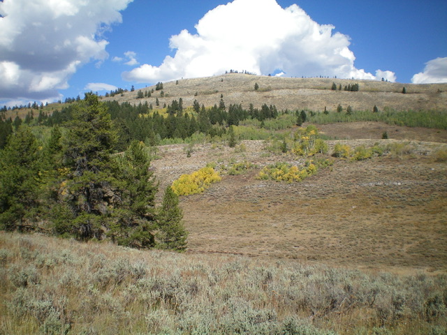
The southwest face of Peak 8108 as viewed from its base at the dispersed campsite. This was my ascent route. Livingston Douglas Photo
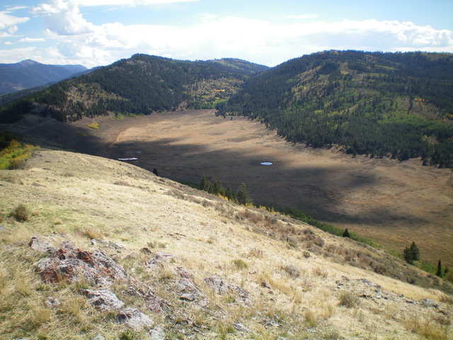
Looking down into Big Basin from the summit of Peak 8108. Livingston Douglas Photo
Additional Resources
Regions: Aspen Range->Peale Mountains->SOUTHERN IDAHO
Mountain Range: Peale Mountains
Longitude: -111.3576 Latitude: 42.6220