Elevation: 8,120 ft
Prominence: 700
This peak is not in the book. Published November 2022
Peak 8120 is a hulking mass that towers over the expensive homes on East Gulch Road near Indian Creek. It is most easily climbed from the northwest from Indian Creek Road. A few small sections of this peak are on private property, including the summit. USGS Hailey
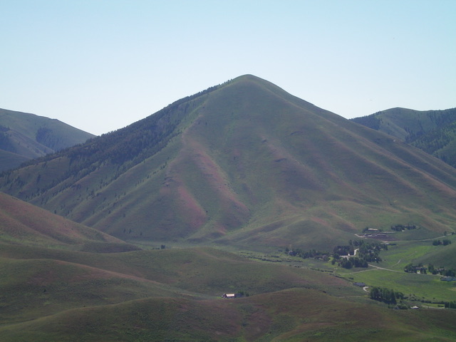
Peak 8120 as viewed from Peak 6702 to its west. Livingston Douglas Photo
Access
From ID-75 in Hailey, drive east up Myrtle Street to its signed “T” junction with Buttercup Road. Turn left/north onto Buttercup Road and drive 1.3 miles to a signed junction with Indian Creek Road. Turn right/east onto Indian Creek Road. Reset your odometer here. At 2.9 miles, reach a signed junction with East Gulch Road. Go straight to stay on Indian Creek Road. At 3.5 miles, reach BLM land. At 3.6 miles, parking along the left side of the road in the field grass (5,890 feet). GPS coordinates: 43⁰34’56”N, 114⁰16’29”W.
This area is a mix of private and public land, so be careful. Consult a land management map before undertaking this climb. This climb is almost entirely on BLM land. However, the summit itself is on private land that is not fenced, signed, or posted.
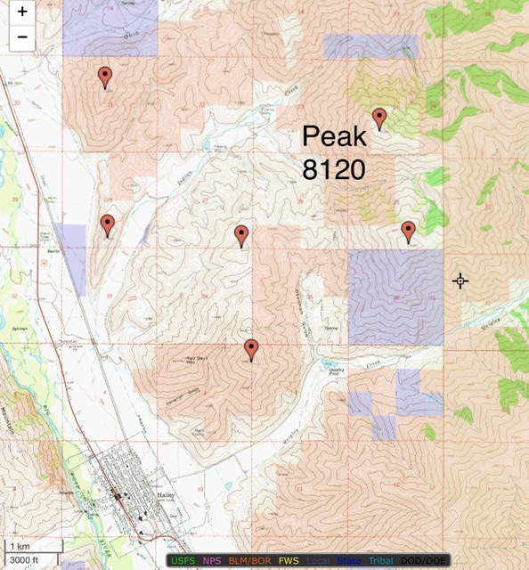
Land ownership around Peak 8120. Blue is State of Idaho land, tan is BLM land, and the remainder is private property.
Northwest Spur/Northwest Ridge, Class 2
The Climb
From the improvised pullout along Indian Creek Road, bushwhack southeast across a dry drainage in thick, tall sagebrush then scramble east-southeast up the obvious spur/shoulder in easier sagebrush. Higher up, the terrain has a nice section of short scrub then reaches a final, steep section of thicker sagebrush to reach the amazing, open northwest ridge at about 7,080 feet. Once on the northwest ridge, grind east-southeast up easy, short scrub. High up, the ridge bends right-ish/southeast and goes directly to the small, but elongated, summit of Peak 8120. The summit had no cairn so I built one atop a boulder just southeast of the high point.
The summit high point is in the open scrub at the northwest end of the summit area but there is a protruding block/boulder to the southeast that looks almost as high, so I built a cairn on it. The descent is very fast on easy scrub/tundra and loose gravel. Remember to leave the northwest ridge at 7,080 feet and descend the northwest spur to Indian Creek Road or you will end up on posted, private ranch land. Be very careful here because the land along much of Indian Creek Road is private property and is aggressively posted.
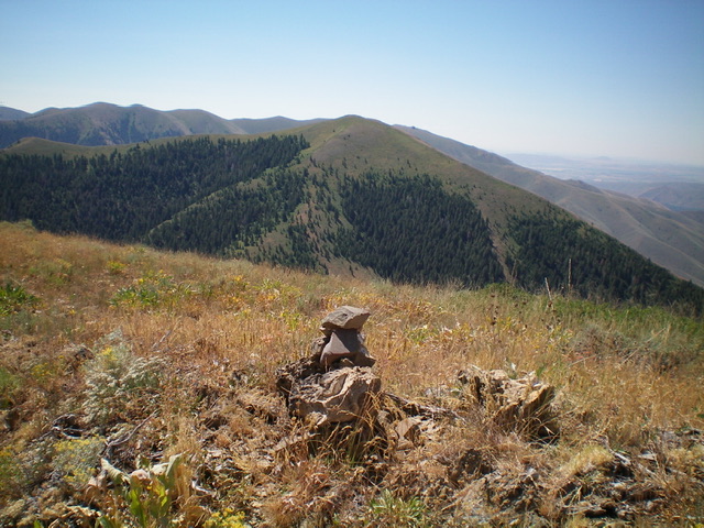
The newly-built summit cairn atop Peak 8120 with Peak 8189 in the distance. Livingston Douglas Photo
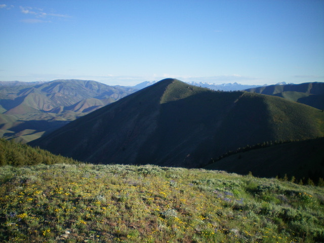
Peak 8120 as viewed from the southeast. Livingston Douglas Photo
Additional Resources
Regions: EASTERN IDAHO->Pioneer Mountains
Mountain Range: Pioneer Mountains
Longitude: -114.26069 Latitude: 43.57419