Elevation: 8,137 ft
Prominence: 317
This peak is not in the book. Published November 2020
Peak 8137 is a foothill hump that sits above the North Fork Fritz Creek. It is dwarfed by Fritz Peak to the south and Scott Peak to the southwest. The rugged ridge of the Continental Divide is to the west and southwest and includes such other luminaries as Eighteenmile Peak and Italian Peak. That being said, Peak 8137 is a ranked summit and is an easy scramble from the end of Fritz Creek Road/FSR-199. You will probably be greeted by bovines grazing in this area both on the drive and on the hike itself. USGS Deadman Lake
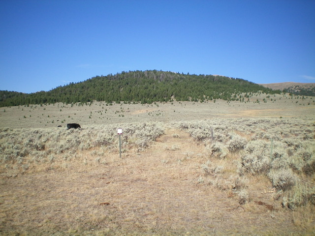
Peak 8137 as viewed from the end of Fritz Creek Road/FSR-199. The summit is open scrub but is hidden behind the pine forest. Note the fence row, the old 2-track road, and the cows. Livingston Douglas Photo
Access
From I-15 at Dubois, ID, drive west on ID-22 for 5.9 miles to Medicine Lodge Road. Turn right/north onto [signed] Medicine Lodge Road and reset your odometer. At 21.0 miles, the pavement ends. At 25.7 miles, reach a [signed] road junction with Irving Creek Road. At 27.5 miles, reach a [signed] fork in the road. The left fork is Fritz Creek Road; the right fork is Warm Creek Road. Go left onto Fritz Creek Road/FSR-199. Reset your odometer here.
At 0.2 miles, cross a cattle guard and reach a road junction. Straight/west is Fritz Creek Road and right/north is Bannack Pass Road. Go straight here to stay on Fritz Creek Road. At 1.7 miles, reach the National Forest boundary. At 3.9 miles, reach the end of Fritz Creek Road at a “T” junction and a cattle fence heading west. Park in a large pullout area at this unsigned junction (7,380 feet).
East Face, Class 2
The Climb
Follow an old, weak 2-track road on the left/south side of a fence row that leads west all the way to the summit area of Peak 8137. The terrain is open sagebrush initially, then a patch of pine forest, then open scrub high up. The 2-track road degrades to a cattle trail then a weak foot trail (if any trail at all) once you reach the forested area. Just keep following the left/south side of the fence row. Once on the summit ridge, the fence row turns right/northwest and leads to the high point of Peak 8137. There is a decent cairn on the summit.
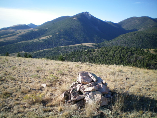
The summit of Peak 8137, looking south. Fritz Peak is dead center with its sheer north face visible. Livingston Douglas Photo
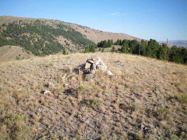
The summit cairn atop Peak 8137, looking northwest. Livingston Douglas Photo
Additional Resources
Regions: Beaverhead Range->EASTERN IDAHO
Mountain Range: Beaverhead Range
Longitude: -112.75501 Latitude: 44.42089