Elevation: 8,140 ft
Prominence: 281
This peak is not in the book. Published November 2023
Peak 8140 is a ridgeline summit located due west of Lewis and Clark Ridge. Like its eastern neighbor, it sits on the ID/MT border. Peak 8140 is easily climbed via its southeast ridge from the Forest Service road that traverses the ridge crest. USGS Lost Trail Pass
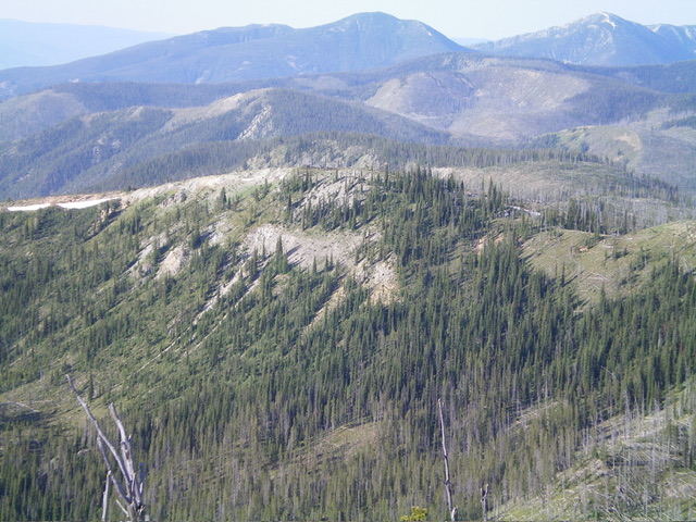
Peak 8140 (in mid-ground) as viewed from the north. Livingston Douglas Photo
Access
Same as for Lewis and Clark Ridge. This is the second leg of a 3-peak adventure that includes Lewis and Clark Ridge, Peak 8140, and Saddle Mountain MT (8,460 feet).
Southeast Ridge, Class 2
The Climb (then Descent)
From the 7,859-foot connecting saddle with Lewis and Clark Ridge, scramble west then northwest up a mostly-open ridge crest of grass/scrub and lots of deadfall to reach the semi-forested summit area of Peak 8140. The high point is on a ridgeline that is mostly surrounded by pines. It is a mix of embedded talus and scrub. There was no summit cairn so I built a modest one.
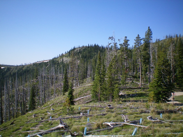
Peak 8140 (forested, just left of center) as viewed from near the base of the north ridge. Livingston Douglas Photo
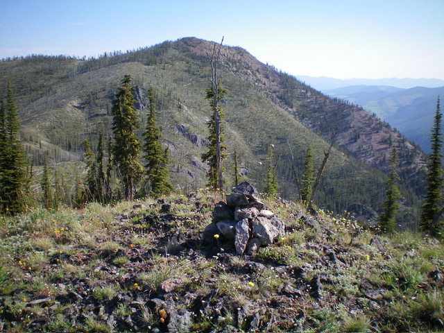
The newly-built summit cairn atop Peak 8140 with Saddle Mountain (MT) in the distance. Livingston Douglas Photo
North Ridge, Class 2
The Ascent
From the 7,850-foot connecting saddle with Saddle Mountain (MT), follow the ridge road southwest briefly then leave it to scramble east up onto the north ridge of Peak 8140 in open terrain. Climb southwest up to Point 8080+. The ridge terrain is semi-open terrain and has a lot of tedious deadfall and cut-down timber. From Point 8080+, descend southeast for 40 vertical feet to a minor saddle then continue southeast up to the true summit. The north ridge is a much harder scramble than the southeast ridge due to the mix of forest and open terrain.
Additional Resources
Regions: Bitterroot Mountains->NORTHERN IDAHO
Mountain Range: Bitterroot Mountains
Longitude: -113.9884 Latitude: 45.7061