Elevation: 8,131 ft
Prominence: 118
This peak is not in the book. Updated February 2026
Peak 8131 sits above the confluence of Baker Creek and East Fork Baker Creek in the Smoky Mountains. It is most easily climbed via its north ridge from the Easley Gulch Trail/FST-148 which can be accessed from East Fork Baker Creek Road/FSR-168. USGS Easley Hot Springs
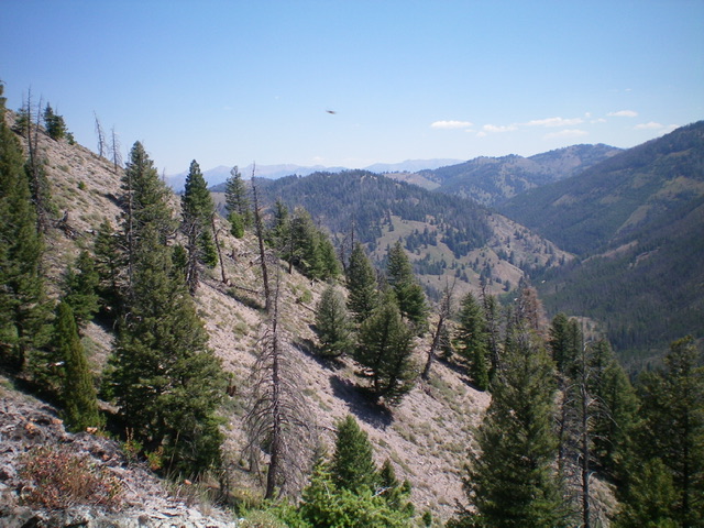
Peak 8131 (forested in mid-ground) as viewed from the southwest. Livingston Douglas Photo
Access
From ID-75 north of Ketchum, turn left/south onto [signed] Baker Creek Road/FSR-162. Drive 2.8 miles up Baker Creek Road to the East Fork Baker Creek Campground (right). Pull into the campground and park near the bathroom (6,950 feet). GPS coordinates: 43⁰44’42”N, 114⁰33’54”W. The campground is 0.1 miles below the road junction with East Fork Baker Creek Road/FSR-168.
Southwest Ridge, Class 2
The Climb
From the campground, cross to the east side of Baker Creek Road and bushwhack east briefly through scrub and semi-open pine forest to reach the East Fork Baker Creek. Jump across the creek in a narrow patch of willows to emerge in open scrub at the toe of the southwest ridge. Climb up into the easy forest and skirt the left/north side of a rocky outcrop. Farther up, descend 35 feet in the forest to a minor saddle then continue up the semi-open forested ridge in scrub with some underlying scree to reach an open, rocky hump with a cairn (Point 8130).
From Point 8130, this semi-open area does not allow you to see the summit, which is still ½ mile away and is hidden by pine forest in between. From Point 8130, scramble north along the ridge and drop 25 feet to a minor saddle. Continue up over Peak 8133. The ridge then bends right/northeast and drops 110 feet to a forested saddle (an easy forest bushwhack). Continue northeast up through a mix of forest and scrub to reach the cairned high point of Peak 8131.
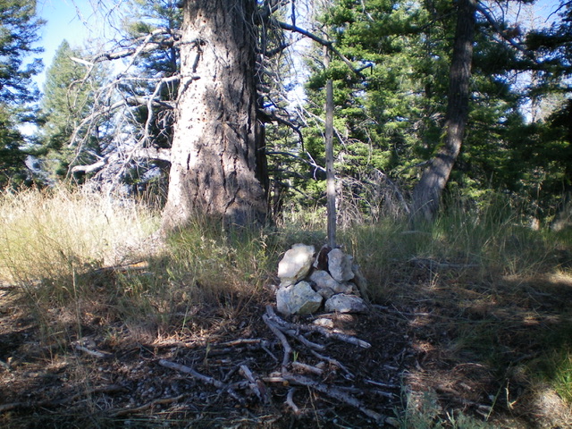
The summit cairn atop Peak 8131. Livingston Douglas Photo
South Ridge, Class 2
The Descent
From the summit, return up over Peak 8133 then down to Point 8130. From there, descend southwest then south on a forested shoulder through a rather thick forest with lots of blowdown and brush. Reach the willow-infested drainage of East Fork Baker Creek and, staying right/north of the willows, bushwhack along the creek to reach the sharp right/north bend in the creek. Once you approach the area of the campground, cross the creek in a shallow, wide section and quickly bushwhack through semi-open forest and scrub to get back to Baker Creek Road and the campground. The southwest ridge route is far preferable to the unpleasant bushwhacking required by the south ridge route.
Additional Resources
Regions: Smoky Mountains->WESTERN IDAHO
Mountain Range: Smoky Mountains
Longitude: -114.54539 Latitude: 43.75409