Elevation: 8,150 ft
Prominence: 330
This peak is not in the book. Published November 2023
Peak 8150 is located near the headwaters of both Cow Creek and Yearlan Creek in the Beaverhead Mountains. It is easily climbed via its west ridge from a pair of unsigned 2-track roads that get you close to the forested summit. Peak 8150 is a minor ridge hump that is almost two miles due west of Point 9185 on the Continental Divide. USGS Agency Creek
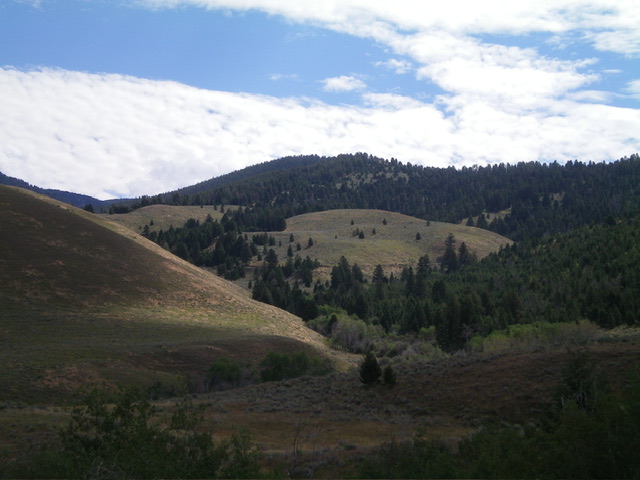
Peak 8150 (forested in dead center) as viewed from Cow Creek Road to its west. Livingston Douglas Photo
Access
From ID-28 at Tendoy, drive east on [signed] Tendoy Lane for 0.1 miles to a “T” junction. Go right/south here and drive 0.2 miles to a [signed] junction with Agency Creek Road (which goes all the way to Lemhi Pass). Drive southeast up Agency Creek Road to a signed junction with Cow Creek Road. Turn right/south onto Cow Creek Road and drive 2.9 miles to a roadside pullout. Cow Creek Road is a narrow 2-track dirt road that is difficult to drive in wet conditions. Park in this pullout(6,150 feet; 44⁰54’48”N, 113⁰33’07”W). If possible, drive another 0.2 miles to an unsigned road junction and park (6,210 feet).
West Ridge, Class 2
The Climb
This climb is mostly Class 1. From the roadside pullout, walk south on Cow Creek Road for 0.2 miles to an unsigned road junction. Go left/east here onto “West Ridge Road.” This road is steep and rough (with two large mudholes early on) and is probably best suited for ATVs and MCs. Hike east up the 2-track road as it weaves around and does some long switchbacks. The road reaches an unsigned, 4-way junction at 7,602 feet (map). Go left/northeast here and follow a good 2-track road (not shown on maps) up onto the ridge crest where there is a fence row.
Hike east up the 2-track road through two cattle fence crossings with wire gates. Ignore a side road that intersects the ridge road twice high up (this side road is shown on the USGS map). Just past the second wire cattle gate crossing, the ridge road turns sharply left/north skirt the left/west side of Peak 8150 and go God-Knows-Where (the road is not shown on maps). Leave the road at this bend and bushwhack east then northeast through an easy patch of pine forest to reach a grassy opening in the forest where the summit is located. The summit has a large cairn.
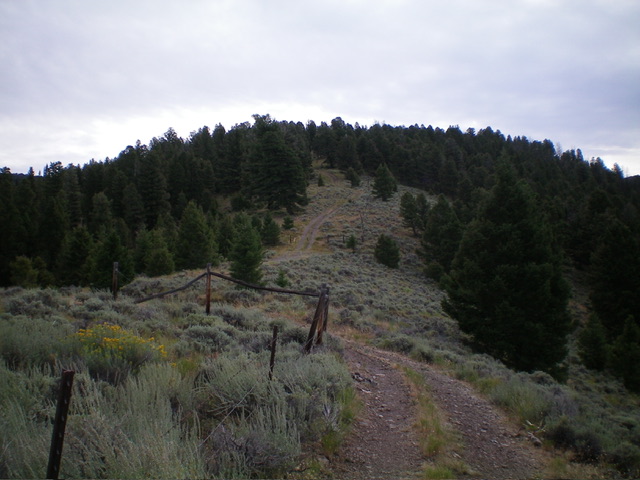
The forested summit hump of Peak 8150 as viewed from high on the west ridge. Livingston Douglas Photo
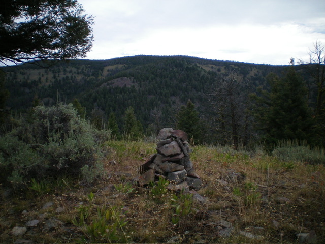
The large summit cairn atop Peak 8150. Livingston Douglas Photo
Additional Resources
Regions: Beaverhead Range->EASTERN IDAHO
Mountain Range: Beaverhead Range
Longitude: -113.5075 Latitude: 44.9075