Elevation: 8,151 ft
Prominence: 371
This peak is not in the book. Published January 2023
Peak 8151 is a forested hump that is located on the west side of Big Basin in the heart of the Aspen Range. It is most easily climbed from FSR-1251 on its north side. Be advised that the bushwhacking in this area can be brutal. USGS Fossil Canyon
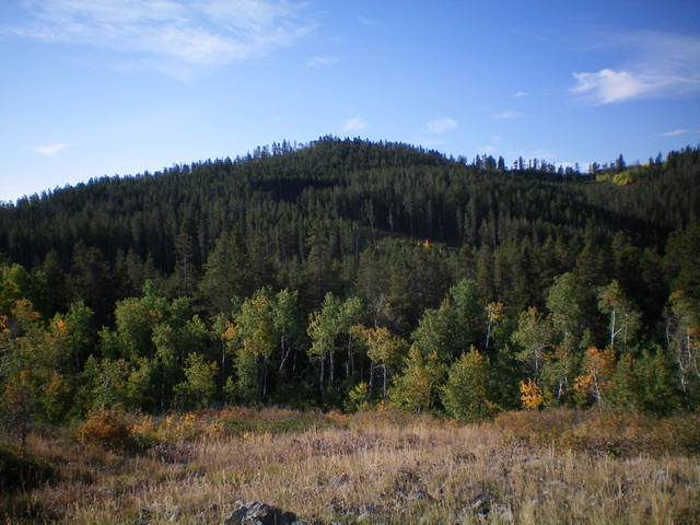
Peak 8151 (dead center) as viewed from the north. Livingston Douglas Photo
Access
Same as for Peak 8330. This is the second leg of a 2-peak adventure that includes Peak 8330 and Peak 8151.
North Face/North Shoulder, Class 2
The Climb
From FSR-1251, leave the road and bushwhack south up through the pine forest. Drop slightly to cross a dry gully then scramble up through semi-open forest and quickly find the remnants of an old road (not shown on maps) which is now just a grassy roadbed. Follow this roadbed south up a shoulder. When the roadbed bends right/southwest then west to cross the gully between Peak 8151 and Point 8122, leave it and bushwhack southeast up through thick pine forest, dense underbrush, and blowdown to reach the crest of the north shoulder.
It may be best to leave the roadbed a bit earlier and stay on the crest of the north shoulder, but it is a thick mess of forest/brush as well. Once on the crest of the shoulder, scramble south up through easier brush/forest. Higher up, the shoulder bends right/southwest to reach the high point of Peak 8151 in semi-open terrain. The summit is a patch of willows and there was a torn-down summit cairn at the north end of this willow patch. I rebuilt the cairn and enlarged it considerably.
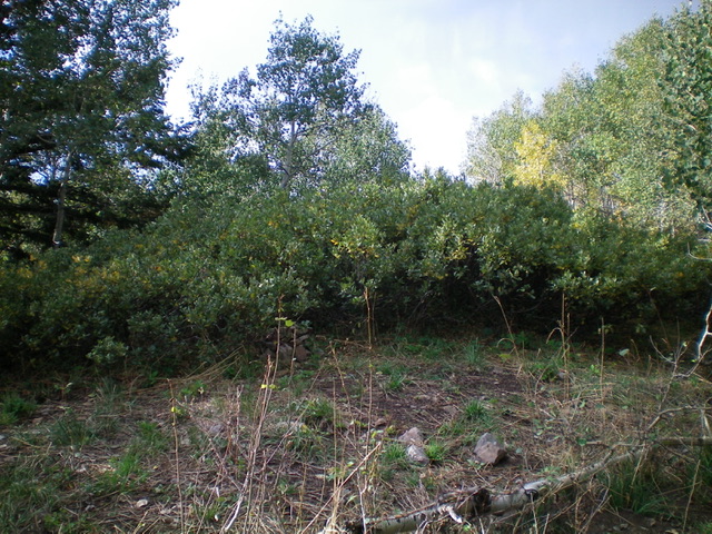
The summit high point of Peak 8151 is a patch of thick willows. Livingston Douglas Photo
East Ridge, Class 2
The Descent
From the summit, descend northeast then east through dense forest to find the east ridge and its “open” right/south side (which is now thick with aspens). Bushwhack down this difficult mess of aspens, thick brush, a scattered line of ridge pines (with forest nearby), and blowdown. Farther down, find a game trail on the left/north side of the ridge. An open scrub gully appears on the left/north side of the ridge and the ridge just dissolves. Bushwhack east-northeast to intercept an ATV trail (FST-128/Fossil Canyon Road/Trail) then follow it left/north to reach its signed junction with FSR-1251. Follow FSR-1251 for 0.6 miles east back to your parked vehicle.
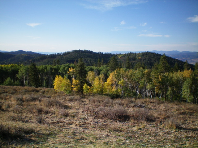
Peak 8151 is the forested ridgeline in mid-ground. The summit hump is left of center and Point 8122 is well right of center. This view is from the north. Livingston Douglas Photo
Additional Resources
Regions: Aspen Range->Peale Mountains->SOUTHERN IDAHO
Mountain Range: Peale Mountains
Longitude: -111.39879 Latitude: 42.60269