Elevation: 8,166 ft
Prominence: 386
This peak is not in the book. Published September 2018
Toller Peak is located north of Bear Pete Mountain and northwest of Burgdorf Hot Springs. The Bear Pete Mountain Trail/FST-142 crosses the peak’s West Slopes less than 200 vertical feet below the summit. USGS Burgdorf
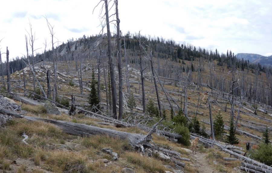
Toller Peak. John Platt Photo
Access
The peak is best accessed from the Burgdorf/French Creek Road/FS-246 [(B)(2.3) on Pages 135-136]. There are two trail options from this road to FST-142. The first option is to hike up FST-144, which leads from FS-246 to FST-142 south of the summit. The second option is a trail that leaves the Burgdorf/French Creek Road at a saddle near the junction of FS-246 and FS-1335. This trail does not show up on the latest USGS topo but does exist and is maintained.
North or South Ridges, Class 2
Access the peak from FST-142 and climb up up either its North or South Ridges. John Platt’s trip report is linked below. He combined trail and cross-country travel to make a loop hike to the summit. His trip covered 7.2 miles and over 2,200 feet of elevation gain.
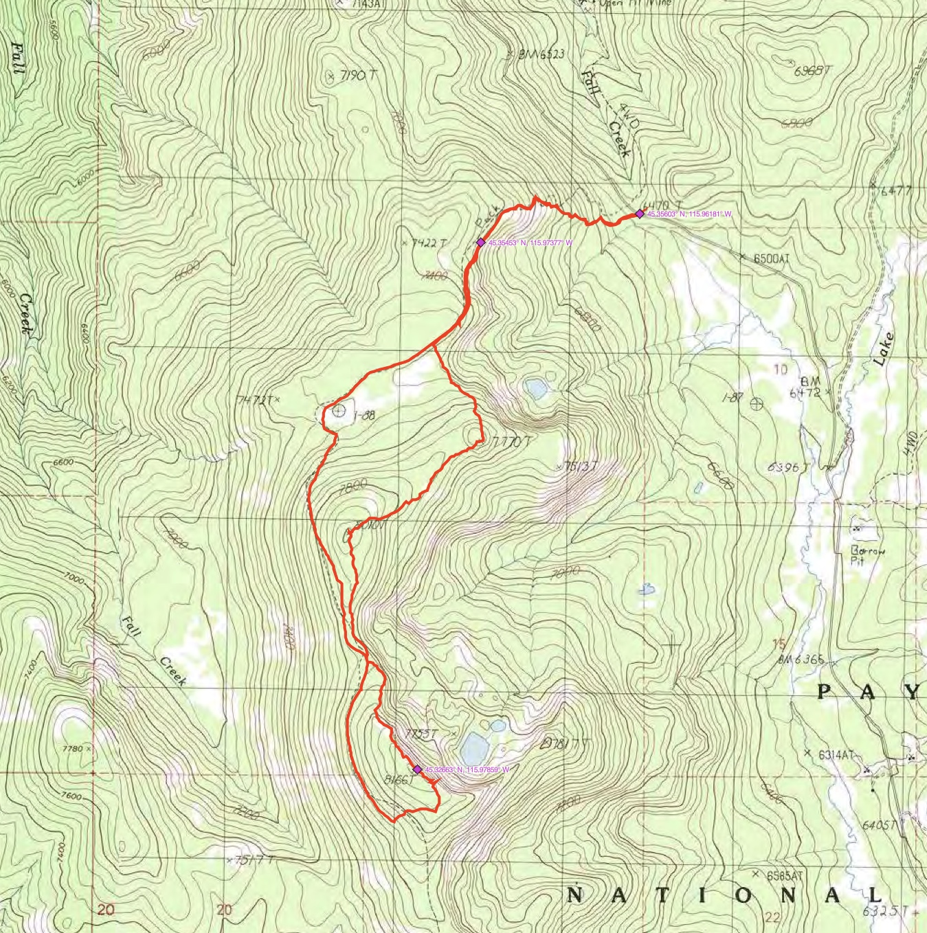
John Platt’s GPS track.
Additional Resources
Regions: Northwest Corner Peaks->Salmon River Mountains->WESTERN IDAHO->Western Salmon River Mountains
Mountain Range: Western Salmon River Mountains
Longitude: -115.97889 Latitude: 45.32649