Elevation: 8,184 ft
Prominence: 484
This peak is not in the book. Published November 2019
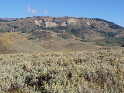
Peak 8184 towers above the Preuss Creek drainage to the north. It is a somewhat brushy climb from Crow Creek Road to the east. The summit is at the south end of a long, narrow elongated ridge crest (8,160+) and is NOT Point 8184 as shown on the USGS map, based on a visual assessment. The east ridge is a rather convoluted mess with a steep face climb up to the narrow north-to-south summit ridge. The north ridge is a steep forested descent to Preuss Creek. USGS Meade Peak
East Ridge, Class 2
Access
From US-89 in Montpelier Canyon, drive north up Crow Creek Road/FSR-111 for 9.6 miles to reach a junction with [signed] FSR-110 and the Preuss Creek trailhead. Crow Creek Road crosses Preuss Creek here. Park at this road junction in a large dispersed camping area on the east side of Crow Creek Road. The elevation here is 7,040 feet.
The Climb
From the road junction, walk south up Crow Creek Road for 0.3 miles to an open, scrub-covered shoulder (with forest on its right/north side) that meets the road. This is actually the terminus of the east ridge. Leave the road here and climb west up the steep face/shoulder through thick sagebrush. Gaps and a few cattle trails will help in your endeavor. Higher up, the forest is unavoidable. Bushwhack through a section of thick pine forest, accompanied by plenty of blowdown and brush.
Continue to push west to a minor forested hump. The ridge now bends left/northwest. Descend about 30 feet from the ridge bump. You can now see the open terrain of the mountain through the trees. You just have to get there to get relief from the punishment that you are currently enduring. Staying to the left/south of the ridge crest is generally less thick and is easier, more open terrain than the forest proper. Pick up a cattle fence in here to help get you through a short section of thick sagebrush.
Once past a flat, brushy saddle, the terrain opens up but is now a combination of thick sagebrush with willows thrown in. Descend another 40 feet to a narrow ridge section. Climb up a shoulder then face, staying just left/south of the forest line. This face section is steep, but very open with shorter scrub. It goes quickly. Once on the narrow summit ridge, follow it left/southwest to reach the cairned high point. The summit ridge is relatively open but there are pine trees nearby and/or scattered on the ridge crest.
North Ridge, Class 2
Access
Same as for the east ridge
The Descent
From the summit, scramble north-northeast along the narrow ridge crest, skirting ridgeline pines and bushes as necessary. You soon enter the pine forest and the descent begins. Initially the ridge descent is gradual and the ridge is heading northeast. It soon bends left/north and begins a steep descent to Preuss Creek. Stay on or close to the ridge crest on this descent as side-hilling here would be tiresome and dangerous. You will find game trails off-and-on to help you, but they don’t last for long. This bushwhack isn’t too bad and it goes quickly. As with any forest, you must navigate through blowdown here and there. When you reach Preuss Creek, jump across the modest-sized creek to reach the Preuss Creek Trail on the N side of the creek. Follow the Preuss Creek Trail downstream to get back to Crow Creek Road and the parking area across the road.
Additional Resources
Regions: Peale Mountains->Pruess Range->SOUTHERN IDAHO
Mountain Range: Peale Mountains
Longitude: -111.18379 Latitude: 42.46019