Elevation: 8,243 ft
Prominence: 623
This peak is not in the book. Published November 2022
Peak 8243 is located east of Indian Creek and at the headwaters of Moran Creek in the Pioneer Mountains. It is most easily climbed via its south ridge from a rugged 2-track road that comes up from Quigley Road to its south. Peak 8243 can easily be climbed in combination with Peak 7308 to its south. This area is a mix of private and public land, so be careful. Most of Peak 8243 is on public land and the nearby 2-track roads seem to allow public entry. USGS Baugh Creek SW
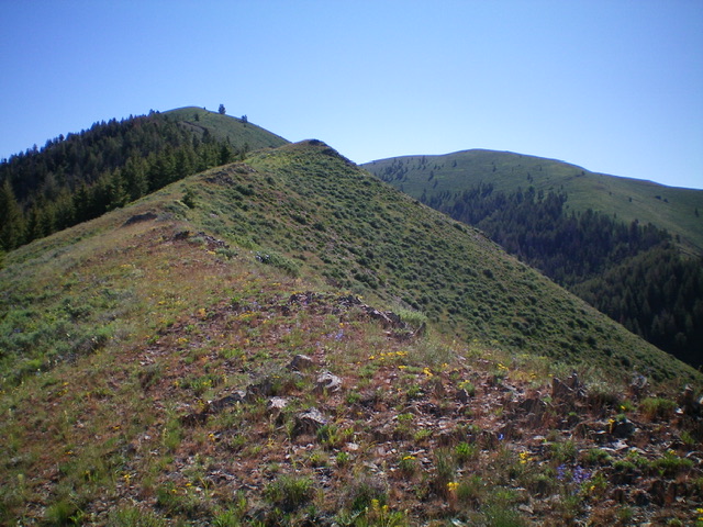
Peak 8243 as viewed from midway up the west ridge. The summit is right of center in the distance. Livingston Douglas Photo
Access
From its genesis at Buttercup Road just north of Hailey, drive northeast then north up [signed] Indian Creek Road. Reset your odometer at the base of the road. At 3.4 miles, reach the BLM boundary. At 4.8 miles, reach an unsigned road junction in a large meadow with ample parking. Park here (6,108 feet). GPS coordinates: 43⁰35’13”N, 114⁰15’22”W.
West Ridge, Class 2
The Climb
From the road junction, scramble east straight up the steep, sagebrush-covered “shoulder” (with good gaps and lanes in the gravel/dirt) up to a better-defined ridge. Follow the ridge up and down a series of minor humps as the ridge bends left-ish/east-northeast to reach Point 8041 and a flattish section. The upper ridge is mostly tundra with some rock but still has some sagebrush sections. Descend to a final sagebrush saddle at 7,980 feet. Bash up through some thick sagebrush to reach an easy tundra-and-broken rock ridge crest. Grind your way up the ridge to the top of Peak 8243, which is the northeast summit hump.
While this is the official summit, is it the true high point? There is only a 1-rock cairn here. The southwest summit hump looks slightly higher and has a larger summit cairn. My altimeter measured them at equal height but, visually, the southwest summit appears to be slightly higher. Stand on both summits just to be sure.
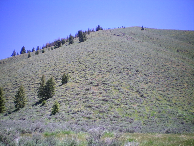
The base of the steep, sagebrush-covered west ridge of Peak 8243. This photo shows the first 1,200 vertical feet of the climb. Livingston Douglas Photo
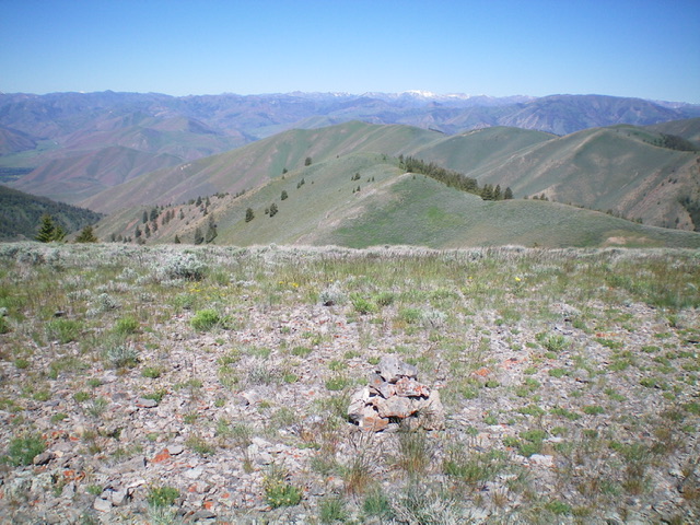
The summit area of Peak 8243 with the west ridge (ascent route) in mid-ground below. Livingston Douglas Photo
Southwest Ridge, Class 2
The Descent
From the southwest summit hump, descend southwest then west on the ridge of sagebrush and loose shale. Ridge humps are visible but require no uphills and the sagebrush isn’t too bad. The ridge eventually turns left/southwest and drops sharply to a 2-track road via scrub and loose shale/gravel. This section goes quickly. Once on the 2-track road (in the forest), follow it west then northwest back to the road junction and your parked vehicle.
Additional Resources
Regions: EASTERN IDAHO->Pioneer Mountains
Mountain Range: Pioneer Mountains
Longitude: -114.22249 Latitude: 43.58969