Elevation: 8,244 ft
Prominence: 304

This peak is not in the book. Published November 2021
Peak 8244 is located south of Willow Creek Summit on a long ridgeline that runs along the west side of US-93. It is most easily climbed from Dry Gulch to its west via a dry gully with a 2-track road in it. A final scramble up the east ridge puts you on top. USGS Dickey Peak
The mountain mahogany-clad south face of Peak 8244. Livingston Douglas Photo
Access
From US-93 exactly 2.7 miles north of Willow Creek Summit, turn left/west onto [signed] Broken Wagon Road and reset your odometer. Take an immediate left at a road fork to head up Dry Gulch toward Road Creek Road. At 3.5 miles, reach an unsigned junction. Go left/east onto a 2-track road that quickly leads to a meadow and two cattle cisterns at the base of the east gully. Park here (7,020 feet).
West Gully/East Ridge, Class 2
The Climb
From the cisterns, follow an old 2-track road in the center of the gully southeast then east. The 2-track moves onto the right/south side of the gully as it gains elevation. Leave the 2-track before it reaches a saddle on the ridge crest. Scramble diagonally left/northeast to cross the dry gully where the forest of mountain mahogany ends. Once across the gully, scramble north up open terrain of easy scrub/grass on the right/east edge of the mountain mahogany forest to reach the crest of the east ridge. Follow the ridge crest west then northwest up through a final patch of mountain mahogany and boulders (not pleasant) to reach the rocky, cairned summit of Peak 8244. The high point is the easternmost of a few high rocky outcrops/buttresses on the ridge crest.
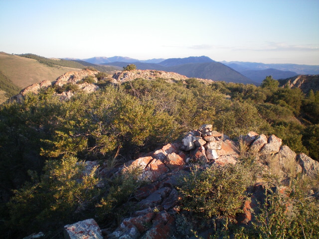
The summit area of Peak 8244, looking northwest along the summit ridge. Livingston Douglas Photo
Additional Resources
Regions: Boulder Mountains->EASTERN IDAHO
Mountain Range: Boulder Mountains
Longitude: -113.98149 Latitude: 44.20369