Elevation: 8,256 ft
Prominence: 516
This peak is not in the book. Published November 2019
Peak 8256 is located on a north-to-south ridge on the west side of Willow Creek Summit, on US-93 south of Challis, ID. It offers beautiful views of the west side of the Pahsimeroi Range. In May, Peak 8256 is likely to be snow-free while the [higher] Pahsimeroi Range is still buried in the white stuff. USGS Dickey Peak
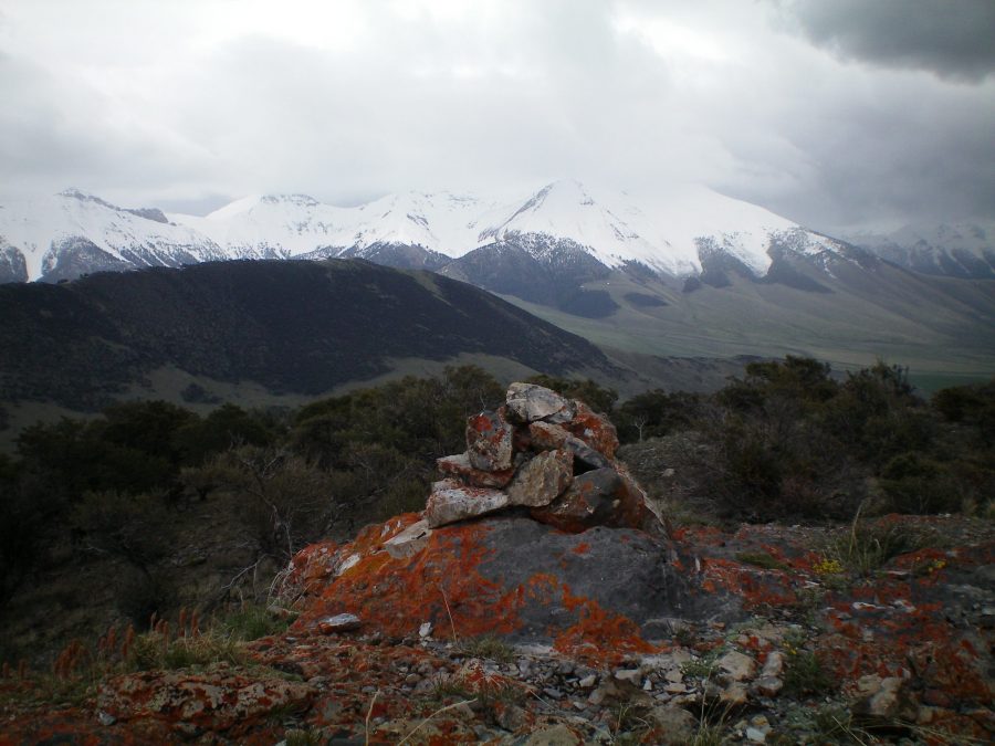
The summit cairn atop Peak 8256 with the snow-laden Pahsimeroi Range in the background. Livingston Douglas Photo
East Face/South Ridge, Class 2
Access
The starting point for this climb is Willow Creek Summit, south of Challis on US-93. The official elevation here is 7,161 feet. There is a large, paved parking pullout on the pass.
East Face/South Ridge, Class 2
From Willow Creek Summit, scramble southwest up an open sagebrush slope. Angle diagonally west across a wide gully, dropping only 20 vertical feet to cross the dry gully. Climb a steep grass-and-sagebrush slope to gain the crest of the northeast ridge high up. Upon reaching its juncture with the south ridge, scramble right/northwest up the south ridge to the summit. This final section ridge is clogged with thick mountain mahogany. Thankfully, the summit high point is rocky and open, providing spectacular views of the nearby Pahsimeroi Range. The summit of Peak 8256 had a small cairn, so I built it into a more respectable summit cairn.
Northeast Ridge, Class 2+
Access
Same as for the east slopes/south ridge
The Descent
Descend southeast to reach the top of the northeast ridge. Follow the ridge northeast as it drops to the valley floor at a gully just below US-93 about 0.4 miles north of Willow Creek Summit. The terrain on this ridge is mostly open, easy grass/sagebrush but has some sections of mountain mahogany and pine forest. Lower down, the ridge becomes less defined and more rounded. Be sure to angle right/east-northeast to intersect US-93 at an opportune point. If you’re lucky, you might see a large herd of elk grazing on a flattish bench on the ridge, a bench that is hidden from view from the highway.
Additional Resources
Regions: Boulder Mountains->EASTERN IDAHO
Mountain Range: Lost River Range
Longitude: -113.99249 Latitude: 44.22779