Elevation: 8,267 ft
Prominence: 527
This peak is not in the book. Published November 2022
Peak 8267 towers over the confluence of the East Fork Valley Creek and Valley Creek in the Sawtooth Range west of Stanley. It is most easily reached from the end of Valley Creek Road on its west side. USGS Elk Meadow
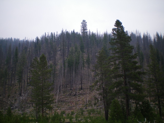
The lower section of Peak 8367 as viewed from the East Fork Valley Creek trailhead to its west. This is a thickly forested area with a mix of burnt and live pine trees. Livingston Douglas Photo
Access
From ID-21 west of Stanley, turn right/north onto [signed] Valley Creek Road/FSR-304. At 0.5 miles, reach a signed road junction. Go right/east onto FSR-304A (this is the continuation of Valley Creek Road) and cross Valley Creek on a good bridge. At 2.3 miles, reach the end of the road at a large trailhead parking area (6,770 feet). GPS coordinates: 44⁰20’27”N, 115⁰03’24”W.
Map Errors
The USGS topo map shows a road heading up the west side of Valley Creek from a junction at 6,640 feet. The main road goes hard right/east here and crosses Valley Creek on a good bridge. The northbound road goes a short distance and ends. The USGS topo map fails to show the two ATV trails that emanate from the end of Valley Creek Road/FSR-304: FST-306/Valley Creek Trail and FST-4037/East Fork Valley Trail.
West Shoulder, Class 2
The Climb
From the large trailhead parking area, walk about 50 yards south on Valley Creek Road. Leave the road and scramble east up a minor dry gully on the right/south side of the [obvious] west shoulder of Peak 8267. Leave the gully as soon as possible to climb left/north up onto the forested shoulder and avoid deadfall as much as possible. This climb is in a partial burn area but the burn debris seems to dominate the landscape.
Once on the shoulder, follow it up through the scattered pines and charred deadfall (not too bad) in fairly steep terrain. The slope eases higher up. A mid-to-upper section of sagebrush then tall field grass with scattered pines is a bit tedious. The shoulder bends left-ish/northwest at about 7,850 feet. Continue up the shoulder to a talus hump (Point 8240+). Scramble up a talus slope on its south side and skirt the hump on its right/south side to reach a saddle on the summit ridge. Scramble dead east in semi-open terrain to reach the gentle high point. There were no signs of previous ascent, so I built a decent cairn atop the high point. The summit area is completely burnt.
Surprisingly, the rocky west summit (Point 8240+) measures at five feet higher than the official east summit. The two potential summits are so close in elevation that it pays to stand atop both just to be sure that you’ve conquered this peak. Since the west summit is along the ascent/descent route, it’s not much work to do the extra 30 feet of uphill to bag both high points. When descending from Peak 8267, be careful to not wander onto a different shoulder. In many areas, the west shoulder is quite rounded and indistinct and is easy to lose on the descent down through the forest.
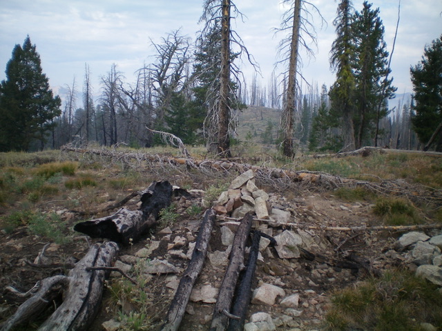
The newly-built summit cairn atop the [official] east summit of Peak 8267, looking west at the west summit, which measures five feet higher than the east summit. Livingston Douglas Photo
Additional Resources
Regions: Eastern Salmon River Mountains->Salmon River Mountains->Southeast Corner Peaks->WESTERN IDAHO
Mountain Range: Eastern Salmon River Mountains
Longitude: -115.03769 Latitude: 44.34211