Elevation: 8,288 ft
Prominence: 548
This peak is not in the book. Livingston Douglas created the first page for this peak. I added an additional route which is set out down the page. Updated July 2023
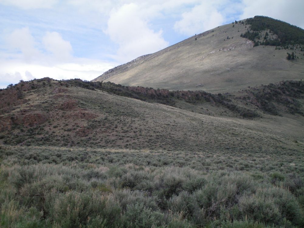
Peak 8288 is the easternmost of three gentle hills in this area: Peak 8297 North, Peak 8297 South, and Peak 8288. Peak 8288 towers over the Broken Wagon Creek drainage to its south. The peak is easily approached from nearby US-93 just north of Willow Creek Summit. The easiest ascent route is via the southwest ridge from Broken Wagon Creek Road. USGS Antelope Flat
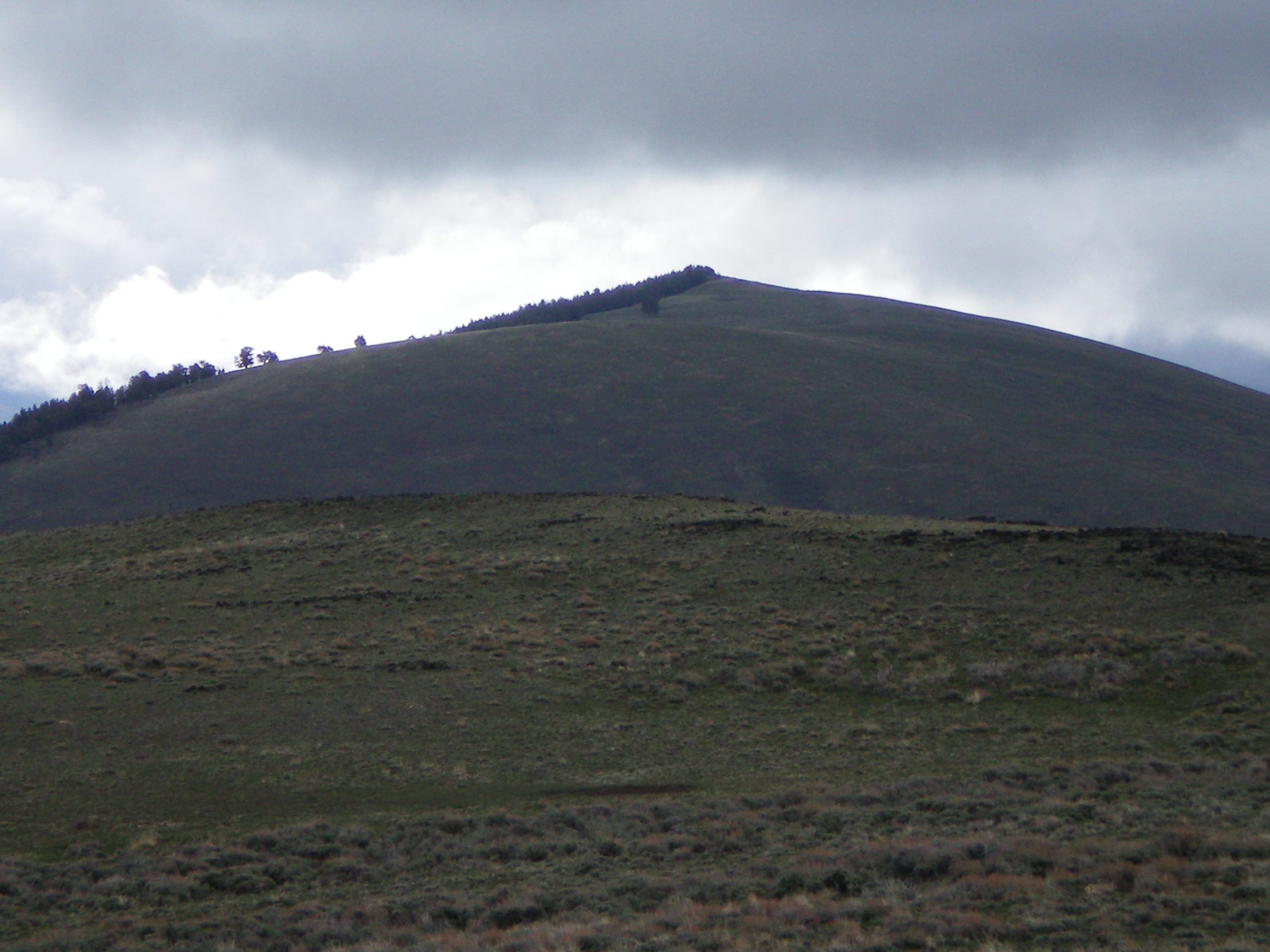
Peak 8288 as viewed from the summit of Peak 8297 South. Livingston Douglas Photo
East Ridge, Class 2
Access
From the signed junction of US-93 and Broken Wagon Creek Road (a few miles north of Willow Creek Summit), turn left/west onto Broken Wagon Creek Road. At an almost-immediate road junction, go straight to remain on Broken Wagon Creek Road. Drive 0.3 miles west up Broken Wagon Creek Road to a large, flat parking/camping area (6,610 feet). This area is at the base of the east ridge of Peak 8288.
The Climb
From the parking area alongside Broken Wagon Creek Road, hike up the road for a short distance. Leave the road to bushwhack west-southwest up through sagebrush to reach the ridge rock of the east ridge near its low point. There is an obvious grassy ramp here which makes it easy to climb up onto the crest of the east ridge. Once on the ridge, follow it west as it climbs gradually then more steeply through open scrub.
Pass a rocky buttress on its right/north side and scramble up easy short scrub and broken scree to reach the left/south edge of a prominent forest. The forest itself is open and equally easy. The rounded ridge narrows as you approach the summit area. The high point of Peak 8288 is the middle rocky point on a narrow section of ridge that borders a pine forest to the north. The summit has a small cairn on top.
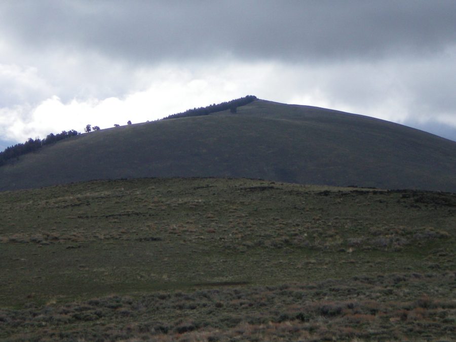
The east ridge of Peak 8288 as viewed from the parking area. Livingston Douglas Photo
Southwest Ridge, Class 2
Access
Same as for the east ridge. This is part of a ridge traverse from Peak 8288 to Peak 8297 South to Peak 8297 North.
The Descent
From the summit, follow the ridge crest west for about ½ mile. Leave the summit ridge area and descend a 2-track jeep road southwest down the gentle ridge crest to a large saddle. Continue heading southwest on the jeep road southwest over a hump and down to another saddle of equal height. This is the base of the southwest ridge.
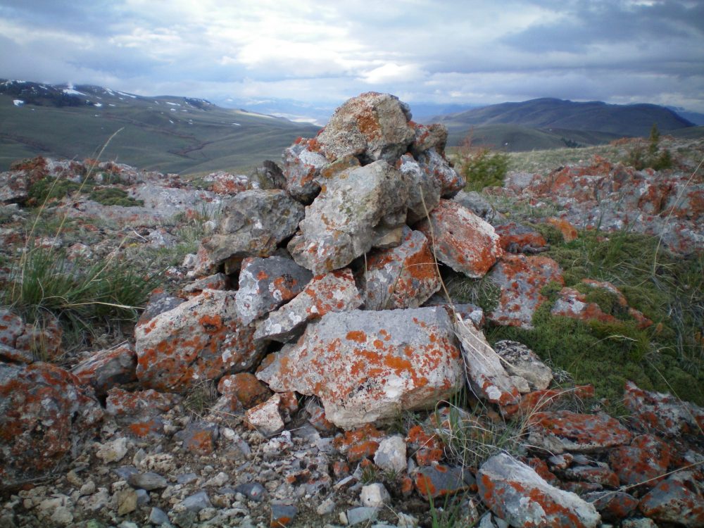
The summit cairn atop Peak 8288 looking west. Livingston Douglas Photo
West Ridge Route by Tom Lopez
Access
The Broken Wagon Road leaves US-93 32.0 miles north of Mackay, Idaho and 22.0 miles south of Challis, Idaho. This narrow road is suitable for high clearance vehicles until it enters into Section 35 where there is a junction in a wide flat area which is private property. There is public access across this property. From this point the road steepens and deteriorates and a 4WD is required. After 3.8 miles and gaining 1,150 feet of elevation the road ends at the saddle dividing Broken Wagon Creek and Corral Basin Creek. Note that the road down into Corral Basin Creek is closed because the basin is a Wilderness Study Area.
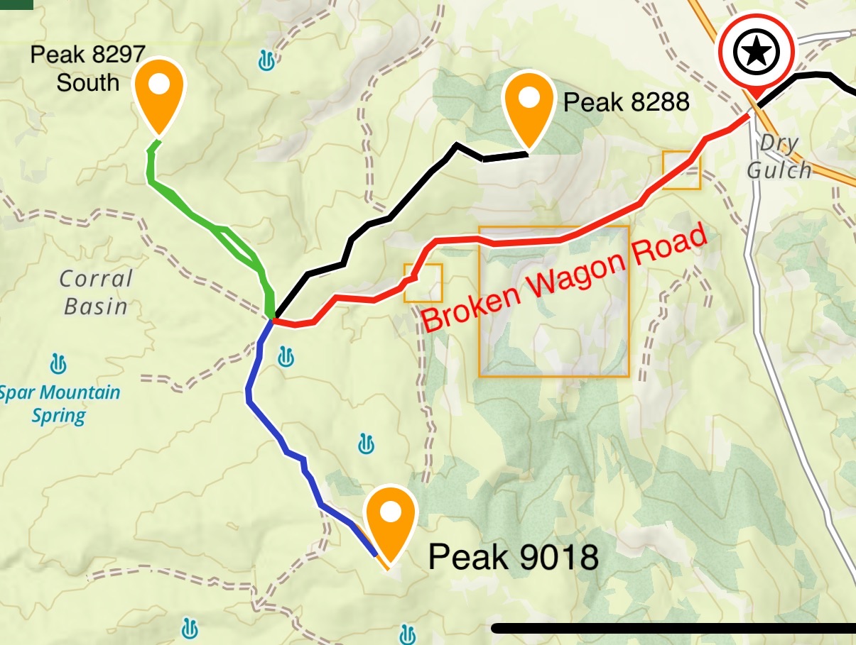
This map shows the three peaks accessible from the Broken Wagon Creek/Corral Basin Creek Saddle.
West Ridge, Class 1+
A two track leaves the Broken Wagon Creek and Corral Basin Creek saddle heading north. This 4WD road crosses over a high point and then turns east and drops down into a broad saddle. The road then continues east up the slopes of Broken Wagon Peak to within 0.6 miles of the summit. If you hike the entire way the summit is 2.6 miles from the Broken Wagon Creek and Corral Basin Creek saddle. Elevation gain will be 640 feet out bound and 310 feet on the return.
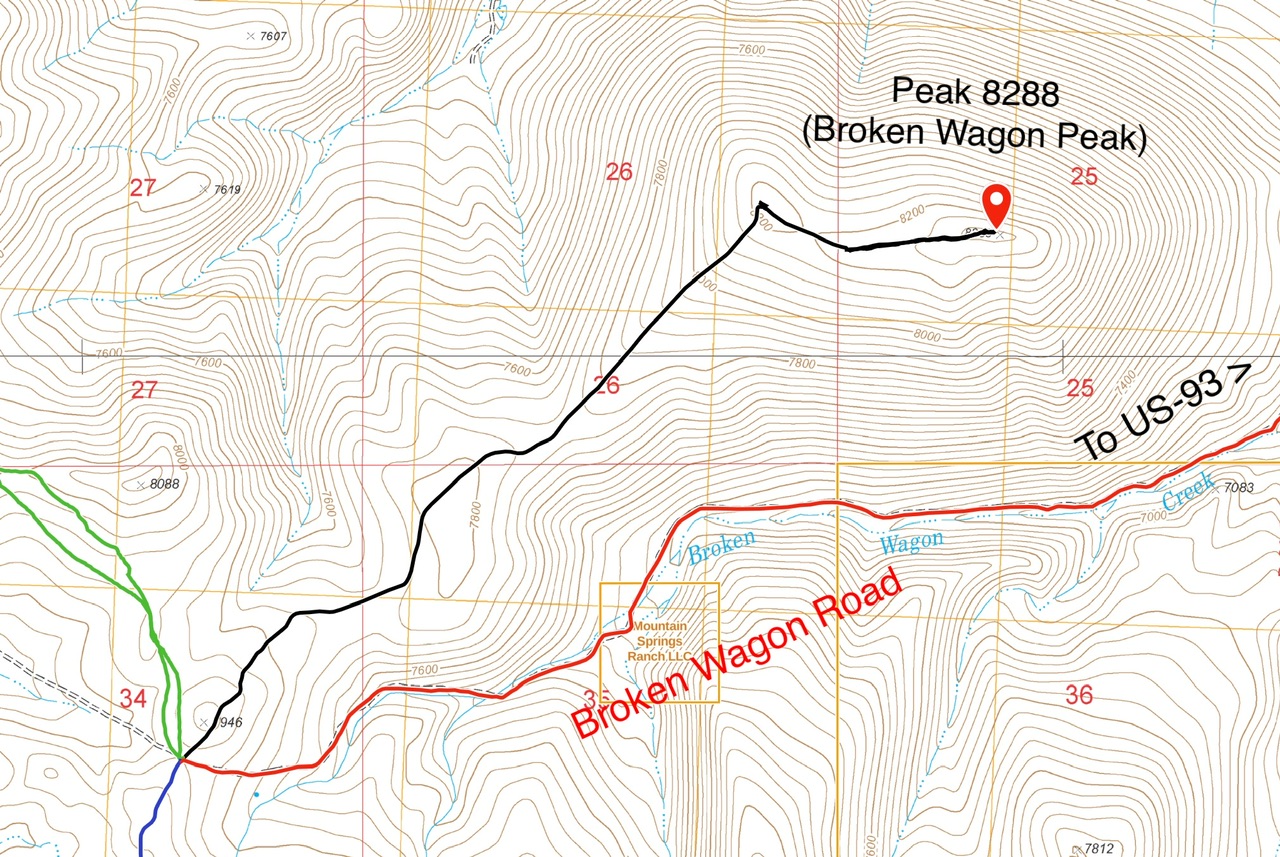
The route to the summit from the Broken Wagon Creek and Corral Basin Creek saddle is entirely open terrain.
Additional Resources
Regions: Boulder Mountains->EASTERN IDAHO
Mountain Range: Boulder Mountains
Year Climbed: 2023
Longitude: -114.04449 Latitude: 44.25379