Elevation: 8,312 ft
Prominence: 322
This peak is not in the book. Published January 2023
Peak 8312 is a beautiful ridgeline summit that towers over nearby Smoky Canyon Road. The easiest way to the top is via the southeast shoulder and south ridge, almost completely in open terrain from Smoky Canyon Road. Views from the open summit are magnificent. USGS Stewart Flat
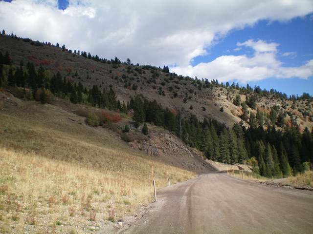
Peak 8312 (summit is at far left) and the southeast ridge descent route (upper left diagonally down to lower right in the photo). The east ridge (my ascent route) is the skyline in the center of the photo. Livingston Douglas Photo
Access
For the ascent route, park along Smoky Canyon Road/FSR-110 exactly 1.4 miles north of the road junction with the Smoky Canyon Phosphate Mining Road. There is a large pullout on an old side road (6,870 feet). GPS coordinates: 42⁰43’23”N, 111⁰07’10”W.
For the descent route (if used as an ascent route), park along Smoky Canyon Road/FSR-110 exactly 1.1 miles north of the road junction with the Smoky Canyon Phosphate Mining Road. Park along the wide, well-graded road just above a large rocky buttress on the right/east side of the road at about 6,980 feet.
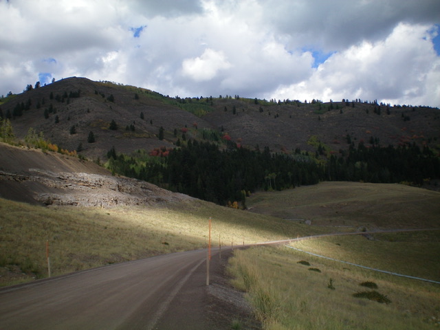
Looking up the east ridge of Peak 8312. The summit is left of center. Livingston Douglas Photo
South Face/East Ridge, Class 3
The Climb
From the side road junction and parking area, cross to the north side of Smoky Canyon Road. Bushwhack north up through a patch of aspens/pines (not too bad) to reach very steep scrub with a wicked band of ridge rock looming above to block entry onto the east ridge. Follow a game trail left/west to just before reaching an aspen-clogged gully. Climb up steep scrub on the south face on the right/east side of the gully. The somewhat-loose underlying scree/gravel is tedious. Scramble all the way up to the base of the cliff band at the top of the face.
Scramble up an easy, short section of Class 3 rock to get above the cliff band. Once atop it, bushwhack up through steep, thick sagebrush to reach the brushy crest of the east ridge. Find a weak, on-and-off game trail on the ridge and follow it up through endless sagebrush and patches of aspens. Ironically, the aspens were easier to navigate than the open, tedious brush. Grind your way west to reach the open summit of Peak 8312. I rebuilt the torn-down summit cairn and made it much bigger. The views from the top are magnificent.
South Ridge/Southeast Shoulder, Class 2
The Descent
This is a much preferable route to ascend Peak 8312 than the ascent route that I took. It is not as steep, has minimal (if any) rock work, and has easier scrub. From the summit, descend the open scree on the south ridge down to about 8,000 feet and a fork in the ridge. The lower section of the south ridge is fairly steep and loose, so be careful. From the 8,000-foot level, descend left/southeast down an obvious shoulder that leads to a forested area.
The upper southeast shoulder is steep scrub with loose scree underneath. When you reach the easy pine forest, find a game trail (for at least part of the bushwhack) and descend southeast. The shoulder becomes a face lower down. Emerge from the forest in open grass/scrub in a flat area at 7,230 feet. Descend the easy grass/scrub eastward to Smoky Canyon Road. Hike about 0.3 miles north down Smoky Creek Road to the side road where the ascent route began.
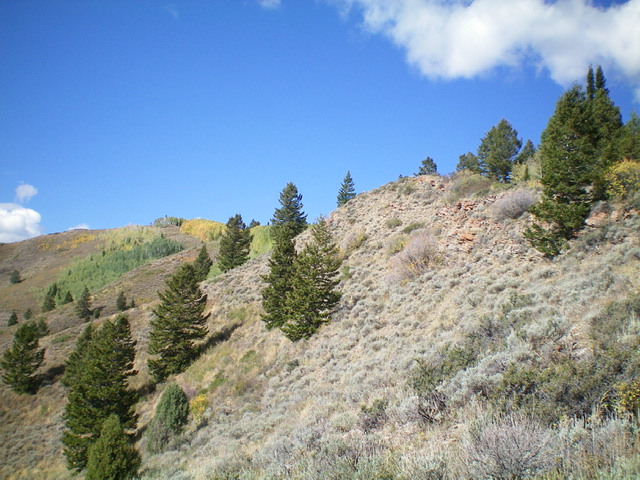
The steep, rocky south face of the east ridge of Peak 8312 (my ascent route). Livingston Douglas Photo.
Additional Resources
Regions: Peale Mountains->SOUTHERN IDAHO->Webster Range
Mountain Range: Peale Mountains
Longitude: -111.1351 Latitude: 42.7265