Elevation: 8,324 ft
Prominence: 544
This peak is not in the book. Published December 2019
Peak 8324 sits at the head of the Cow Creek drainage and just west of Limekiln Gulch. A herd of pronghorn antelope live in a meadow on its southwest side. The ridge terrain here is generally open and easy, albeit with its ups-and-downs. The south aspects of Peak 8324 are typically free of snow by mid-May, making the southeast ridge and south ridge good choices for early-season hikes. The easiest ascent route is via a ridge traverse from Bald Mountain to the northeast. USGS Mahoney Butte
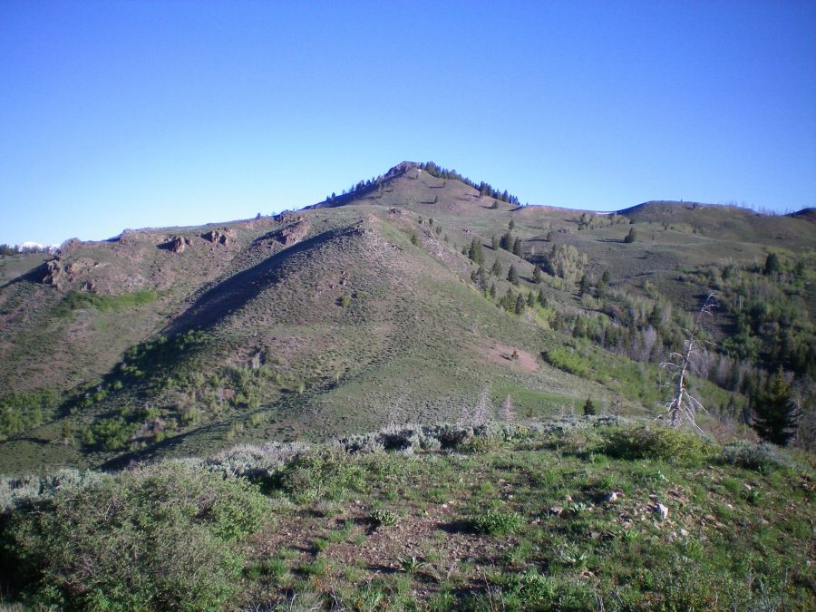
Peak 8324 as viewed from Point 7608 high on the southeast ridge. Livingston Douglas Photo
South Spur/Southeast Ridge, Class 2
Access
Greenhorn Road is located 5.3 miles north of the stoplight at Albertson’s in Hailey, ID on ID-75. It is signed and has a stoplight. Turn left/west onto Greenhorn Road and drive 3.5 miles to its end at the large trailhead parking lot (5,900 feet). Three trails leave this trailhead parking area: Greenhorn Creek Trail (FST-156), Cow Creek Trail (FST-180), and Cow Creek Connector Trail (FST-153).
Please note that the USGS topo map is incorrect in its placement of the end of Greenhorn Road. The road goes about ¼ mile farther up Greenhorn Creek (to just before the trail shown on the map crosses the creek), exactly 0.5 miles past the Sawtooth National Forest boundary. The USGS topo map fails to show FST-180 and FST-153, useful trails to know about when hiking in or near the Cow Creek drainage.
The Climb
From the trailhead parking area, bushwhack north up a slope of sagebrush, grass, and scree to reach a minor shoulder. Scramble northwest on this shoulder for a short distance to reach the south spur of the southeast ridge. Climb north up the south spur all the way to Point 7608. You will know that you are on the south spur if you can hear (and see) noisy Cow Creek to your immediate left/west. The terrain on the south spur isn’t too bad except for some loose shale underneath the vegetation. You may also be hiking on Cow Creek Trail once or twice when the trail is on the ridge crest of the south spur.
Point 7608 requires a steep scramble up a scrub-covered hillside/ridge. When you reach the top of Point 7608, the south spur ends at its merger with the southeast ridge. From here, follow the ridge northwest, initially dropping 200 vertical feet to a saddle. Climb up another hump (Point 7881). From this point, drop 25 vertical feet to a broad saddle then grind your way up a face section to reach the brush-and-rock summit of Peak 8324.The summit has a modest cairn and great views of the surrounding peak and valleys.
West Ridge/South Ridge—WEST, Class 3
Access
Same as for the south spur/southeast ridge
The Descent
From the summit, descend the west ridge to a saddle. This descent is a horrifically loose combination of ridge rock and very loose talus/scree with scrub thrown in. This is a dangerous Class 3 proposition on a mountain that is generally easy Class 2 work, so be aware of the critical difference in the degree of difficulty in this section. Thankfully, the horror doesn’t last for long. Once below the steep, awful rock, the terrain becomes easy, open scrub and you can cruise to a gentle saddle at the headwaters of Cow Creek. There are two large, flat marshes below this saddle (to the south), which make for great grazing for pronghorn antelope.
Descend diagonally south into the upper marsh and cross Cow Creek which, up here, is only a small stream. Scramble diagonally upward and to the right/west to reach the crest of the south ridge. The terrain here is somewhat thick brush with aspens and willows thrown in for good measure. Higher up, this concoction of awfulness thins out and becomes mostly field grass. The ridge doglegs left/east to cross over Point 7545 and the weaves its way south, paralleling Cow Creek to its left/east.
You will make fast time through the ridge’s easy field grass, but you must also bash through some sections of thick sagebrush when the ridge temporarily morphs into sidehills/faces and flat areas. When you reach about 6,400 feet, look for a trail that crosses Cow Creek below and to your left/east. Leave the south ridge at about 6,200 feet to descend southeast to intercept the trail where it crosses Cow Creek on a footbridge. This is FST-153/Cow Creek Connector Trail. Follow this hiker/biker trail all the way back to the trailhead parking area, with its many long switchbacks more suitable for mountain bikers than for hikers.
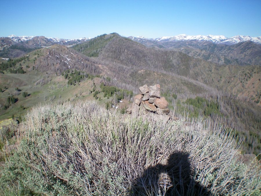
The summit cairn atop Peak 8324 amidst the thick brush. Livingston Douglas Photo
Additional Resources
Regions: Smoky Mountains->WESTERN IDAHO
Mountain Range: Smoky Mountains
Longitude: -114.43929 Latitude: 43.63019