Elevation: 8,330 ft
Prominence: 630
This peak is not in the book. Published January 2023
Peak 8330 is a forested hump that is located on the west side of Big Basin in the heart of the Aspen Range. It is most easily climbed from FSR-585 on its east side. USGS Fossil Canyon
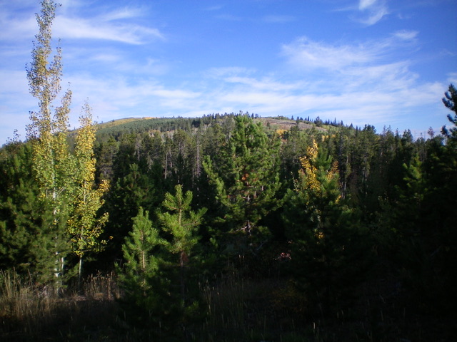
Peak 8330 (the summit is in the yellow aspens well left of center) as viewed from the south. Livingston Douglas Photo
Access
From US-30 in Georgetown, turn right/east at the Mormon Church and drive up Stringtown Road to reach a signed fork in the road at the east end of town. Go left onto Left Fork Georgetown Canyon Road/FSR-1095. At 7.8 miles up from US-30, reach a signed junction with FSR-1238 near the Summit Campground. Turn left onto FSR-1238 (which is a bit narrow and rocky) and drive northwest then north to reach a signed junction with FSR-1251/Big Basin Road at 4.5 miles.
Reset your odometer here. Turn left onto FSR-1251 and follow it as it drops down into Big Basin. At 4.1 miles, reach a pullout on the right-hand side of the road. Park here (7,620 feet). GPS coordinates: 42⁰36’15”N, 111⁰22’26”W. You may be able to drive another ½ mile up FSR-1251 before the road becomes quite rough and has some impassable mudholes.
Map Errors
The USGS topo map fails to show any of FSR-1238 which comes from the Left Hand Fork Georgetown Canyon Road at the Summit Campground all the way to a signed junction with FSR-1251/Big Basin Road (which IS shown on the map). The USGS topo map also fails to show the ATV trails in Big Basin.
East Face/South Ridge, Class 2
The Climb
From the pullout, hike west on FSR-1251 for about 1.3 miles to a signed junction with FSR-585. Go right/north onto FSR-585 and follow this jeep road for about 0.6 miles. Leave the road and bushwhack left/west up onto the south ridge. This forested bushwhack up the east face is tedious due to thick underbrush and large blowdown. There are some thick willows to bash through up near the crest of the south ridge. Once on the open terrain of the south ridge, scramble northwest up the ridge on an old road/trail (on-and-off) and through an easy, open aspen forest to reach the open south end of the summit ridge crest. I rebuilt the torn-down summit cairn. I investigated the forested ridge crest to the north and there was no higher point.
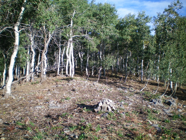
The summit of Peak 8330. Livingston Douglas Photo
South Ridge FULL, Class 2
The Descent
From the summit, descend southeast then south in mostly open scrub using an old 2-track/trail for much of the way down to FSR-1251. This is the near the low point between Peak 8330 and Peak 8151. It concludes the first leg of today’s 2-peak adventure. Peak 8151 is up next.
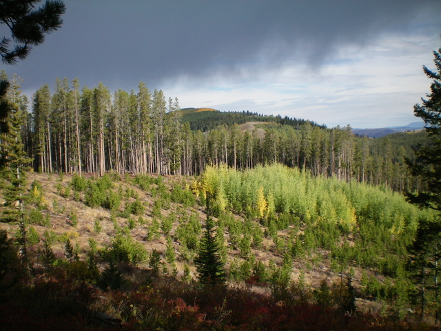
Peak 8330 (dead center in the distance) as viewed from the south. Livingston Douglas Photo
Additional Resources
Regions: Aspen Range->Peale Mountains->SOUTHERN IDAHO
Mountain Range: Peale Mountains
Longitude: -111.4037 Latitude: 42.6207