Elevation: 8,340 ft
Prominence: 635
This peak is not in the book.
Peak 8340 is in a remote, rugged area of the Boise Mountain Range in the Boise National Forest. However, the peak is easily accessed via FS-312, the long winding road that leads to the upper reaches of the North Fork Boise River. USGS Tyee Mountain
Access
To access the peak by road via the Graham GS Road [(B)(2.1) on Page 153], take ID-21 from Boise for 55 miles to the turn for FS-384 at the [signed] Edna Creek Campground turn. Turn onto the excellent FS-384 gravel road and follow it to FS-312 in 4 miles. FS-312 is a good road but is not recommended for passenger vehicles. The main intersections are signed for Graham GS Road. The road crosses a pass between Archie Mountain and Peak 7561, continues to another pass and a junction with Jackson Peak Road, and then descends into the upper reaches of Crooked River.
Southeast Ridge, Class 2
As the road begins to climb up to the next pass, park at roughly 7,500 feet. From this spot, climb north up to the ridge top on the peak’s East Ridge. You will find a decent game trail on the ridge top that follows the road to the summit. My one-way stats: 0.85 miles with 1,004 feet of elevation gain.
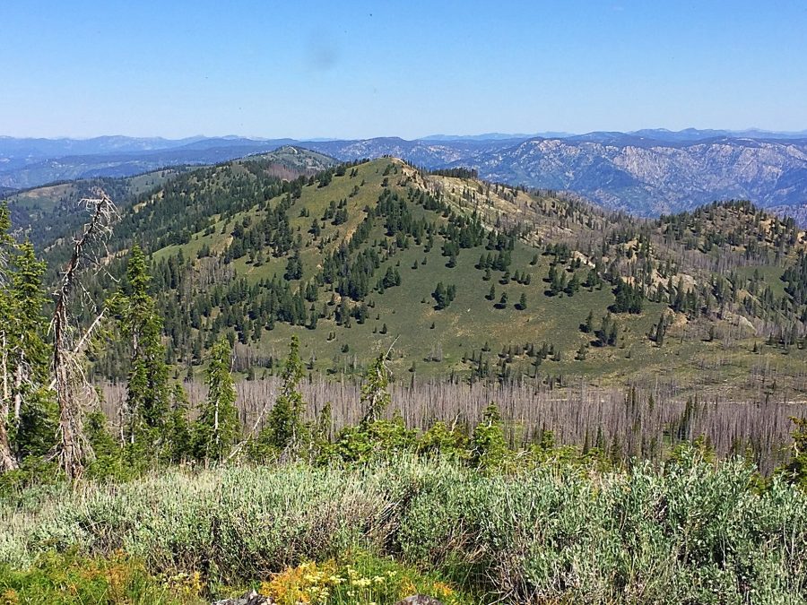
Peak 8340 with Jackson Peak behind it as viewed from Peak 8498.
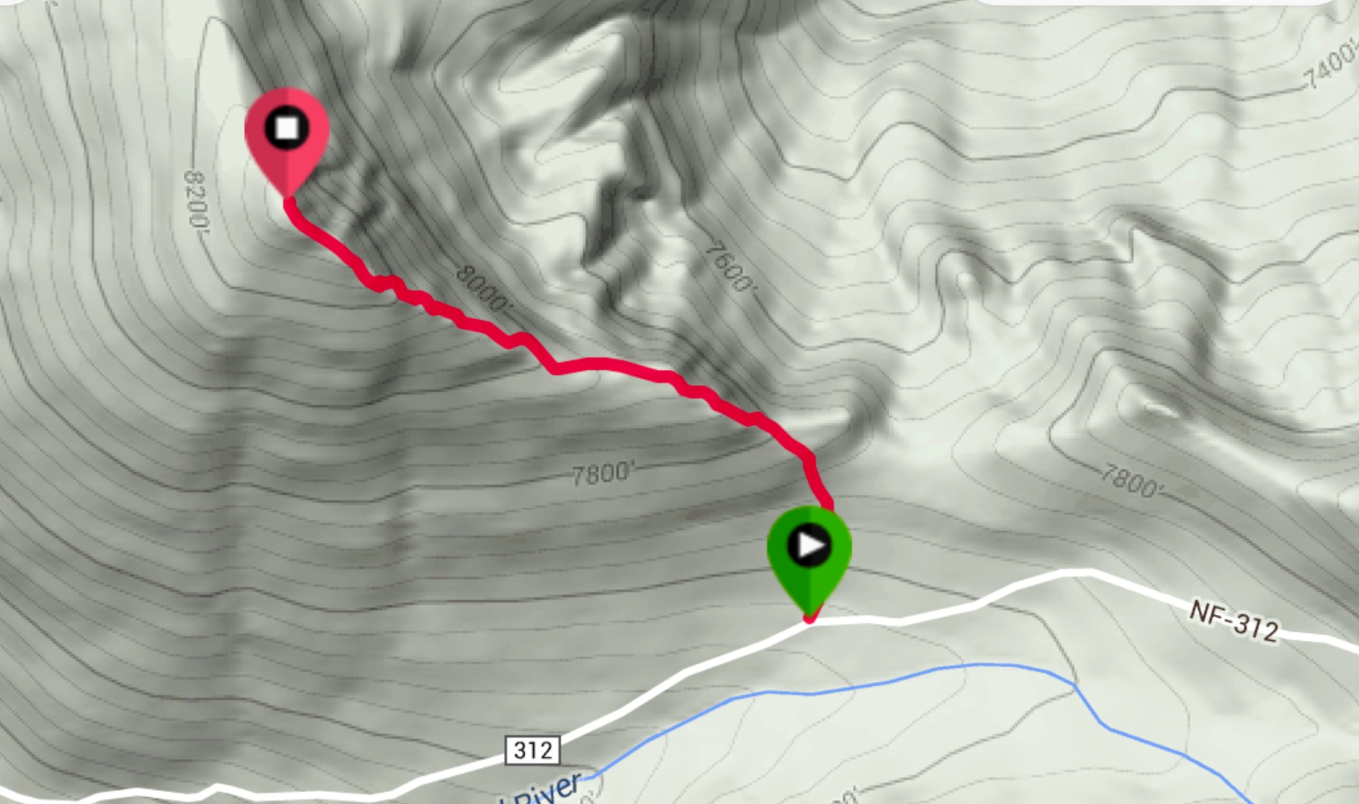
My GPS track.
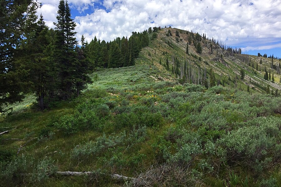
The lower section of the East Ridge.
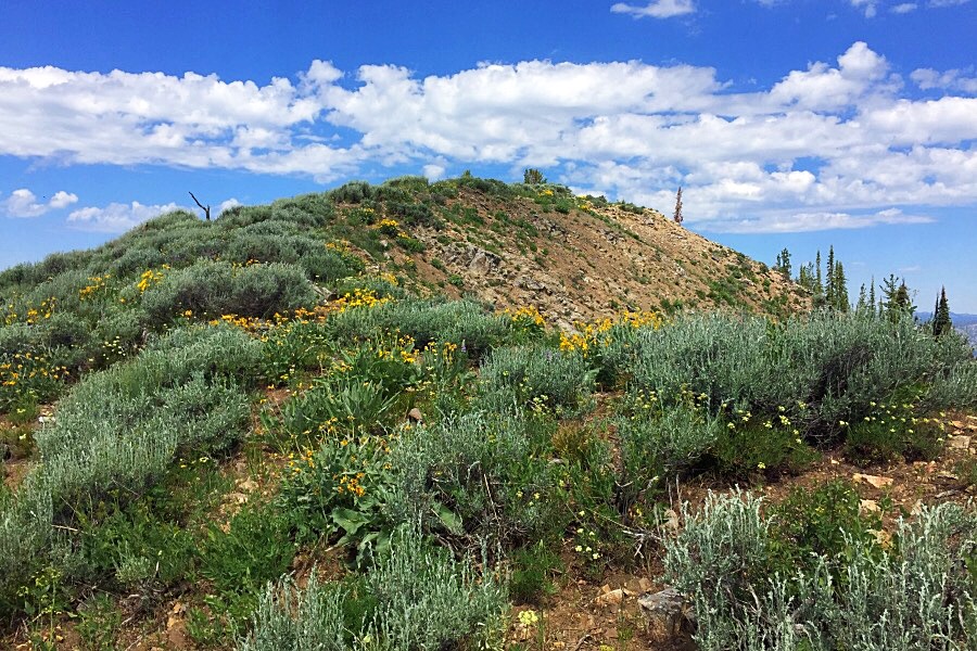
The last few feet of the East Ridge.
Additional Resources
Regions: Boise Mountains->WESTERN IDAHO
Mountain Range: Boise Mountains
Year Climbed: 2016
Longitude: -115.35539 Latitude: 44.03589