Elevation: 8,344 ft
Prominence: 564
This peak is not in the book. Published November 2022
Peak 8344 sits at the head of Snowslide Gulch and separates Wolftone Creek from Kinsey Creek. It is most easily climbed from either Wolftone Creek to its east or from Deer Creek to its north. USGS Mahoney Butte
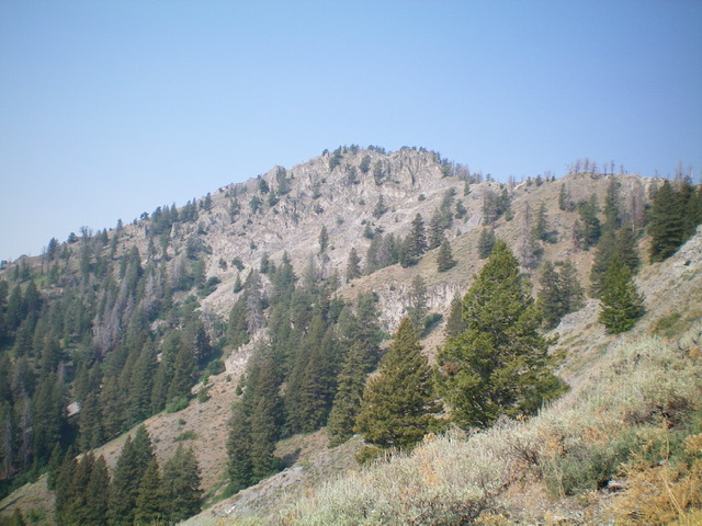
Peak 8344 as viewed from the northeast. The southeast ridge (my ascent route) is the left skyline. The northeast ridge (my descent route) is the right skyline. Livingston Douglas Photo
Access
From Albertson’s at the north end of Hailey, drive north on ID-75 for 1.9 miles to a signed junction with Deer Creek Road/FSR-097. Turn left/west onto Deer Creek Road and drive 7.8 miles to a signed junction with Wolftone Creek Road/FSR-102. Turn left/south onto Wolftone Creek Road and drive 2.8 miles to the end of the road at the Wolftone Creek trailhead. Park here (6,525 feet). GPS coordinates: 43⁰30’00”N, 114⁰28’58”W. Please note that Wolftone Creek Road goes farther up Wolftone Creek than the USGS map indicates. Also note that the USGS map calls it Wolf Tone Creek rather than the Wolftone Creek spelling that the [more recent] Sawtooth National Forest map uses.
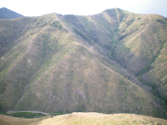
Peak 8344 (summit is right of center) and its magnificent north ridge (center and left of center) on the east side of Snowslide Gulch. It can be climbed from the bridge crossing of Deer Creek (bridge is in lower left of the photo). Livingston Douglas Photo
Southeast Ridge, Class 3
The Climb
From the trailhead, bushwhack west up through the forest briefly to reach the visible and obvious crest of the southeast ridge. Follow the steep ridge crest on scrub, loose scree/gravel, and scattered pines to reach rockier terrain pretty quickly. Begin a long, tedious scramble up through endless rocky outcrops, cliff bands, and ridge towers to reach a flattish ridge area at about 7,400-7,425 feet. The low- to mid-section of the southeast ridge requires a lot of weaving around blocks/towers and up chutes and face rock. The ridge rock is firm but any rock (talus/scree/gravel) laying atop the ground is loose. The terrain is steep with little upward visibility, if any. You must skirt the base of some of the ridge blocks/towers.
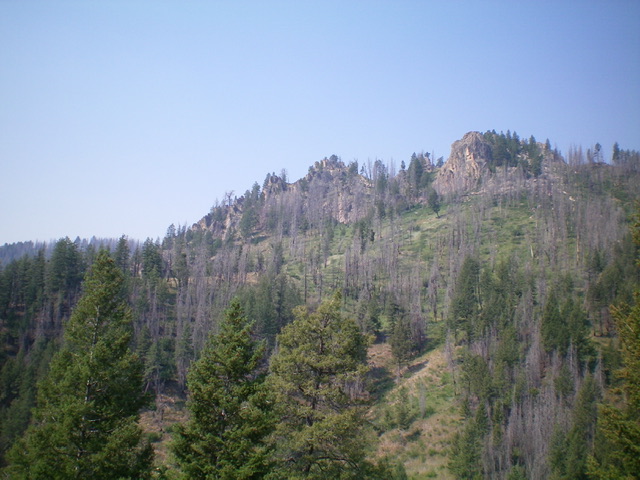
The rocky mid-section of the southeast ridge ascent route (Class 3). Livingston Douglas Photo
From the flattish ridge area, descend 50 feet down to the right/northeast to skirt several final blocks/towers and reach a gentle ridge saddle. The going is much easier from here. There are still some rocky outcrops and blocks to go over or around, but the difficulty is no worse than Class 2+ and there are no steep walls or chutes to contend with. You can avoid all of the Class 3 ridge rock by following a prominent gully on the east side of Peak 8344 (the Baugher Route) up an old 2-track then bushwhack in easy, open scrub to reach the ridge at the aforementioned flattish ridge area. The east gully begins on an unsigned side road that is 0.2 miles before reaching the end of Wolftone Creek Road.
The southeast ridge does a final bend (and minor drop) left/west to reach the narrow summit area. The large summit cairn may or may not be on the high point. It seems like the high point is a rocky outcrop (large embedded boulders) about 50 feet away to the west. The USGS map shows the cairned point as the high point. Stand on both points just to be sure. The USGS map makes the southeast ridge look smooth and easy but it most certainly is not.
Northeast Ridge/East Spur, Class 2+
The Descent
From the summit, descend northeast down the ridge through some steep, rocky outcrops with a lot of loose talus/scree (with scrub mixed in) to reach pure scrub below and a gentler slope. Scramble up over two ridge humps then leave the northeast ridge and descend the [initially steep] obvious east spur. The east spur has no rocky outcrops, just scrub and a few scattered pines. However, the underlying scree and gravel is very loose. Make a final descent right/south to the east gully on steep, loose gravel/scrub to reach the remnants of a 2-track road, just above its road closure point. Follow the old 2-track for just over 0.1 miles down the gully to Wolftone Road. Hike 0.2 miles right/south up Wolftone Road to the trailhead and your parked vehicle.
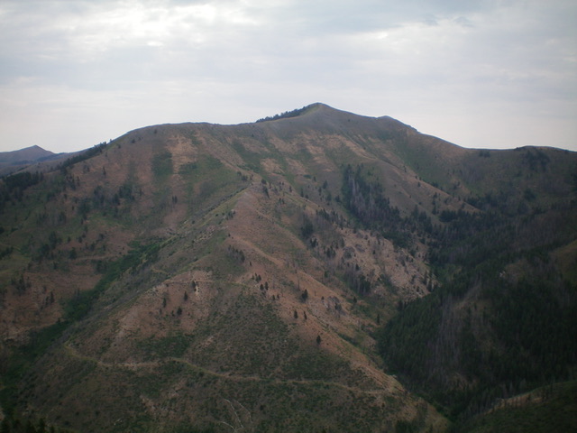
Peak 8344 as viewed from the west. Livingston Douglas Photo
Additional Resources
Regions: Smoky Mountains->WESTERN IDAHO
Mountain Range: Smoky Mountains
Longitude: -114.49759 Latitude: 43.50739