Elevation: 8,377 ft
Prominence: 517
This peak is not in the book. Published November 2020
Peak 8377 is located on the Continental Divide in the Henrys Lake Mountains. It sits above Anthill Creek (MT) and Poison Creek (MT). Peak 8377 towers over nearby Henrys Lake to the east. It is most easily reached from Raynolds Pass to the north via FSR-056 and a bushwhack up the west face. USGS Targhee Peak
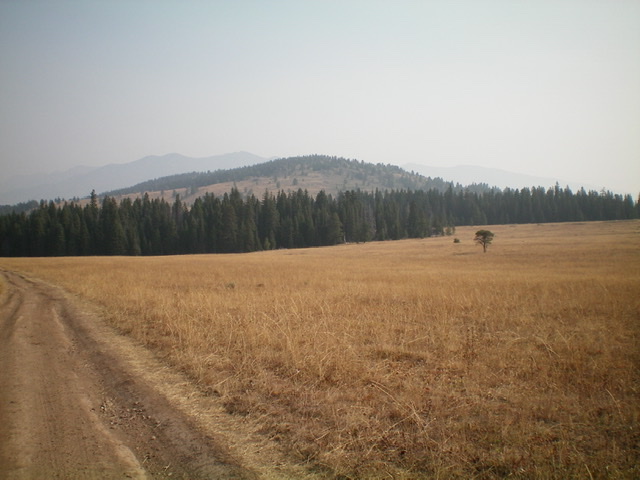
Peak 8377 (forested hump in center) as viewed from the southwest. Livingston Douglas Photo
Access
Same as for Pup Peak. This is the final leg of a two-peak journey that begins at Red Rock Pass.
The Approach, Class 2
From the road junction east of Pup Peak, follow steep, rocky FSR-056 northeast up to an 8,080-foot saddle just below Point 8174. Follow FSR-056 briefly down from the saddle, heading northeast and descending about 40 vertical feet. Leave the road and head northeast across a broad grassy field to reach a thick patch of pine forest that lies between the grassy field and the saddle at the base of the southwest ridge of Peak 8377. Bushwhack east through this blowdown-strewn, veg-laden forest to reach open terrain on the east side of this awful pine forest. Follow a fence row northward in open terrain on the east side of the forest to quickly reach the saddle.
Southwest Ridge, Class 2+
The Climb
Only the summit cap boulders and outcrops are Class 2+. From the grassy saddle at the base of the southwest ridge, follow the left/west side of the fence row as it climbs north then northeast up the crest of the open, grassy southwest ridge. The fence row ends at the first rocky outcrop on the ridge crest. Move to the right/southeast side of the ridge crest here to stay in open or semi-open terrain. The ridge is now a tedious mess of rocky outcrops/buttresses, pines, and brush.
Reach a prominent rocky ridge outcrop that must be climbed then descended into a short patch of forest. Continue a tedious scramble up the ridge in a combination of field grass/brush and rocky outcrops to reach the semi-open, rocky summit of Peak 8377. There is an ID/MT boundary post just below the summit high point. This post confirms that you are on the correct hump. There is a summit cairn atop the high point.
When you descend, return to the saddle at the base of the southwest ridge. To avoid the unpleasant forest bushwhack, follow an old 2-track road northwest (briefly) then bushwhack across field grass/brush to intercept FSR-056. Go left/south on FSR-056 and follow it up over the 8,080-foot saddle and down to the road junction east of Pup Peak. Go left/south to remain on FSR-056 and follow it back to Red Rock Pass and your parked vehicle.
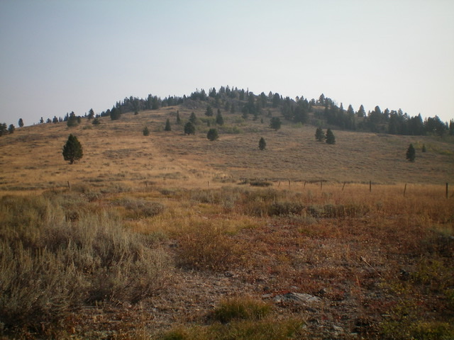
Peak 8377 as viewed from the base of the southwest ridge. Livingston Douglas Photo
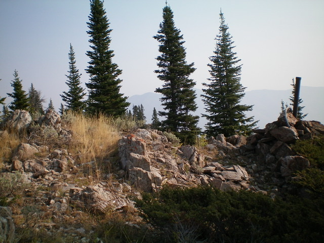
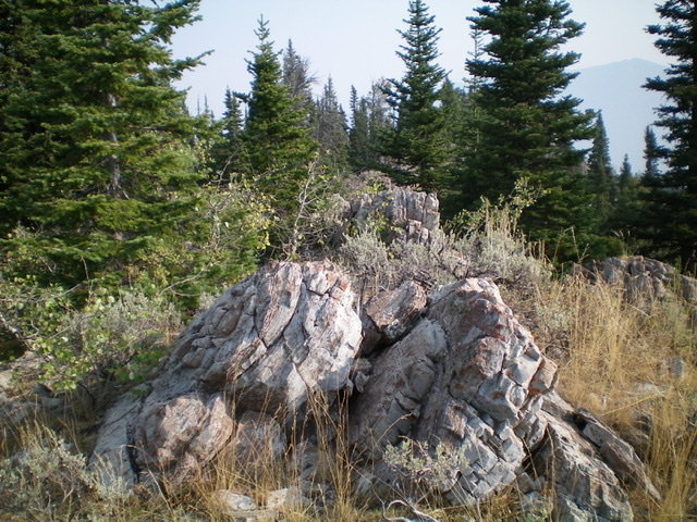
The summit area of Peak 8377. Livingston Douglas Photo
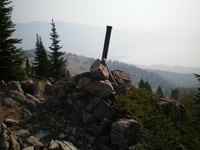
The ID/MT boundary post atop Peak 8377. Livingston Douglas Photo
The boulders on the high point of Peak 8377, just above the ID/MT boundary post. Livingston Douglas Photo
Additional Resources
Regions: EASTERN IDAHO->Henrys Lake Range
Mountain Range: Henrys Lake Range
Longitude: -111.47929 Latitude: 44.65869